Devils Tower & The Northern Black Hills

Up and off we went around 7:30am from the M Star Rapid City on Mount Rushmore Road/US-16. The weather was still a bit hazy, but it was probably the clearest morning we’d had on the entire trip. We got started a little later than we’d hoped, but we figured we still had time to hit Devils Tower and make it to Cody in time to set up camp and see the famous rodeo there. After finally remembering to clean the bugs off the windshield, we followed I-90 up to US-85, and then followed SD-34 across the Wyoming state line. Here, the road turns into WYO-24 and heads to Devils Tower. We could have stayed on I-90 and taken a faster route via US-14, but these three roads were all marked scenic.
Becky and I had already decided yesterday that what we’d seen so far of the Black Hills was pure awesome! We’d love to come back and camp either in Black Hills National Forest or Custer State Park. Seeing it for a day made us want to come back for a week! However, Devils Tower and what we saw of the Northern Black Hills in Wyoming made it hard to imagine confining a return trip to only the better-known Southern Black Hills in South Dakota.
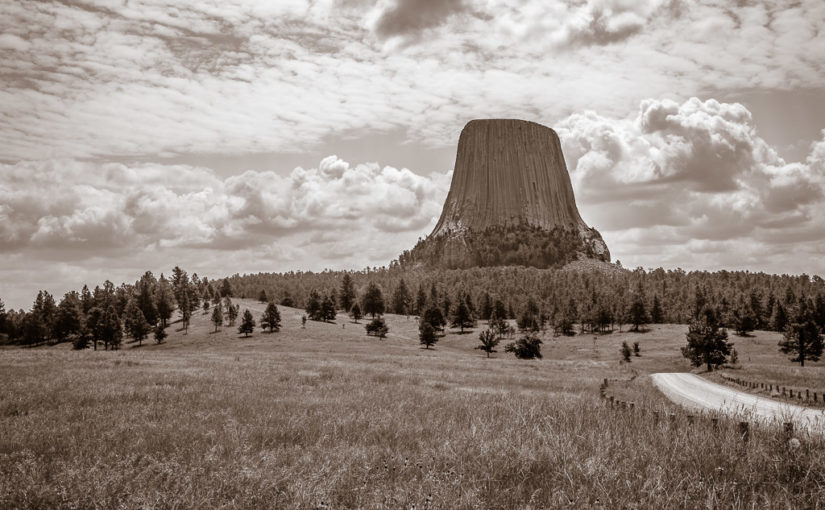
At the last second I almost decided to stick to faster highways in the interest of time. After we got a few miles into Wyoming, though, I was so glad that we took the scenic route instead of the freeway! The red rocks and canyons along the Belle Foursche River held a type of beauty we saw nowhere else in the Black Hills. It was definitely worth the extra few minutes! Then we passed over a crest and around a curve—and caught our first glimpse of something like a giant tree stump on the horizon—that was just unmistakably Devils Tower.


It’s no wonder the Sioux and Kiowa saw it and thought, “This means something! This is important.” (Sorry, couldn’t resist!). The Kiowa have the coolest story about what Devils Tower means. The story is told in Ken Burns’ documentary, The West, and they had a display about a similar legend.
I can’t help but feel a sadness about the cultures that were destroyed by the United States’ westward expansion. The Indians really loved the land, and all the creatures that lived in it (at least when they weren’t warring with rival tribes). While the new Americans certainly intended on leaving their imprint on the West, often for the love of power and riches—they at least saw that places like Devils Tower should be held sacred, just as the Indians thought they were. And thus in 1906 with the passage of the Antiquities Act, President Theodore Roosevelt created Devils Tower National Monument—the country’s very first national monument.


At the visitor center, there were lots of ranger-lead activities and several hiking trails around the mountain that I would love to have seen. There were plenty of gorgeous campgrounds in the area too, within the national monument land as well as all up and down the nearby Belle Foursche River. Unfortunately, we didn’t allocate much time here in favor of more time at Yellowstone—and we needed to get going in order to make Cody. So on we pushed to US-14 and I-90…
Continue reading RealImaginaryWest Day 7 – Devils Tower, the Bighorns & Our First Rodeo