RealImaginaryWest 2019 Day 3—Nebraska’s Bridges To Buttes Highway & Beyond

Waking Up On the Niobrara

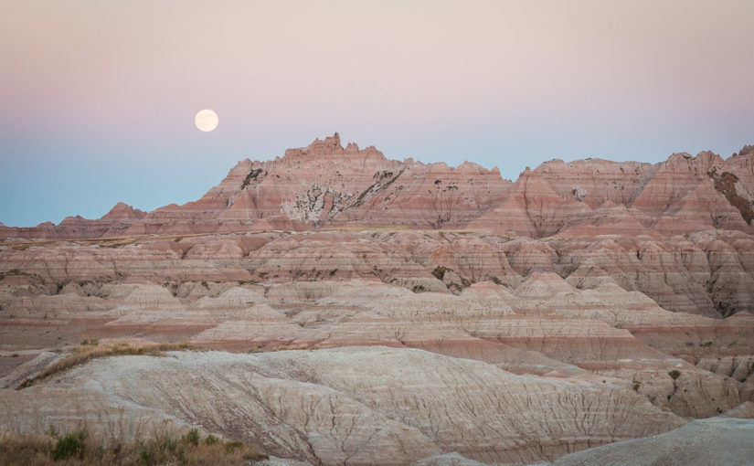
Turning In By Moonlight

I forgot to mention in last night’s post that I finished packing up by moonlight. The campground at Smith Falls so far as I could tell lacked artificial lighting, so my eyes were able to adjust very well. It’s incredible that a 3/4-full moon could light the night up so well, and for the most part we modern humans have no idea how well our eyes adjust to it because of all the artificial light we surround ourselves with. The funny thing about it is that orange or yellow light from a fire doesn’t prevent your eyes adjusting to the moonlight. Had it not been for me sitting there in just firelight, I don’t think I would have realized how bright the moonlight was.

Getting Started

Anyway, I think I may have actually slept reasonably last night. And my mattress stayed inflated all night too! On last year’s trip I realized it was losing air when we camped at Yosemite. I found a tiny little hole on the bottom and patched it up earlier this season. After two weekend camping trips since, I wondered if a leak might still be present because it seemed to still lose air, albeit more slowly. Perhaps that was not the case.

I stirred around 5:30am, about an hour before sunrise. The moon was gone but the sun had alrighty begun to intrude with first light. The entire campground was quiet with the exception of the tranquil flow of the Niobrara River.

Becky awoke around 6:15. We witnessed some brilliant red colors this morning—I should have thought about that saying, “Red sky in morning, roadtripper take warning,” or something like that. We certainly ran into some weather today…but I get ahead of myself.

What’s With the Humidity?

The first weather we noticed last night was the humidity. Smith Falls State Park is just west of the 100th Meridian, which is about where the altitude of the Great Plains increases and in turn the climate becomes more arid. In general, you can grow crops without relying heavily on irrigation east of the 100th Meridian, but not west of it. We’ve noticed in years past that the air is generally much dryer overall than it was tonight. It felt positively clammy well before sunset—more like an Ohio summer.

When we woke up this morning, our tent was soaked from the dew. We’d left the rainfly open last night to get airflow since it was rather warm. I made the mistake of leaving my sandals out in the open and they were terribly wet. Once we bit the bullet and got down to business, we made short work of packing the bedding and tent, leaving the campground around 7:30am.

Real Food For Breakfast!

Our original plan included a full day of stops at a few more places in Nebraska before heading into Wyoming for the night. One of these was Toadstool Geological Park, which sounded wonderful, but required a 13-mile drive down a gravel road. Maybe we’ll try that in the future during a more normal dry year when the road is less likely to be flood damaged like we saw in the campground in Smith Falls State Park.

Since we’d dropped Toadstool, that freed up plenty of time for us to get real food for breakfast! We headed into Valentine and ate a full breakfast at the Bunkhouse Restaurant in the center of town. The service was great, and the food was good diner fare that hit the spot for us.
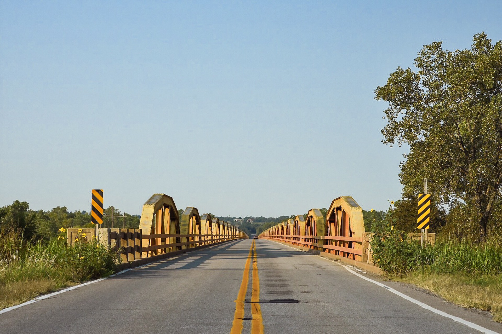
The Bryan Bridge

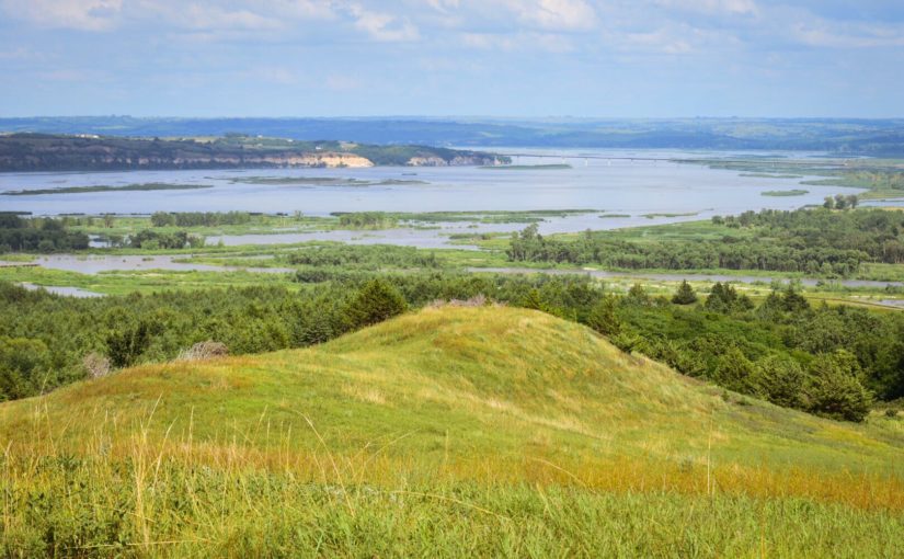
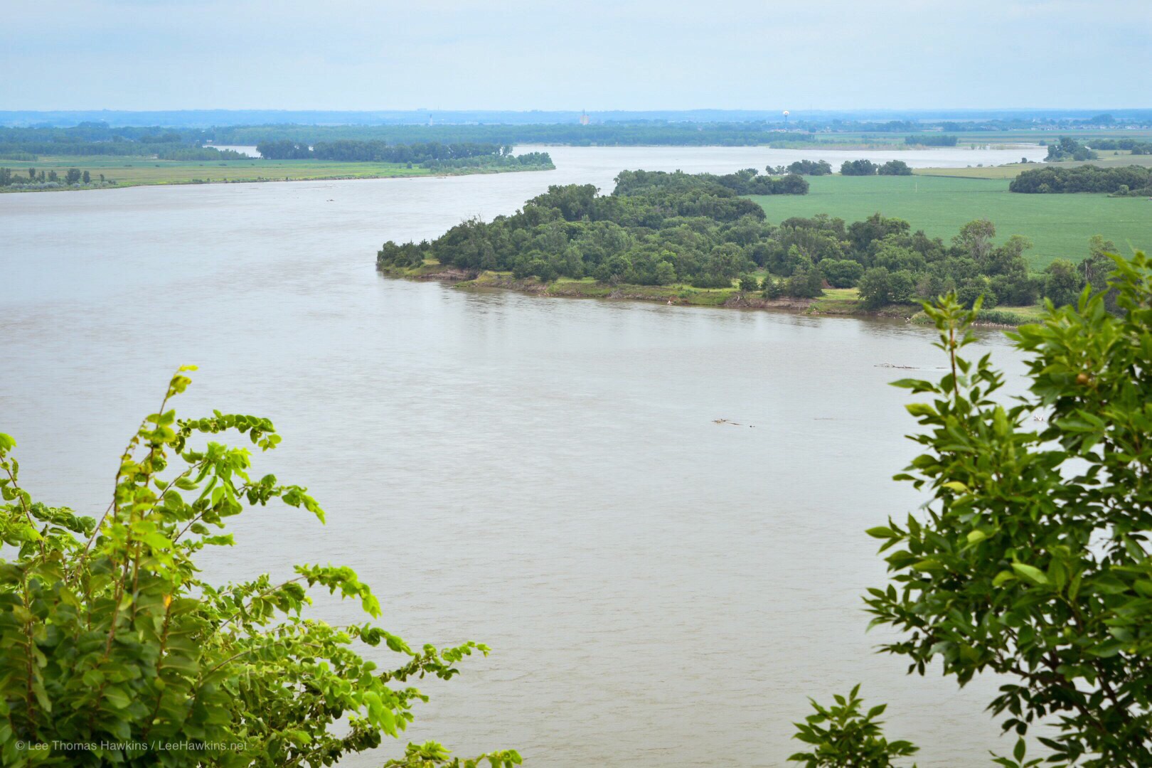
After breakfast we headed south of town a mile or two to check out the Bryan Bridge, which used to carry US-20 across the Niobrara River. On the opposite side of the new US-20 bridge sits an old railroad trestle that now carries bicycles instead of trains.

The entire area around Valentine has incredibly beautiful terrain! The hills around town are lovely, and the Niobrara River seems like a wonderfully quiet place to canoe or kayak through them.

Northwest Nebraska

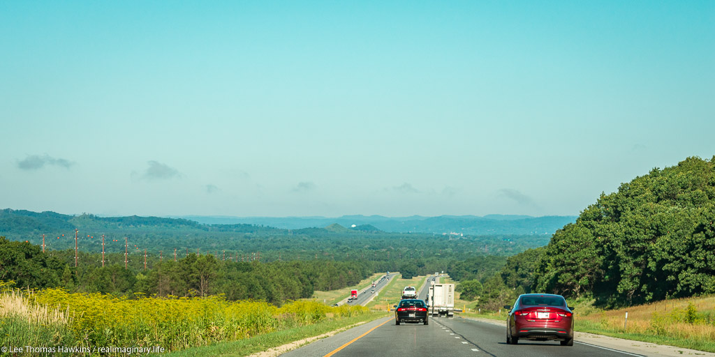
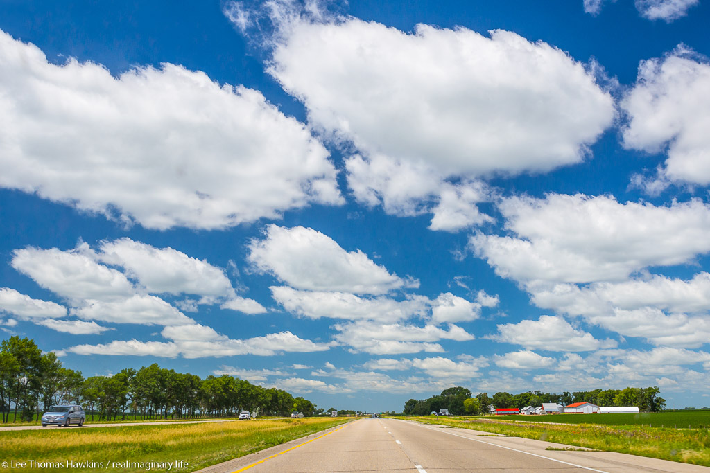
Not far west of Valentine, the terrain becomes less rugged with more rolling hills and fewer trees. The aridity west of the 100th Meridian certainly becomes apparent. We drove about two hours through another handful of very quiet tiny little towns.

As we approached Chadron the terrain changes again. Along with rolling hills, rocky buttes began to impose themselves on the horizon. Chadron was a bit larger than Valentine and even had Walmart. Here we turned south to visit Chadron State Park.

Chadron State Park

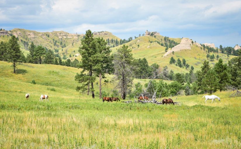
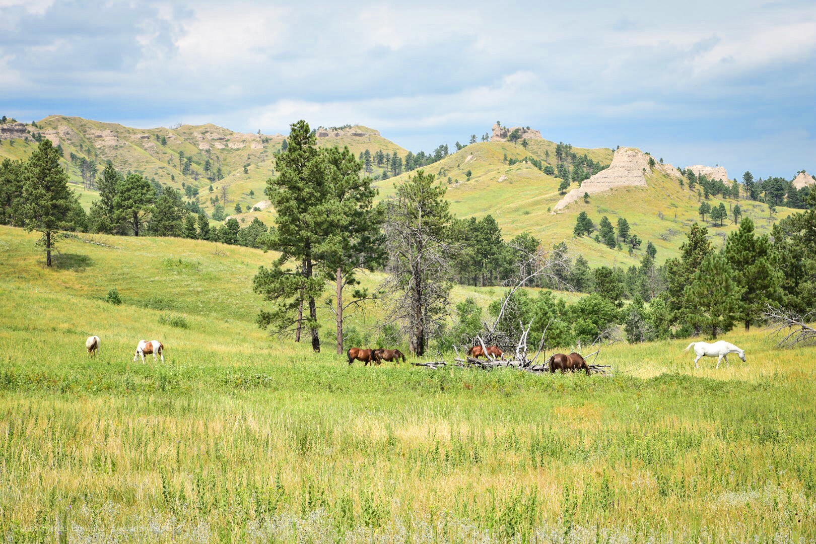
The buttes only became bigger and more concentrated as we approached the park. This area reminds me very much of the drive between the Badlands and Black Hills on Highway 44 in South Dakota and Wyoming. We pulled into the park office, paid the $8 out-of-state day-use fee, and headed up the park’s scenic drive.

I wanted to see the Blackhills Scenic Overlook, but the narrow high-crested gravel road made us rethink this. We instead continued on the scenic drive past a picnic shelter with a nice retro playground near the horse pasture. We didn’t stay long here since we hoped to get to our campground for the night a bit earlier than originally planned, and we still had one more stop…

Horses graze in light-green grass meadow with grass-covered peaks in the background. Evergreen trees dot the meadow and the peaks.
Horses grazing in a pasture at Chadron State Park in Northwest Nebraska

Continue reading RealImaginaryWest 2019 Day 3—Nebraska’s Bridges To Buttes Highway & Beyond

RealImaginaryWest 2019 Day 2—Nebraska’s Outlaw Trail

Seven Hours, No Stops!

We made it…this far! Once we got out of Greater Cleveland, traffic was a breeze, even around Chicago. Incredibly, Becky made the entire 7-hour drive without even a single stop! This got us to our hotel in the Quad Cities last night at 11:30pm local time. Checkin at the LaQuinta Inn Moline Airport was a breeze, and we settled into bed maybe a minute or two past midnight.

Iowa

‘Tis the Season

I haven’t had the best time sleeping lately…it seems 4 or 5 hours is about all I get most nights. I set an alarm for 6:15 with the hopes we could grab a quick breakfast in the hotel lobby and get on the road. My sinuses had other ideas—every year they let me know when August arrives. This morning they reminded me, which made it difficult to exist let alone get up. Becky was feeling it too.

“The World’s Largest Truckstop”

We finally got out the door and back on the road at 7:30am. The Iowa 80 Truck Stop just west of Davenport was our first refueling stop of the trip. It bills itself as “The World’s Largest Truckstop”, with about half a dozen fast food franchises, a ton of retail, a buffet restaurant, plenty of American automotive memorabilia, and of course gas and diesel.

Where We’re Going, We Don’t Need Interstates…

Normally we just follow I-80 all the way across Iowa. This time I wanted to try a different route farther north. US-20 runs from coast to coast—Massachusetts to Oregon—and it passes maybe 50 miles north of I-80 through Central Iowa before running across Nebraska within a few miles of the South Dakota border. Today we’ll head up I-380 to join US-20 until Sioux City, where we’ll diverge on the Outlaw Trail Scenic Byway to follow the Missouri River more closely.

The Great Plains: #NotFlat #NotBoring

I can’t say this enough, but I don’t understand why people repeat over and over again that the Great Plains are flat. I mean, I realize it’s not exactly mountainous (except it actually is in the High Plains!), but most of it has rolling hills. Eastern Iowa is especially pretty where farmers sow their crops to follow the terrain. We usually go through in July. August offers larger and more mature plants, including tasseled corn, but everything is still a wonderful green. When we passed through last September, things definitely appeared less verdant.

Splat 🙁

The weather was mostly cloudy at first. We even hit some rain between Cedar Falls and Fort Dodge. We also hit some gigantic bugs with yellow innards. Yuck. (Turns out these were actually monarch butterflies! Now I feel guilty too! Those poor things have it tough enough!)

Driving Across Iowa on US-20

We found the drive across Iowa on US-20 very pleasant compared to I-80. Traffic is nearly nonexistent past Fort Dodge, and the route is more scenic in the Western part of the state. The only drawback we discovered was the total lack of rest areas…but there were adequate numbers of gas stations all the way up to Sioux City.

Nebraska

At Sioux City we crossed the Missouri River and the state line into Nebraska. After stopping for fuel we diverged from US-20 to begin our journey along Highway 12—the Outlaw Highway—which follows the Missouri River and the state line with South Dakota.

Ponca State Park

Our first stop, Ponca State Park, preserves a section of the River that still looks much the way it did back in the time of Lewis & Clark. We stopped to enjoy the view at the Three State Overlook, where you can see South Dakota and Iowa while standing in Nebraska. This is one of the few places where the Missouri River hasn’t been dammed, straightened, or bypassed with a canal to better facilitate shipping (and flooding). The overcast sky and humidity weren’t the most comfortable, but it was exciting to ponder the beginning of Lewis & Clark’s adventure across the continent, as well as their return through this stretch of river two years later.

Continue reading RealImaginaryWest 2019 Day 2—Nebraska’s Outlaw Trail

RealImaginaryWest 2017 Day 3 – Plains, Canyons & Mountains on Route 66

We again covered some serious mileage on Route 66, starting in Stroud, Oklahoma. We followed a good section of the original highway west of Oklahoma City. Next we made a few stops on the Texas Panhandle, including Palo Duro Canyon State Park and the Cadillac Ranch outside Amarillo. Finally we passed into New Mexico, following the highway’s pre-1937 alignment up to Las Vegas and Santa Fe.

An Early Start from the Skyliner Motel

We were packed up and ready to go at 6:15-6:30am. Vic was up in two seconds to brew coffee for Becky, just like he promised! He has some big plans for this place…more on that when we return.

38-Span Camelback Bridge

We got right back on I-44 and passed through Oklahoma City to I-40. About 15 years ago I traveled here on business. It looks like they added a very large new skyscraper since then.

We exited I-40 at US-281 so we could drive over this 38-span camelback bridge near Geary, Oklahoma. Route 66 passed over it starting in 1933…and it still keeps going on, and on, and on!

Lucille’s Route 66 Gas Station

We got back on I-40 near Hydro, Oklahoma after driving to this historic and well-maintained gas station.

Conoco Tower Station in Shamrock, Texas

Next we entered Texas, and stopped here at the Conoco Tower Station in Shamrock. Unfortunately, very little in Texas seems to be open on Sunday, so we couldn’t do much but admire the old art deco exterior.

The Leaning Tower of Texas

A proprietor purchased and moved this water tower next to his truck stop in Groom, Texas. He purposely had someone drive a tractor into this tower so it would lean about 10 degrees. This set motorists up to stop in…often frantic to warn him that the tower was tipping. He’d reply, “Oh, it’s been that way for years…can I get you anything?” You gotta love gimmicks that get people to stop!

Palo Duro Canyon State Park

Palo Duro Canyon just south of Amarillo comes in as the second longest in the country, second only to the Grand Canyon. We took a detour to come check it out, and the intention was to have lunch here.

Cadillac Ranch

This public art installation of old Cadillacs invites people to “repaint” them. I was careful not to get me or my camera spraypainted!

Late Roadside Lunch

Since we didn’t stop and make lunch in Palo Duro, and since we didn’t see anything resembling a park or a picnic area around Amarillo, we stopped at this rest area to the west on I-40 and cooked up some hamburgers.

Finding the Absaroka County Sheriff’s Office in Las Vegas, New Mexico

No photo on this for now, but we did find the old town plaza in Las Vegas, New Mexico where outside scenes for the TV series Longmire were shot. Las Vegas sat in as Durant, Wyoming. We even found the door, which was still marked for the show.

Santa Fe

The drive to Santa Fe was incredible! The sun set as we drove into town, and we checked out the old town plaza before checking in at the Kings Rest Court Inn. This place was immaculately preserved from 1939, just two years after Route 66 was realigned to connect directly across New Mexico from Santa Rosa to Albuquerque…bypassing Santa Fe entirely. We’ll actually have time to stop and smell the roses before heading west again to the Holbrook, Arizona tomorrow.

Save

RealImaginaryWest 2017 Lite Day 3 – Roasting in the Badlands & Relief in the Black Hills

After a very early start at Badlands National Park, we packed up camp and made a short hike at Saddle Pass, followed by hikes on the Notch, Window, and Door Trails. Before driving the Badlands Loop Road and heading to Wall Drug, we returned to Cedar Pass Campground to get showers. After lunch and a couple of hours perusing Wall Drug, we took I-90 to Rapid City and SD-79 & SD-36 into the Black Hills and Custer State Park. Finally we followed US-16A to Bismarck Lake Campground near Custer in Black Hills National Forest.

Well today had a pretty good start with a rather dry finish… I suppose another way of putting it would be, “The Great Plains strike again!” Let me start at the beginning…

Sunrise at Badlands National Park

It all started at about 4:30am for me. I didn’t quite sleep as long as I’d hoped, but I did feel OK. The eastern horizon was already alight with the impending sunrise and birds were up singing. And just like last night, except in reverse, the moon was close to setting in the west.

Since we got to bed fairly early the night before and the forecast high would likely surpass the century mark, I woke Becky. It wasn’t supposed to get truly hot until late morning or noon. If we got up now, we could do some hiking and beat the heat as well as the crowds. While Becky moseyed to the restroom and got herself ready for the day, I packed up the tent and everything inside. We might come back later to cook or take showers, but there was no need to leave the tent up since it was already bone dry. I’m proud to say I had our bedding and tent all packed up solo in 25 minutes.

Just as the sun began to peek through the clouds over the Badlands wall, I ran off and shot a panorama of the brilliant sunrise! There were some reds but mostly oranges and violets. I would have shot the moonset too, but clouds on the western horizon totally obscured it.

Saddle Pass Trail


Looking up the Saddle Pass Trail in Badlands National Park. Blue markers help to identify the trail amid the indistinct terrain.
Looking up the Saddle Pass Trail. Blue markers help to identify the trail amid the indistinct terrain.

We were on the road before 6am and drove the short distance to the Saddle Pass Trailhead. The temperature was comfortable for now, around 70 degrees and low humidity. The Saddle Pass Trail is short at only 1/3 mile, but it’s a steep 216-foot climb up to the top of the Badlands wall.

We were on the road before 6am and drove the short distance to the Saddle Pass Trailhead. The temperature was comfortable for now, around 70 degrees and low humidity. The Saddle Pass Trail is short at only 1/3 mile, but it’s a steep 216-foot climb up to the top of the Badlands wall.

We started up the trail around 6am. It starts out exceptionally steep and has loose gravel footing. We were nearly halfway up when Becky decided she couldn’t go any further. It was just too much for her first thing in the morning. All the literature promised 360-degree views, so I decided to continue up to the top. The view did not disappoint!

Looking south from Saddle Pass in Badlands National Park.
Looking south from Saddle Pass. The tiny black thing in the parking lot near the tree is our car!

After shooting a few photos, one of the car from all the way up on top, I headed back down. There’s a trail that runs along the top of the Badlands wall, but I didn’t check it out because I wanted to make sure Becky was OK. I was off the trail and back at the car just 45 minutes after we arrived. Becky was starting to feel better and suggested that she probably just needed something to eat to get her energy up. While I’d guess our bodies were still on our usual Eastern Time Zone schedule, it was probably just too quick of a start to the day for her.

Up to the Door/Window/Notch Trailhead

A bighorn sheep rests in morning shade north of Cedar Pass along the Badlands Loop Road in Badlands National Park.
A bighorn sheep rests in morning shade along the Badlands Loop Road on our way to the Door/Window/Notch Trailhead.

When we visited Badlands back in 2015, our only real hike here was the Door Trail. The same trailhead actually has two other trails, the super short Window Trail, and the more challenging Notch Trail. None of the three trails are particularly long, so we had plenty of time to do all three if we wanted to. The sky was crystal clear with bright sunshine now, but the temperature was still comfortable.

We made it to the parking lot around 7am, still well ahead of the crowds. We started with the Notch Trail, which is only 1.5 miles round trip. It winds through a small canyon for about 1/3 mile or so, and then there’s a ladder that takes you up to the rim so you can continue through a slightly larger canyon. We somehow missed the ladder, and realized it when the trail suddenly ended at an impasse. We could hear people just above us, so we retraced our steps. Turns out we followed a wash and went right past the ladder. It’s pretty easy to get disoriented and lose trails here! Almost all of them, including Notch, are actually marked with stakes at regular intervals so you can tell you’re going the right way.

Becky awaits my return as I hike the section of the Notch Trail above the ladder.

A Perilous Wrong Turn

Becky took a look at the ladder and gave it a nope. I’m afraid of heights and didn’t find it at all intimidating. The easy slope and the grip of my hiking boots made it easy to walk upright the entire way.

I then made my way around the rim and came across some signs that got me confused. One said “KEEP RIGHT”, and the other was an arrow pointing at what I thought was the way to go. I’d heard the Notch Trail could be challenging, but I was surprised it would go right up this steep wash. I forgot to even look for a marker stake. Before I knew it, the wash got too steep and too loose to safely go any further—obviously a dead end!

Continue reading RealImaginaryWest 2017 Lite Day 3 – Roasting in the Badlands & Relief in the Black Hills

RealImaginaryWest 2017 Lite Day 2 – The Jolly Green Giant & the Big Badlands

From our motel in Madison, Wisconsin, we followed I-90 West to Badlands National Park with brief stops at Green Giant Statue Park in Blue Earth, Minnesota and The Corn Palace in Mitchell, South Dakota.

Despite getting in late last night, I was awake at 5am. I suppose it’s always harder to sleep in a new bed. By 6:30am we were out of the motel and refueling across the street. With all of our meat still solidly frozen, there was no need to buy ice for the cooler. After Becky grabbed a coffee at Starbucks, we were back on I-90 again by 6:50.

Crossing Wisconsin & On to Minnesota

It was a beautiful morning! Last time we passed through Wisconsin, the sky was a very strange color due to forest fire smoke from way up in Alaska and Canada. This time we had magnificent sunny blue skies and good early morning light. Wisconsin is wonderfully green and pretty in summer. We’ll definitely spend more time here on some future road trip.

Since we got going early, there were no traffic problems through the often-congested Wisconsin Dells area. When we crossed the Mississippi River into Minnesota near LaCrosse, our chances of hitting any traffic at all dropped to almost nothing.

Overlooking the Driftless Region of Wisconsin from Jacksonville Pass on I-90 near Tomah, Wisconsin on a summer morning
Overlooking the Driftless Area of Wisconsin from Jacksonville Pass on I-90 near Tomah, Wisconsin

In the past we’d never been on I-90 across Minnesota beyond the first exit. We gradually worked our way west from Pepin along the Mississippi through heavily-wooded regions of the state. As we passed directly west this time, we noticed a significant transition in the nature of the land. After winding up the hill from the Great River and onto Minnesota’s rolling hills, it was as if all the trees were different and more sparse. The land also transitioned from mostly woodland to entirely agricultural. This dramatic change told me we were now on the Great Plains.

Cumulus clouds stretch across the sky over I-90 and prairie farmlands near Blue Earth, Minnesota.
Cumulus clouds stretch across the sky over I-90 and prairie farmlands in Minnesota.

Green Giant Statue Park & Blue Earth, Minnesota

A billboard along I-90 near Blue Earth, Minnesota encourages tourists to stop and visit their 60' Jolly Green Giant.
A billboard along I-90 encourages tourists to stop and visit the 60′ Jolly Green Giant in Blue Earth, Minnesota.

By 10:50am we’d crossed half the state. We stopped for an early lunch in a small town called Blue Earth. Besides the town’s eccentric name, it also has a 55-foot, 8,000-pound statue of the Jolly Green Giant we have all seen on numerous Green Giant labels and television commercials. He made his first appearance at the dedication of I-90, as the very last section was completed near Blue Earth in 1978.

The Story of the Jolly Green Giant Statue

People gather at Green Giant Statue Park in Blue Earth, Minnesota to photograph a 60-foot tall statue of the Jolly Green Giant.

At the time, the Green Giant company operated a canning plant in Blue Earth and was headquartered 60 miles north in Le Sueur. The idea for erecting the statue to attract travelers on the new transcontinental freeway originated with local radio station owner Paul Hedberg. On his weekend program he would interview families passing through Blue Earth on US-169, providing them with samples of Green Giant vegetables. Many children inevitably asked where they could see the Jolly Green Giant. So with the company’s blessing, Mr. Hedberg assembled funding from local businesses to bring the Giant to life in time for the freeway dedication.

One year later, the Green Giant company merged with Pillsbury, and the brand has changed hands a few times throughout the years. However. another company still continues to can corn and peas at the plant in Blue Earth. And the statue attracts 10,000 annual visitors. Each year the Giant Days festival is held at the adjacent Fairbault County Fairgrounds.

Continue reading RealImaginaryWest 2017 Lite Day 2 – The Jolly Green Giant & the Big Badlands

RealImaginaryWest Day 18 – Reflections, Reunions & Returns

We woke up to heavy rains that were predicted to last longer than we wanted to stay in St. Louis, so we just kept heading east toward home. The extra time allowed me to cook up a little surprise for Becky with our friends near Columbus, Ohio.

Itching to Get Going

It was a dark and stormy…morning. Rain fell torrentially as if it was trying to wash our motel off the map like a bad stain. I think I would have been OK with that, so long as it waited until after we checked out…

It’s no fiction…it was dark for being first thing in the morning, and I’m not kidding when I say that this was the only motel room on the whole trip that seemed like a joke for the price.

Becky and I got up before 6am Mountain Time the day before, and took turns driving across Colorado, Kansas, and most of Missouri yesterday. When my head hit the pillow at close to 11pm last night, I fell fast asleep. I wasn’t crazy about our motel, but I was too tired to worry about it.

Our Motel Room…

Let me say that I would not recommend the Colonial Inn off of I-70 in High Hill, Missouri. Before I went to bed last night, I saw a sign on the air conditioning controls strongly encouraging guests to turn off the A/C while they’re gone. I mentioned yesterday that there was a strange damp sort of smell that I hoped subsided with the A/C running for a while…well, it was still there. This room definitely had a mold problem, which was not readily visible by looking at it. I’m highly allergic to mold, as my itchy eyes reminded me this morning. It’s really no surprise, because the A/C was off…and probably remains off almost every entire hot, humid Missouri day in the summer…so the mold probably likes it here.

I also awoke once in the middle of the night and noticed the sheet was not really on my corner of the mattress…because apparently they don’t use anything but top sheets at this establishment. I thought I pushed it back, but when I awoke this morning, it was all out of place again…which is why one uses bottom sheets to cover the mattress!

As I got up to go to the bathroom, I noticed a sign on the door. It became clear to me why the hotelier took so much information…the sign clearly indicated that management would charge my credit card and call the police should any of my room’s appurtenances come up missing. For a $39 motel room, they certainly had decided to go out of their way to protect their small investment in inadequate bedsheets. This may be a little paranoid, but I thought this motel room could easily get a lot more expensive if the maid got sticky fingers and pointed one of them at us.

I was in no way interested in lounging around to be implicated or to fill my airways with more of the milldewyness, and neither was Becky. The downpour outside made rushing to the car quite easy. Our stuff barely got unpacked, so it was pretty easy to throw back into the trunk. The rain was still coming down hard enough to get us pretty wet though.

To St. Louis, Or Not to St. Louis?

With the heavy rain coming down, I checked the forecast and the radar. The plan for this morning was to make a quick stop to photograph the Gateway Arch in Downtown St. Louis. The radar…and my ears…told me that the rains were not going to cooperate…so when we got in the car, I decided to scrub St. Louis and get home a bit earlier. Although this did give us just enough time…

Our friends, Justin and Jennifer, at a steampunk-themed party we held at Pugh Cabin at Malabar Farm State Park

You see, we have two very good friends who live in Delaware, Ohio…about 20-30 minutes from the I-270 Jack Nicklaus Outerbelt around Columbus, which is on our way home. I wrote about Justin and Jennifer last year after Justin, a roofer at the time, fell and suffered a traumatic head injury that scared us all and landed him in the hospital for over a month. He’s mostly his old self again, but it still takes about five full years to fully recover from an injury as bad as his. Anyway, before we left the hotel, I snuck a text out to Justin and Jennifer to see if they could meet us this evening and surprise Becky—and they were game! I just needed a proper smokescreen for stopping somewhere innocuous in their area. I wasn’t totally sure of the timing, but I thought we might be able to make it to the REI store in Dublin before it closed at 6pm.

Continue reading RealImaginaryWest Day 18 – Reflections, Reunions & Returns

RealImaginaryWest Day 17 – Kansas, Kansas, More Kansas, and Kansas City Barbecue

We began our bittersweet journey home after an early breakfast with my family in Denver. We took I-70 across almost all of Kansas, save for a detour for some Kansas City barbecue! Finally, we took I-70 across most of Missouri to a motel in High Hill, about 30 minutes outside the St. Louis area.

So we were back on the road again. When you’re headed east from Denver, the plains of Colorado and Kansas look pretty much the same until you get close to Kansas City…and then there are some trees. And then you cross Missouri.

The End.

OK, just kidding! Actually, the reason we were driving across Kansas in the first place was because I wanted to have something eventful to look forward to along the way home. There was a real temptation to take I-80 back through two states I’d never seen before, Nebraska and Iowa, but the lure of Kansas City barbecue and the Gateway Arch along I-70 thwarted it. Besides that, I didn’t know of anything pressing I wanted to see except for maybe Chimney Rock along the Oregon Trail.

Last Breakfast

So after having such a great time and a short time together with my Denver family last night, we all decided we’d get up super duper early to have a last hurrah this morning before Becky and I hit the road. So we woke up at about 5:30am to pack up our car for our two-day voyage home. This went quite easily, as we had no tent to pack up. Kelli was so kind as to supply us with ice from her freezer, so our cooler was even stocked well enough to make it through most of the day.

We all met up at a regional chain breakfast restaurant called Snooze, right off of I-25 on Lincoln Avenue. The food was very good. I had the French toast and fruit, which was well-prepared and came with real maple syrup. The fruit was also fresh and tasty, and obviously not from a frozen bag. Even though we were in a shopping center in a sea of parking lot, the patio was comfortable and far enough from the cars. It was a perfect place to relax one last time with the family before heading out.

All but a few from last night sacrificed their chance to sleep in today to see us off, and I sure appreciated it! Even though it had been several years since we’d spent time together, it felt just like I’d expect family to feel. I’d seen my Aunt Pat in the last couple of years, but I hadn’t seen my cousins Cathy, Kelli, and D.J. much since 2012, when they came in for our grandma’s funeral in my hometown of Wellington, Ohio. And until yesterday, it had been 15 years since I’d seen any of Cathy’s girls. I sure hope it won’t be another 15 years before I see them again!

After breakfast, we stood in the parking lot for several more minutes…finishing our conversations, saying our thank-yous, we’ll-miss-yous, and our last good-byes. They all talked of making plans to come to Ohio since it’s been several years…I hope they make it soon!

On The Road Again

MOAR TRANEZ!!!

After all the hugs, we drove north up I-25 while I checked prices on GasBuddy. The best price, coincidentally, was at the Sam’s Club off of I-225 and Mississippi Avenue, near where my Aunt Pat lived when I last visited 29 years ago in 1986!

Getting out of the Denver area went smoothly, but as I mentioned, there isn’t much to see along the road across Eastern Colorado and most of Kansas. While it isn’t exactly a void, this part of the country is sparsely populated. The view along I-70 isn’t really too much different from I-90 across South Dakota, except with flatter terrain and fewer trees. Something that’s cool about Eastern Colorado though, is that you can see the glorious Rocky Mountains on the western horizon. You can even single out Pikes Peak from well over 100 miles away. Since I-70 runs southeast for a few dozen miles, it’s fairly easy to look west and enjoy the view when you’re not driving. The highway also parallels a railroad line, with a few opportunities to look out to see entire trains as they cross the plains.

Cows drink from a well near Agate, Colorado. The hazy silhouette of Pikes Peak can be seen on the horizon here, even though it’s over 70 miles away!

Kansas

My cousins scoffed at how terribly boring and long it is to drive across Kansas, and I have to admit my childhood memories of it are mostly just heat, humidity, and boredom. I talked to my mom a little bit one day while we were at Kelli’s, and expressed that I wasn’t longing for this part of the trip. Interestingly, she had a much more positive spin on Kansas. She liked the rolling grassland and fields, and enjoyed seeing the windmills and water troughs used to water the cattle. So I did my best to keep an open mind about Kansas.
Continue reading RealImaginaryWest Day 17 – Kansas, Kansas, More Kansas, and Kansas City Barbecue

RealImaginaryWest Day 16 – Downtown Denver & 16th Street Mall

Today started out as a lazy day near my cousin’s house in Lone Tree. We then took the RTD E Line light rail from Lincoln Station to Downtown Denver for lunch on the 16th Street Mall. We finally took the F Line light rail back to my cousin’s house for a family barbecue in the evening.

Taking It Slow

After a big day in Colo Spgs with Lexi and Joe yesterday, we slept in soundly at my cousin Kelli’s house in Lone Tree. They have a beautiful house in a subdivision near the edge of suburban Denver. The end of their street is high enough that you get an incredible view of almost the entire city stretching out in front of the Rocky Mountains.

After running so much the last few days, we decided to take things slow this morning. We didn’t have to be anywhere until noon, when I’d planned to meet a colleague for lunch. We made plans to meet up on the 16th Street Mall in Downtown Denver at my cousin D.J.’s suggestion. Being that I’m super interested in urban planning and design, I wanted to see what they’d done there, and I was interested in checking out the light rail system the region had built in the past 30 years. This evening we’d be back where we started, as my aunt and all my cousins were coming to Kelli & Jamie’s for a barbecue. Some of my younger cousins were well into their 20s and married now, and I hadn’t seen them in almost 15 years, so I really looked forward to this!

After spending so much time on the road, it was really nice to have a home base and hang with friends and family for a few days. By this point, our cooler didn’t have much beyond a few bottles of beer and our condiments, but it’s amazing how much more we appreciated the simple things…like refrigerators! Since we got to Kelli’s, we no longer had to check and restock ice. And then yesterday, Joe drove us around for the entire day, and today, the train would drive us everywhere.

Breakfast

Well, everywhere except breakfast…Jamie recommended a little place a few minutes from their house called the Silver Creek Diner. Being that this part of town was built in the last decade or so, the decor had a clean white contemporary look with some warm color accents. And even though it’s in the suburbs, Becky and I appreciated that it was a mom and pop establishment instead of a national chain. The service was top-notch, the prices were good, and the food was superb! Becky and I both went with eggs, bacon, toast, and home fries. Everything was prepared to perfection.

After breakfast, we still had a little time before we headed downtown, so we dropped into a nearby REI store to check out camping gear. Despite some negative experiences with wind and rain on this trip, Becky and I were far from finished with camping! And while we weren’t likely to camp on the way home, we were interested in options for upgrading our tent and our ever-flattening air mattress. Besides that, the nearest REI for us was over 100 miles away, so carpe diem!

Heading Downtown on RTD

It was either a five-minute drive or a ten-minute walk to Lincoln Station where we could catch either the E Line to Union Station or the F Line to the middle of the 16th Street Mall in Downtown Denver. Since Union Station sits at the end of the 16th Street Mall, either train would do…but first we had to buy tickets. RTD uses a zone system, which made it a little more confusing to figure out which tickets we needed to buy. I finally realized that we needed to buy regional tickets to get downtown, and opted for two all-day passes for $14 each. The price was a little steep compared to transit systems I’d used recently in New York, Chicago, Los Angeles, San Francisco, or Cleveland, but I figured it would probably be easier and cheaper than driving and parking.

Union Station, with the tops of the Amtrak and commuter rail platforms in front

Even though we were well between rush hours, trains ran rather frequently. It took no time at all before we were on our way to Union Station. All but the last few miles run right next to I-25, with several stations at major interchanges along the way. The stations connected the line conveniently with nearby shopping centers, office parks, hotels, and apartment complexes. When the line diverges from I-25, it follows old railroad right-of-way through a more industrial neighborhood before passing through stations for Mile High Stadium, Elitch Gardens, and Pepsi Center. The very last stretch goes through a bustling canyon of brand-new residential complexes before pulling into Union Station. Amtrak and commuter rail lines all converged here, and the underground bus terminal below saved everyone from dodging a plethora of noisy buses as well. All of this was a short walk to the west end of the 16th Street Mall and the heart of Downtown Denver. It was awesome to see such a modern and efficient transit system in a major city!

Downtown Denver & the 16th Street Mall

A Mall Ride bus crosses Stout Street as we look west down Denver’s 16th Street Mall.

The Colorado State Capitol peaks through the trees at the east end of Downtown Denver’s 16th Street Mall.

Continue reading RealImaginaryWest Day 16 – Downtown Denver & 16th Street Mall

RealImaginaryWest Day 15 – Colorado Springs & Pikes Peak

We took a short drive to spend the day with our friends, Lexi and Joe, in Colorado Springs. After going to the top of Pikes Peak on the cog railway, we got lunch and visited the penny arcade in Manitou Springs. Afterward, we visited Helen Hunt Falls and Garden of the Gods. We headed back to my cousin’s in Denver not long after dinner.

Starting for Colorado Springs Early…WAY Early!

We got up and on the road at 6am today. We were headed to Colorado Springs to spend the day with our friends, Joe and Lexi. They wanted to get a jump on the crowds heading up to Pike’s Peak, so we agreed to meet at their house at 6:45. Neither Becky nor myself are what you call “morning people”…but in three days, we would be back home—in the Eastern Time Zone, which is two hours ahead of Colorado. So as much as we’d have loved to sleep in, it really was practical to get going way early.

The sun was already cracking the horizon by the time we got on the road. The air was a little hazy, but that only added to the dramatic look of the golden light and dark shadows on the terrain ahead of us, and on the Rocky Mountains to our West. Though we were heading from one major city to the next, the drive was a mere 45 minutes, thanks to my cousin’s house being as close to the edge of Denver’s suburbs as you can get. The farther south we went on I-25, the more it felt like we were in the foothills rather than on the plains like in Denver.

Becky with Lexi and Joe

Now Lexi and her family are originally from Cleveland. I met Lexi on the exact same day as I met Becky for the first time, actually! She was already a good friend of the family by then. Becky’s sister, Rachel, was actually in Lexi’s wedding three years ago. Lexi ended up in Colorado Springs with her two brothers when her mom remarried a few years before that. Lexi’s husband, Joe, was good friends with Lexi’s brother, who recently married one of Rachel’s best friends after he moved back to Cleveland. Lexi came in for our wedding, and we met Joe when they both came in for her brother’s wedding. So yeah…we know Lexi and her family…but today would be our first time really getting to know Joe. So far he seems like an OK guy…

Pikes Peak Cog Railway

We pulled into Joe and Lexi’s driveway a minute or two after 6:45. They both rushed out and told us to jump in their car so we could get to the train in time to get good seats. For the rest of the day, Joe did all the driving, which was an awesome break for us!

The Pikes Peak Cog Railway station in Manitou Springs

In 20 minutes we were at the station for the Pikes Peak Cog Railway in the mountain town of Manitou Springs. Parking was painless, and we were in line for good seats for the first train of the day, which departed at 8am. The station was rather compact, with just enough room for a ticket office, a gift shop, small restrooms, and an area to queue passengers boarding the train. Unfortunately, they do not allow outside food or drinks—not even water bottles—and therefore the prices remind you of what you’d pay in a movie theater. Joe was kind enough to buy each of us a 32-ounce bottle of water, but my eyes popped out when I saw it cost him $13!

Speaking of water, I was glad that we were on the first train, and therefore there was not double the amount of people because of returning passengers. I’m sure the small restrooms get quite a bit of use since there are no restrooms aboard the trains. Altitude and hydration were still foremost on my mind, being that even on the ground we were already at 6,000 feet. Since it’s a 60-90 minute trip each way, I knew that managing my drinking and peeing would be critical to my comfort today.

As we waited for the train, we could see splendid examples of the reddish colored Pikes Peak granite all around. This rock was everywhere in and around Manitou Springs, and really contrasted well with the green of the pines and aspens all around us in the golden rays of the low morning sun.

Up!

Passengers enjoying the view as we ascend Pikes Peak on the cog railway

Tree-covered slopes give way to rocky ones as we ascend toward the tree line, where the climate is too harsh for trees to grow.

We were on the train and out of the station at 8:07am. From here on up to the top, the conversation amongst ourselves was intertwined with that of our conductor and tour guide, Luke. Luke was a young man who looked to be at most 25, but easily could have been much younger. He shared quite a bit of history on Pikes Peak and the railway. He shared that Pikes Peak had several names before it was finally called Pikes Peak. The mountain is named after Zebulon Pike, who mounted an expedition to climb to the summit, but failed. And while Pikes Peak is but 1 of Colorado’s 53 “fourteeners”, or mountains over 14,000 feet, there are very few mountains between it and the Great Plains. This makes it the most prominent mountain in Colorado’s Front Range, making it appear to stand alone for hundreds of miles over the Great Plains to the east—all the way to Kansas.

As Pikes Peak has a story that is unique among Colorado’s mountains, the Manitou & Pikes Peak Railway also has a unique story among Colorado’s railroads. Back in the 1880s, railroads were built primarily for industrial purposes to take advantage of the state’s many mining opportunities. After a ride to the summit of Pikes Peak on the back of a donkey, Zalmon Simmons of Kenosha, Wisconsin and founder of the Simmons Beautyrest Mattress Company, saw a business opportunity. He decided to build a railway to make it way easier to go to the top of Pikes Peak, and he did it purely for tourism. He went home and lined up investors, and two years later he was taking people to the top of Pikes Peak for a cool $5 each—that’s $125 in today’s money. The railroad was a hit back then, and since our early train was completely full, I’d say it’s still a hit today. The good news is that the cost of tickets has not kept up with inflation, as round-trip tickets cost only about a third of $125—and that may be why they sell water at $3.25 per bottle.

Anyway, there are three cars on each train heading up and down the mountainside. There’s an aisle down the middle with three seats on the left side going up, and two seats on the right side. The seats are arranged front-to-front and back-to-back, meaning every passenger faces another passenger. Before we embarked on our 18-day journey, a friend back home warned us that we want to get seats that angle up rather than down. And about 15 minutes up the mountain, Luke suggested that we introduce ourselves to the folks across from us—we were heading into our first 25 percent grade, and we’d probably be getting more familiar with them as a result. This was easy for us, because we knew each other, but we followed his advice nonetheless. Becky and I were angled down on the way up, though, and we really didn’t have any problems staying in our seats.

Joe points out at something when we are well above the tree line.

Each set of seats facing each other has it’s own window. On the bottom, the windows are all open, and it’s easy to see over them and take pictures. By the time you pass the tree line into alpine elevations, the temperature is decidedly cooler, so Luke told us we could close our windows and turn on the heater for the rest of the trip. The heater made things quite comfortable in spite of the 36°F temperature at the summit. I would still recommend having at least one or two extra layers of long sleeves handy though, not just for the trip, but the summit too.

Before we reached the top, Luke advised us that we’d have a little less than an hour there, and that the train whistle would blow ten minutes before departure. He said it was important for round-trip passengers to be on the train at departure—Otherwise we would “slowly transform into hikers—and what a hike it is! Thirteen miles in one direction from the summit back to Manitou Springs. And for you runners out there thinking, ‘thirteen miles!’, yes, they do have a marathon each year, going up and back down the mountain.”

The Summit of Pikes Peak

The view at the top!

Continue reading RealImaginaryWest Day 15 – Colorado Springs & Pikes Peak

RealImaginaryWest Day 6 – The Black Hills, Mount Rushmore & Wind Cave

The weather held up really well, with just a little rain falling on us south of Rapid City as we drove from Badlands National Park to lunch in Keystone. We visited Mount Rushmore and got down to Wind Cave National Park just in time to catch the Natural Entrance Tour. Then we drove north into magnificent Custer State Park—WOW!—and finally made our way to our motel in Rapid City via the spectacular Iron Mountain Road.

Dreaming of the Old West

After a positively uneventful and peaceful night in Cedar Pass Campground at Badlands National Park, Becky and I woke up refreshed, and packed up our tent bound for the Black Hills. Becky cooked eggs in a tiny little portable stove she bought that resembles more of what a caterer uses to keep food warm than an actual stove. This was what we had to use to cook at Badlands, since there were no campfires allowed due to the risk of prairie fires. It took a while to cook a single egg, but it was effective.

After seeing I-90 and the Badlands Loop Road, I thought it would be best to drive to Rapid City via SD-44 so we could see the other side of the Badlands. Few likely see this area, since it is a much less popular part of the park. This was a great drive, which starts by going through the tiny little town of Interior, then passing through the town of Scenic, and finally to South Dakota’s second-largest city, Rapid City.

SD-44 straggles the border between Badlands National Park and Buffalo Gap National Grassland as it stretches West toward Scenic and Rapid City.

Black-footed ferrets, once extinct in South Dakota, prey almost exclusively on prairie dogs for food. They were reintroduced to the wild here in the 1990s, and as a result prairie dogs are protected in Buffalo Gap National Grassland.

Most of the way was either within Badlands National Park or Buffalo Gap National Grassland. The road runs alongside an abandoned railroad line where small wooden trestles still cross creeks, just without the rails. There were also plenty of pulloffs where you could drive into the grassland on dirt roads. Signs said that this was a management area for the black-footed ferret, which was thought extinct in the late 1970s. A few years later they were spotted again in Wyoming, and eventually reintroduced in areas such as this one. For the majority of the route we could see badlands going on for miles and miles and miles.

The railroad line crossing all of the creeks just a few feet above was odd to me. The fact that the creeks had grass all the way down to the water along their entire banks was strange to me too. Back East, the railroads are built far above floodplains, and there are trees and underbrush all around creeks and rivers, and pretty much just mud on the dropoff into the creek. The rolling hills and twisting and turning railroad bed conjured up all sorts of westerns and cartoons I’d seen all my life with scenery like this. When we entered into Black Hills country, it especially felt like I was living in an old western movie, except that technology and the 20th Century had happened and it was a little different now. It was strikingly beautiful country, and a lot of the things I’d seen in stuff set in the Old West started to make sense. I could imagine riding a galloping horse through this valley and on up into Rapid City with the rolling prairie on either side of me, and with the first pines appearing in the Black Hills.

Writing the Itinerary As We Go…

Now today had me a bit nervous…up to this point, we had all of our accommodations planned and/or reserved well before we left, except for the motel in Wisconsin. I had also managed to score three nights worth of campsites in Yellowstone online the day we left, and after that nothing was reservable anyway. The one and only night I hadn’t planned out was tonight…I figured on getting a campground as close as possible to Mount Rushmore. I thought it would be good to be able to capture it at sunrise in case sunset didn’t work out, plus it would eliminate any extra driving at the end of the night and hopefully we’d be able to relax. Unfortunately, there were zillions of campgrounds in the area and I had no opportunity to research many of them. The ones I did check were all super-expensive, as in might-as-well-get-a-motel expensive.

When we got cell service back again and I could check the forecast, the potential rain and the possibility of having another repeat of DeSmet weather settled it! I Googled around and found a motel—the M Star Rapid City. It was the cheapest thing I could get, and it was close to I-90, so I jumped on it. That was settled!

Now it was time to decide which destination to hit first…there were two on our itinerary. I’d originally planned on going to Wind Cave National Park first thing, then heading to Mount Rushmore by way of the Iron Mountain Road and seeing Rushmore closer to sunset. This would give me the opportunity to photograph the sculpture both in the Golden Hour and after dark when it’s all lit up. It was still partly to mostly cloudy, but the forecast called for overcast and possibly rain in the evening. This significantly reduced the probability of getting any interesting shadows or blue sky—and it shouldn’t matter what the weather outside is to tour inside a cave—so we elected to hit Rushmore first after we grabbed lunch.

We got a bit of rain between Rapid City and Keystone. I’d never seen a freeway interchange with wood-framed overpasses like this one at the junction of US-16 and US-16A!

The drive out of Rapid City and deep into the Black Hills was peppered with many and varied tourist traps. Several were totally designed to grab an eight-year-old’s attention so that they would pressure their parents to visit. I still have to admit, a few were tempting to check out.

Right before Mount Rushmore, you go through the town of Keystone, which seemed to have more hotels than residents. Again, there were many and varied tourist attractions, several of which were themed around the presidents and their history. We stopped at the Grizzly Creek Restaurant to try their burgers. I went for the bourbon burger and Becky had the buffalo burger. They were tasty and hearty, but not remarkable for the price. They have ten beers on tap, two or three of which were the standard Miller and Budweiser choices, while the rest were all local microbrews. We still had a lot ahead of us for the day, so I decided not to have anything after I tasted a sample of the only beer that really sounded good to me—which was a wheat beer that tasted too hoppy for my liking.

Mount Rushmore National Memorial

The clouds were just beginning to subside as we caught our first sight of Mount Rushmore from SD-244.

Mount Rushmore was a busy place, probably the busiest we’d seen so far on this trip. It was nowhere near congested though, especially compared with just about any of the major tourist attractions in California. As you drive up on SD-244 to the monument, you actually catch your first site of it, which is pretty striking. At the entrance are ticket gates where you have to pay to park in the massive deck they built back in the 1990s. Unfortunately, the Annual Pass we just bought at Badlands doesn’t apply here, as a separate organization operates the parking deck. Finding parking was not too difficult, and neither was making our way up to the monument.

Mount Rushmore towers over the grand entrance to the memorial from the parking decks.

Continue reading RealImaginaryWest Day 6 – The Black Hills, Mount Rushmore & Wind Cave