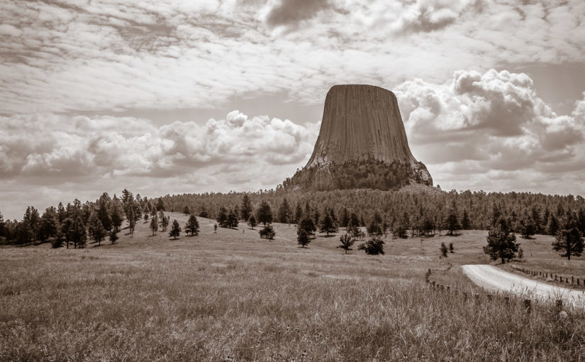
Well today had a pretty good start with a rather dry finish… I suppose another way of putting it would be, “The Great Plains strike again!” Let me start at the beginning…
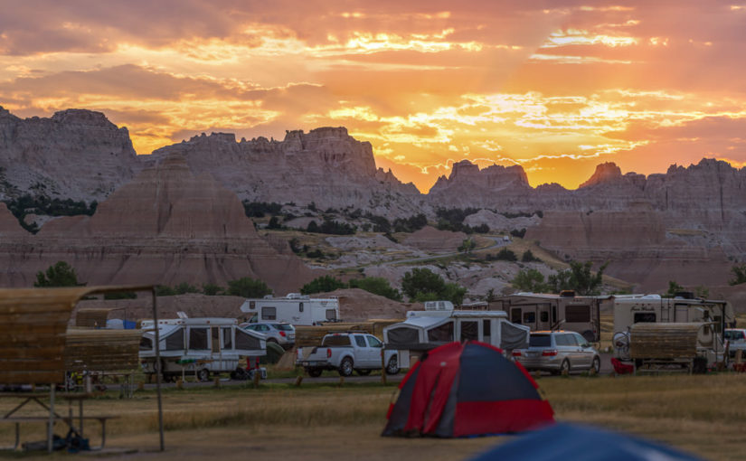
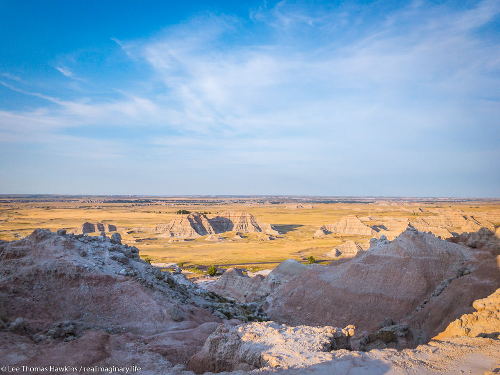
Sunrise at Badlands National Park
It all started at about 4:30am for me. I didn’t quite sleep as long as I’d hoped, but I did feel OK. The eastern horizon was already alight with the impending sunrise and birds were up singing. And just like last night, except in reverse, the moon was close to setting in the west.
Since we got to bed fairly early the night before and the forecast high would likely surpass the century mark, I woke Becky. It wasn’t supposed to get truly hot until late morning or noon. If we got up now, we could do some hiking and beat the heat as well as the crowds. While Becky moseyed to the restroom and got herself ready for the day, I packed up the tent and everything inside. We might come back later to cook or take showers, but there was no need to leave the tent up since it was already bone dry. I’m proud to say I had our bedding and tent all packed up solo in 25 minutes.
Just as the sun began to peek through the clouds over the Badlands wall, I ran off and shot a panorama of the brilliant sunrise! There were some reds but mostly oranges and violets. I would have shot the moonset too, but clouds on the western horizon totally obscured it.
Saddle Pass Trail
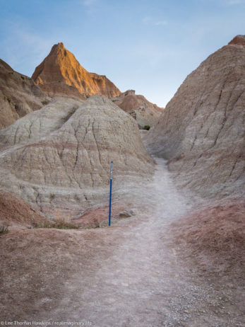
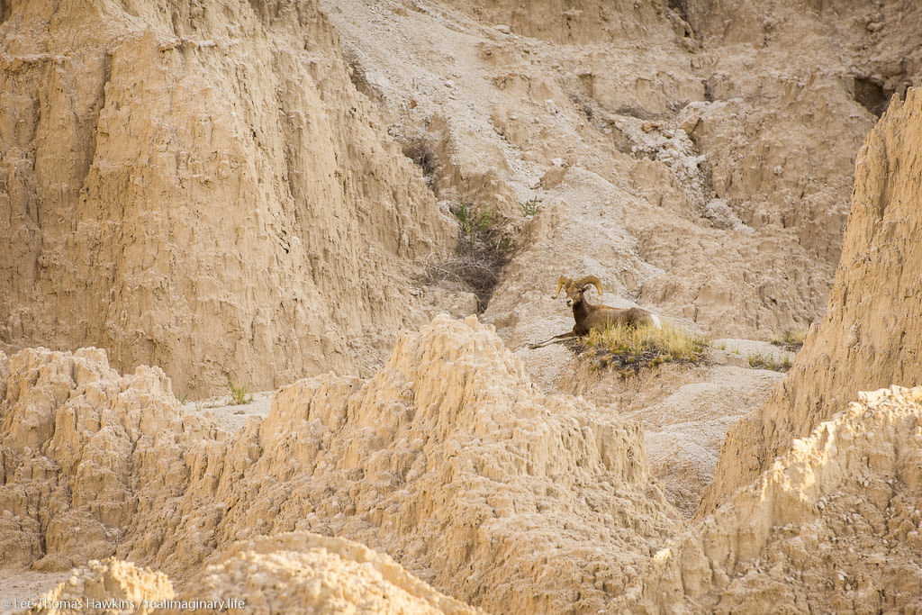
We were on the road before 6am and drove the short distance to the Saddle Pass Trailhead. The temperature was comfortable for now, around 70 degrees and low humidity. The Saddle Pass Trail is short at only 1/3 mile, but it’s a steep 216-foot climb up to the top of the Badlands wall.
We were on the road before 6am and drove the short distance to the Saddle Pass Trailhead. The temperature was comfortable for now, around 70 degrees and low humidity. The Saddle Pass Trail is short at only 1/3 mile, but it’s a steep 216-foot climb up to the top of the Badlands wall.
We started up the trail around 6am. It starts out exceptionally steep and has loose gravel footing. We were nearly halfway up when Becky decided she couldn’t go any further. It was just too much for her first thing in the morning. All the literature promised 360-degree views, so I decided to continue up to the top. The view did not disappoint!
After shooting a few photos, one of the car from all the way up on top, I headed back down. There’s a trail that runs along the top of the Badlands wall, but I didn’t check it out because I wanted to make sure Becky was OK. I was off the trail and back at the car just 45 minutes after we arrived. Becky was starting to feel better and suggested that she probably just needed something to eat to get her energy up. While I’d guess our bodies were still on our usual Eastern Time Zone schedule, it was probably just too quick of a start to the day for her.
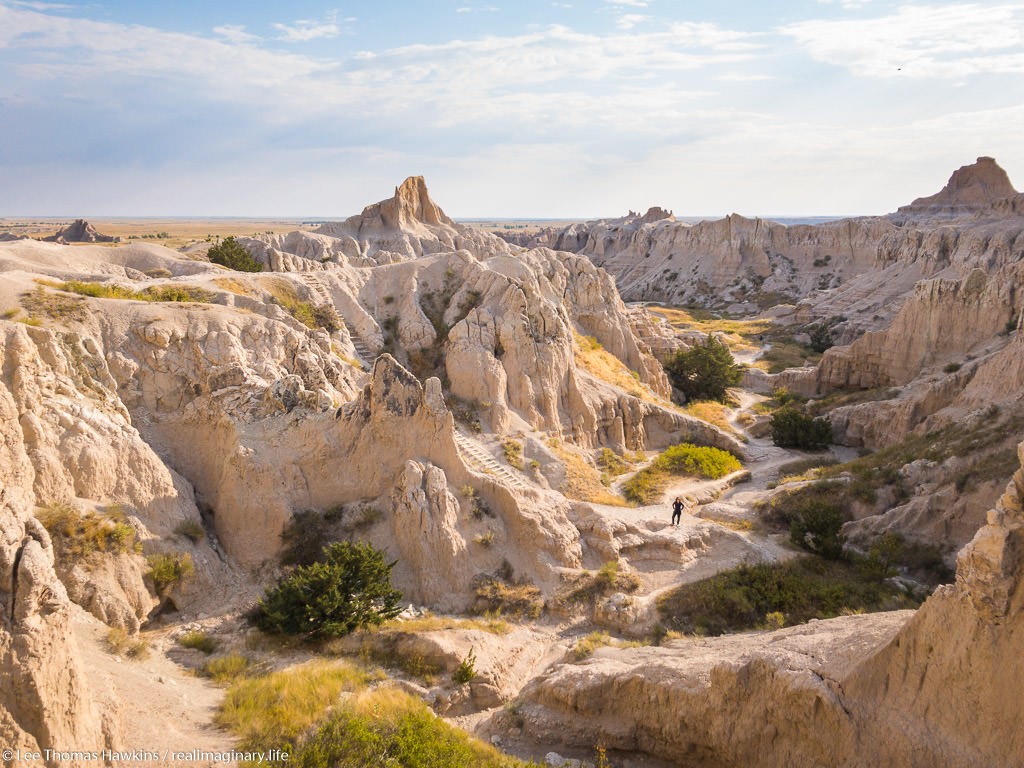
Up to the Door/Window/Notch Trailhead
When we visited Badlands back in 2015, our only real hike here was the Door Trail. The same trailhead actually has two other trails, the super short Window Trail, and the more challenging Notch Trail. None of the three trails are particularly long, so we had plenty of time to do all three if we wanted to. The sky was crystal clear with bright sunshine now, but the temperature was still comfortable.
We made it to the parking lot around 7am, still well ahead of the crowds. We started with the Notch Trail, which is only 1.5 miles round trip. It winds through a small canyon for about 1/3 mile or so, and then there’s a ladder that takes you up to the rim so you can continue through a slightly larger canyon. We somehow missed the ladder, and realized it when the trail suddenly ended at an impasse. We could hear people just above us, so we retraced our steps. Turns out we followed a wash and went right past the ladder. It’s pretty easy to get disoriented and lose trails here! Almost all of them, including Notch, are actually marked with stakes at regular intervals so you can tell you’re going the right way.
A Perilous Wrong Turn
Becky took a look at the ladder and gave it a nope. I’m afraid of heights and didn’t find it at all intimidating. The easy slope and the grip of my hiking boots made it easy to walk upright the entire way.
I then made my way around the rim and came across some signs that got me confused. One said “KEEP RIGHT”, and the other was an arrow pointing at what I thought was the way to go. I’d heard the Notch Trail could be challenging, but I was surprised it would go right up this steep wash. I forgot to even look for a marker stake. Before I knew it, the wash got too steep and too loose to safely go any further—obviously a dead end!