RealImaginaryWest 2019 Day 5—A Grand Geyser Tour of Yellowstone National Park

Getting Started

We both woke up for our own reasons around 5am this morning. (You can probably guess what they were.) My pad was deflated again, so I did something about that when Becky got up. Sadly for me, I was too warm in the cold, and sweat so much that I think it saved me an earlier trip to the restroom. Sadly for Becky, she did not stay comfortably warm despite her best efforts. Becky tried to catch some more Zs while I tried to catch up on my writing since I knew it was unlikely I’d fall asleep again.

Norris Geyser Basin

At 6am we were both awake and I asked Becky if she was up for getting out early to beat the crowds. She said OK, so by 6:30 we were on our way to Norris Geyser Basin. The entire drive was foggy and mysterious, mainly because of the cold morning air and all of the hot steamy water in the park. We couldn’t see very far ahead of us in Gibbon Meadows and the entire Norris area was shrouded in fog.

Norris Geyser Basin is one of the most popular attractions in the park, and it has extremely limited parking (as do most things in Yellowstone). We definitely made the right move coming early, since we snagged the very closest parking space to the trail into the geysers while the lot was still mostly empty.

Steamboat Geyser

My first thought when we arrived was to check on Steamboat Geyser, the park’s and the world’s most powerful, topping over 350 feet during major eruptions that can last for days. Norris is almost a full thousand feet higher in elevation, so there was ice on the boardwalk leading to Steamboat. I hadn’t considered what this actually meant until we got close enough to the geyser to hear it bellowing water and steam! Sure enough, Steamboat began a major eruption at 10:23pm last night that was still going on this morning!!! People who stayed at Norris Campground a mile away last night said they could hear it when it blew! Even though it wasn’t hitting 300 feet when we saw it, it was still pushing water up exceptionally high and in exceptional volume. What a treat!

A large geyser erupting with hot water and huge plume of steam.
Yellowstone National Park’s Steamboat Geyser, the world’s largest, during a major eruption that began the night before.
A huge plume of steam rises from a geyser.
Steamboat bellows an enormous amount of steam during a major eruption.

Continue reading RealImaginaryWest 2019 Day 5—A Grand Geyser Tour of Yellowstone National Park

RealImaginaryWest 2019 Day 4—Our Return to Yellowstone

Waking In Wyoming

Bridgegate

Last night was not my best sleep. The white noise from the river running was wonderful when I was awake, but too loud and too much like howling wind, so I woke up after only short bursts of slumber. I wish I’d put in my earplugs, I think they would have helped. To top it off, my pad deflated, which just made the bad situation with my back worse.

While the humidity was not much indication, this was our first night at altitude, as Ayres Natural Bridge sits at about 5,000 feet. Usually it’s pretty dry here, but the forecast dew point was actually close to our overnight low. Thankfully, though, dew wasn’t too bad a problem as our tent was dry on top. Since we’re now rather high, it’s time for the peeing to begin, as we have to drink ample water to stay hydrated.

So now you know what motivated me to get up at 6am. After this, I thought about the park gate—didn’t it say they lock the gate between certain hours? Sure enough, the checkin slip says the gate is *locked* from 8pm to 8am—and my notes indicated we needed to leave by 7am! So does that mean we’re stuck here until 8??? Since I didn’t feel a bit like trying to get more sleep and I didn’t know if I should wake Becky up, I needed to investi-gate!

Investi-gate

I didn’t want to leave Becky without the car or wake her up, so I decided just to hoof my way to the gate and determine the situation before proceeding. I guess my attempts to get into better shape before we left paid off, since I had hardly any trouble at all hiking the 1/2 mile or so uphill at 5,000 feet to the gate. Turns out it’s electric, and a car parked in front will trigger it—so we can leave anytime we want—fantastic! Now to go get back to Becky and start packing up camp.

By the way it was a beautiful morning, even though a bit overcast. The clouds and the colored light of the rising sun really made the mountain in the distance to the Southeast look dramatic! My hike also caused me to cross paths with several creatures, including a big black beetle and several rabbits.

Breaking Camp

By the time I returned, Becky was already astir and ready to help break camp. We got everything put together by 7am, but I had to take advantage of the much brighter light to get some photos and video before we left…which didn’t happen until about 7:20 or so.

Pit Stop In Casper

We stopped just inside Casper for gas, mostly so I could clean the windshield and of course, pee again. I really picked the wrong gas station though…an older gentleman stood outside the restroom…and there was a handwritten “OUT OF ORDER” sign on the men’s room door. He sheepishly went into the women’s room, and then came out saying something about the flapper on the toilet…oh man. I walk in, see the cover off of the toilet tank and decide I’ll figure it out, and tried to close the door. Seriously??? The door was not properly hung, so I couldn’t close it! I didn’t have the time to monkey with it, so I closed it as much as possible and hoped for the best. I did have to make sure the flapper in the tank didn’t get hung up on the lever pulling it open, but otherwise everything went fine after that.

I ran back outside to work on the windshield and apologized to Becky for picking the worst possible gas station. I guess it was clean…but they really need a handyman to get things in proper order. Becky came back a couple of country songs later (the pickup truck song really got me working faster) and we got back on the road.

A New Route To Yellowstone (For Us)

Now the usual road to Yellowstone for a lot of people from the East is to cross South Dakota and most of Wyoming on I-90, and then to take either US-16 from Buffalo or US-14 from Rochester. We did that route with US-16 on our first trip back in 2015, passing through Ten Sleep Canyon and Cody. Since we were coming through Casper farther south this time, we would continue to follow US-20 and pass through Cody again. This would give us an opportunity to see some new parts of Wyoming.

I-25 between Douglas and Casper mostly follows the North Platte River, with mountains off in the distance, mostly to the south. After we diverged to stay on US-20, the road basically passes through barren lands without much of a view of anything but grass, sagebrush, and an occasional oil or gas well until you get to Shoshoni.

Hells Half Acre

Our first stop, Hells Half Acre, breaks up this drive. This rugged canyon actually sprawls 320 acres, and appears to have at some point had a building there, but all that’s left now is the foundation.

A multilayered jagged rock wall in a canyon with mountains in the distance against a blue sky
Hells Half Acre on US-20/26 west of Casper, Wyoming

Continue reading RealImaginaryWest 2019 Day 4—Our Return to Yellowstone

RealImaginaryWest 2017 Lite Day 3 – Roasting in the Badlands & Relief in the Black Hills

After a very early start at Badlands National Park, we packed up camp and made a short hike at Saddle Pass, followed by hikes on the Notch, Window, and Door Trails. Before driving the Badlands Loop Road and heading to Wall Drug, we returned to Cedar Pass Campground to get showers. After lunch and a couple of hours perusing Wall Drug, we took I-90 to Rapid City and SD-79 & SD-36 into the Black Hills and Custer State Park. Finally we followed US-16A to Bismarck Lake Campground near Custer in Black Hills National Forest.

Well today had a pretty good start with a rather dry finish… I suppose another way of putting it would be, “The Great Plains strike again!” Let me start at the beginning…

Sunrise at Badlands National Park

It all started at about 4:30am for me. I didn’t quite sleep as long as I’d hoped, but I did feel OK. The eastern horizon was already alight with the impending sunrise and birds were up singing. And just like last night, except in reverse, the moon was close to setting in the west.

Since we got to bed fairly early the night before and the forecast high would likely surpass the century mark, I woke Becky. It wasn’t supposed to get truly hot until late morning or noon. If we got up now, we could do some hiking and beat the heat as well as the crowds. While Becky moseyed to the restroom and got herself ready for the day, I packed up the tent and everything inside. We might come back later to cook or take showers, but there was no need to leave the tent up since it was already bone dry. I’m proud to say I had our bedding and tent all packed up solo in 25 minutes.

Just as the sun began to peek through the clouds over the Badlands wall, I ran off and shot a panorama of the brilliant sunrise! There were some reds but mostly oranges and violets. I would have shot the moonset too, but clouds on the western horizon totally obscured it.

Saddle Pass Trail


Looking up the Saddle Pass Trail in Badlands National Park. Blue markers help to identify the trail amid the indistinct terrain.
Looking up the Saddle Pass Trail. Blue markers help to identify the trail amid the indistinct terrain.

We were on the road before 6am and drove the short distance to the Saddle Pass Trailhead. The temperature was comfortable for now, around 70 degrees and low humidity. The Saddle Pass Trail is short at only 1/3 mile, but it’s a steep 216-foot climb up to the top of the Badlands wall.

We were on the road before 6am and drove the short distance to the Saddle Pass Trailhead. The temperature was comfortable for now, around 70 degrees and low humidity. The Saddle Pass Trail is short at only 1/3 mile, but it’s a steep 216-foot climb up to the top of the Badlands wall.

We started up the trail around 6am. It starts out exceptionally steep and has loose gravel footing. We were nearly halfway up when Becky decided she couldn’t go any further. It was just too much for her first thing in the morning. All the literature promised 360-degree views, so I decided to continue up to the top. The view did not disappoint!

Looking south from Saddle Pass in Badlands National Park.
Looking south from Saddle Pass. The tiny black thing in the parking lot near the tree is our car!

After shooting a few photos, one of the car from all the way up on top, I headed back down. There’s a trail that runs along the top of the Badlands wall, but I didn’t check it out because I wanted to make sure Becky was OK. I was off the trail and back at the car just 45 minutes after we arrived. Becky was starting to feel better and suggested that she probably just needed something to eat to get her energy up. While I’d guess our bodies were still on our usual Eastern Time Zone schedule, it was probably just too quick of a start to the day for her.

Up to the Door/Window/Notch Trailhead

A bighorn sheep rests in morning shade north of Cedar Pass along the Badlands Loop Road in Badlands National Park.
A bighorn sheep rests in morning shade along the Badlands Loop Road on our way to the Door/Window/Notch Trailhead.

When we visited Badlands back in 2015, our only real hike here was the Door Trail. The same trailhead actually has two other trails, the super short Window Trail, and the more challenging Notch Trail. None of the three trails are particularly long, so we had plenty of time to do all three if we wanted to. The sky was crystal clear with bright sunshine now, but the temperature was still comfortable.

We made it to the parking lot around 7am, still well ahead of the crowds. We started with the Notch Trail, which is only 1.5 miles round trip. It winds through a small canyon for about 1/3 mile or so, and then there’s a ladder that takes you up to the rim so you can continue through a slightly larger canyon. We somehow missed the ladder, and realized it when the trail suddenly ended at an impasse. We could hear people just above us, so we retraced our steps. Turns out we followed a wash and went right past the ladder. It’s pretty easy to get disoriented and lose trails here! Almost all of them, including Notch, are actually marked with stakes at regular intervals so you can tell you’re going the right way.

Becky awaits my return as I hike the section of the Notch Trail above the ladder.

A Perilous Wrong Turn

Becky took a look at the ladder and gave it a nope. I’m afraid of heights and didn’t find it at all intimidating. The easy slope and the grip of my hiking boots made it easy to walk upright the entire way.

I then made my way around the rim and came across some signs that got me confused. One said “KEEP RIGHT”, and the other was an arrow pointing at what I thought was the way to go. I’d heard the Notch Trail could be challenging, but I was surprised it would go right up this steep wash. I forgot to even look for a marker stake. Before I knew it, the wash got too steep and too loose to safely go any further—obviously a dead end!

Continue reading RealImaginaryWest 2017 Lite Day 3 – Roasting in the Badlands & Relief in the Black Hills

RealImaginaryWest 2017 Lite Day 2 – The Jolly Green Giant & the Big Badlands

From our motel in Madison, Wisconsin, we followed I-90 West to Badlands National Park with brief stops at Green Giant Statue Park in Blue Earth, Minnesota and The Corn Palace in Mitchell, South Dakota.

Despite getting in late last night, I was awake at 5am. I suppose it’s always harder to sleep in a new bed. By 6:30am we were out of the motel and refueling across the street. With all of our meat still solidly frozen, there was no need to buy ice for the cooler. After Becky grabbed a coffee at Starbucks, we were back on I-90 again by 6:50.

Crossing Wisconsin & On to Minnesota

It was a beautiful morning! Last time we passed through Wisconsin, the sky was a very strange color due to forest fire smoke from way up in Alaska and Canada. This time we had magnificent sunny blue skies and good early morning light. Wisconsin is wonderfully green and pretty in summer. We’ll definitely spend more time here on some future road trip.

Since we got going early, there were no traffic problems through the often-congested Wisconsin Dells area. When we crossed the Mississippi River into Minnesota near LaCrosse, our chances of hitting any traffic at all dropped to almost nothing.

Overlooking the Driftless Region of Wisconsin from Jacksonville Pass on I-90 near Tomah, Wisconsin on a summer morning
Overlooking the Driftless Area of Wisconsin from Jacksonville Pass on I-90 near Tomah, Wisconsin

In the past we’d never been on I-90 across Minnesota beyond the first exit. We gradually worked our way west from Pepin along the Mississippi through heavily-wooded regions of the state. As we passed directly west this time, we noticed a significant transition in the nature of the land. After winding up the hill from the Great River and onto Minnesota’s rolling hills, it was as if all the trees were different and more sparse. The land also transitioned from mostly woodland to entirely agricultural. This dramatic change told me we were now on the Great Plains.

Cumulus clouds stretch across the sky over I-90 and prairie farmlands near Blue Earth, Minnesota.
Cumulus clouds stretch across the sky over I-90 and prairie farmlands in Minnesota.

Green Giant Statue Park & Blue Earth, Minnesota

A billboard along I-90 near Blue Earth, Minnesota encourages tourists to stop and visit their 60' Jolly Green Giant.
A billboard along I-90 encourages tourists to stop and visit the 60′ Jolly Green Giant in Blue Earth, Minnesota.

By 10:50am we’d crossed half the state. We stopped for an early lunch in a small town called Blue Earth. Besides the town’s eccentric name, it also has a 55-foot, 8,000-pound statue of the Jolly Green Giant we have all seen on numerous Green Giant labels and television commercials. He made his first appearance at the dedication of I-90, as the very last section was completed near Blue Earth in 1978.

The Story of the Jolly Green Giant Statue

People gather at Green Giant Statue Park in Blue Earth, Minnesota to photograph a 60-foot tall statue of the Jolly Green Giant.

At the time, the Green Giant company operated a canning plant in Blue Earth and was headquartered 60 miles north in Le Sueur. The idea for erecting the statue to attract travelers on the new transcontinental freeway originated with local radio station owner Paul Hedberg. On his weekend program he would interview families passing through Blue Earth on US-169, providing them with samples of Green Giant vegetables. Many children inevitably asked where they could see the Jolly Green Giant. So with the company’s blessing, Mr. Hedberg assembled funding from local businesses to bring the Giant to life in time for the freeway dedication.

One year later, the Green Giant company merged with Pillsbury, and the brand has changed hands a few times throughout the years. However. another company still continues to can corn and peas at the plant in Blue Earth. And the statue attracts 10,000 annual visitors. Each year the Giant Days festival is held at the adjacent Fairbault County Fairgrounds.

Continue reading RealImaginaryWest 2017 Lite Day 2 – The Jolly Green Giant & the Big Badlands

RealImaginarySmokies Day 6 – Exploring the Ghost Town of Elkmont & Cruising the Cherohala Skyway

We departed Elkmont and got stuck in traffic for 90 minutes heading up to cross the park on Newfound Gap Road. We then drove US-74 west to NC-28 and NC-143 to Robbinsville. Finally, we drove the spectacular Cherohala Skyway across to Indian Boundary Campground in Cherokee National Forest.

Do We Have a Mouse?

It’s always a good night for me when it’s warm enough that I don’t need to wear socks. Last night was one of those nights. At 4:45 I was awake, and amid the still darkness, I wondered if we had caught our mouse. We’d been trying to catch him for the last two days to no avail. He thwarted our first attempt and managed to make off with every bit of the bait.

After finding my socks inside my sleeping bag, I quietly exited the tent, trying not to disturb Becky. I walked up to the car, turned on my LED lantern, pulled on the car door handle AND—it was locked! Crap! Forgot about that…this was certainly less dramatic than I’d imagined!

Our second, somewhat more improvised mouse trap lying behind the driver seat (Photo by Becky)

I retrieved my keys from the tent, unlocked the car this time (that Toyota beep is awful loud in a dead-silent campground!), pulled on the handle AND—saw that the bottle and the sticky trap were still together, but totally jostled out of position from where I had wedged it on the floor behind the driver’s seat. The outside fringe of the sticky trap had been gnawed around, just like the day before, and then I saw the box rock! The mouse was still there, but was he inside?

I slowly picked up the trap and peered in through the front—and sure enough, a long tiny tail on a little tiny mouse about two or three inches long was stuck inside! YES!!! We finally got him!!! He was small enough that he probably would have been able to get inside the bottle and eat the bait with no problem had I not added the sticky trap as an extra hurdle. I set the trap down on the picnic table and went over to the tent to share my jubilation with Becky. “We got him! Do you want to see it?”

Now What?

When Becky said no, my mind moved on to letting him out of the trap. I hadn’t given much thought to this until now—and I felt profoundly sad and even guilty. This poor scared, tiny little creature was stuck in my trap and no longer in my car, but now I have no idea how to let him go. While he was obviously quite strong to be able to jostle a 12-ounce glass bottle around, he was too delicate for me to free from the sticky trap without some serious injury; furthermore, I’d probably get my fingers bitten up in the process. I could just leave him for a predator, but chances are that it too would get stuck in the trap, or worse yet the bait in the bottle could attract a black bear to investigate.

I was all out of ideas, I had no Internet service and therefore no Google, and it was still before 5am…so I asked Becky what I should do. She told me to just put him in the dumpster. 🙁 I felt terrible about it, but that’s what I did. I hoped he would break loose in there, but I didn’t think that was likely.

I concluded that I hate these sticky traps, and that I’m never going to use one again. I have no idea what I could have done better to deal with a mouse taking up residence in our car on a camping trip, but I knew the way I chose was too inhumane to use it again. (UPDATE: I Googled later and found out that you can release a mouse from a sticky trap, but it’s not very easy to pull off on the road. If I’d known, I’d have tried to get him out.)

Remember folks: keep your food safe in hard-sided lockable containers, and don’t leave your car open long enough for wildlife to move into your car for the winter. They can make a real mess, and it’s hard to get rid of them. Out West they have a saying, “A fed bear is a dead bear,” and that seems to be true for all wildlife. I know this experience has made us extra careful on the road and at home.

Shooting Elkmont

After crawling back into bed, I got up again when my alarm went off at 6:30. This was our last day here at Elkmont, and I wanted to take advantage of the still air and soft, even, early light to shoot some panoramas of our campsite and the abandoned buildings. Even the slightest breeze makes it difficult to get a clear 360° image, and the winds have been almost nonexistent first thing in the morning. I had my pano rig set up not long after first light, and thought that shooting our campsite from the top of our picnic table would offer a good vantage point. This is usually no big deal, but today I did something stupid and earned my injury for the week…

The Picnic Table Incident

I was standing on top of the picnic table next to my camera and decided to walk around and check the leveling on my panoramic head…I took my first step, and realized I had made a terrible mistake! As I set my foot down onto nothing, I thought, “Oh no, well I guess I better be ready to land on the bench!” And then I realized…I’d missed the bench! I was going all the way down! In this split second, I realized I’d better be ready so I don’t twist my body all up and really get myself hurt.

So I came down on the one foot, turning myself enough that my upper body continued to fall backwards, past the bench. This saved me from bumping my head, tearing my groin, or twisting a joint, but it meant breaking my fall with my legs on the bench and my hands on the rocky ground! Ach! And when I landed, I looked up just in time to see my camera and tripod coming down after me!

Thankfully, everything landed softly on top of me. No damage came to my equipment or me, save for one sore wrist and a gravel rash on my hands. After the adrenaline passed a bit, I of course set up again and got my shot on top of the picnic table. Then I moved on to the Elkmont Historic District…

360-degree panorama of Site N1 in Elkmont Campground. Click and drag to look around. Click the top right button to go full-screen.

The Saga of Elkmont’s Appalachian Club and the Creation of Great Smoky Mountains National Park

Elkmont’s oldest structure, the Levi Trentham cabin in Daisy Town, built in 1830

The Sneed cabin in Elkmont’s Daisy Town district

The Hidgon cabin in Elkmont’s Daisy Town district

A children’s playhouse in Elkmont’s Daisy Town district called “Adamless Eden”

I know that heading is a mouthful, but there’s a story here with all of these abandoned buildings and the old cemetery I found on Tuesday. You see, back in 1908, Colonel Wilson B. Townsend set up a logging camp where Elkmont Campground is today. Lumber was transferred to his sawmill by a railroad he built and extended to Knoxville. When most of the timber was gone, Townsend advertised Elkmont as a mountain getaway. In 1910 he sold land to an affluent group of Knoxville outdoor enthusiasts who formed the Appalachian Club. They built the Appalachian Clubhouse and several vacation cabins, creating the small neighborhoods of Daisy Town, Millionaires Row, and Society Hill.

In the 1920s, the young National Park Service sought to create a national park in the Eastern United States. The movement to create one in the Great Smoky Mountains was started by certain members of the Appalachian Club. Due to maneuvering by politically influential members who desired to create a national forest rather than a national park, cabin owners in Elkmont were allowed to obtain lifetime leases when the park was created in 1937. Meanwhile, residents in less affluent areas like Cades Cove were flat-out evicted through eminent domain.

The last lease in Elkmont expired in 2001, which would have allowed the park to proceed with demolition plans it had at inception. However, some leaseholders’ descendants succeeded at placing Elkmont on the National Register of Historic Places in 1994. This caused a 15-year debate that finally resulted in the preservation of most of Daisy Town and two other structures further up the mountain. The rest of the buildings will be demolished early in 2017.

I unfortunately did not get to photograph inside any of the abandoned cabins, as all were posted with “NO TRESPASSING” signs, and several of them had collapsed floors and roofs. Things were still plenty creepy though! I did, however, shoot a panorama inside the Appalachian Clubhouse, which was restored in 2009. This was thanks to a ranger who was kind enough to let me in while he performed some maintenance.

360-degree panoramas of abandoned vacation cabins in Elkmont’s Society Hill district. Click and drag to look around & click the arrows to see a different location. Click the top right button to go full-screen.

Continue reading RealImaginarySmokies Day 6 – Exploring the Ghost Town of Elkmont & Cruising the Cherohala Skyway

RealImaginarySmokies Day 5 – Cades Cove & Abrams Falls

In spite of yesterday’s misadventures, we got an early start and headed to Cades Cove. We hiked to Abrams Falls at midday and returned to Elkmont for an early dinner and our biggest fire of the week.

Did We Catch It?

My very first thought this morning was, “Did we catch it?” Yesterday we discovered a mouse had moved into our car and probably intended to spend the winter there. Rather than enjoying a hike here in the Great Smoky Mountains, we spent most of the day rearranging and cleaning everything so we could protect our food and be able to tell if our little friend was still at large. Since he loved my hot dog buns, we used a piece to bait a sticky trap that I placed on the floor behind the driver seat.

I was up before dawn and decided to check the trap before I walked to the restroom. I opened the door AND…the trap was gone?!? What?!? I moved a few things around and found the trap lying behind the car jack under the seat…and the bait was completely gone. There were gnaw marks around the paper with a couple of turds inside, but no mouse. Argh! I tossed the trap and went back to the drawing board…

Our new and improved trap…bait in a bottle, with a sticky trap gauntlet around the neck (Photo by Becky)

Obviously this little guy was stronger and smarter than I realized! While I wanted him out of my car, I had to respect his resourcefulness. We had some empty 12-ounce bottles, so I stuck another chunk of the hot dog bun deep inside on of them, and stuck the opening into the sticky trap. Now he’ll have to get past the sticky trap twice, and he’ll have to risk getting stuck inside the bottle. I actually hope he does get stuck inside the bottle, because it’ll probably be easier to let him go. I wedged my new and improved trap underneath some stuff behind the seat and the waiting game began again…

Assessing Becky

As if battling a mouse living in our car wasn’t enough yesterday, Becky battled with a log she was cutting—and it drew blood. She was OK, but she got a cut inside her mouth when it whacked her teeth, and she had a small cut above her lip. When I saw it happen I thought it would be much worse—but it turned out that there were no teeth missing and no eyes put out. Before this and the ensuing hubbub occurred, we’d planned to get up before dawn this morning to beat the crowds to Cades Cove. This is our last full day here before we move on tomorrow to Cherokee National Forest.

Since we did get to bed early and Becky was doing OK last night, I checked to see if she thought she was still up to going now. She didn’t say much, because things still hurt quite a bit, but she was good to go. So we got on the road at about 7-7:30.

Cades Cove

From everything I’ve read, Cades Cove is the stuff at Great Smoky Mountains National Park. I’ve seen a few pictures and read that there are animals and old farms to see, but I wasn’t sure I understood the draw of this part of the park thus far. I figured maybe I would after seeing it with my own eyes.

We pulled in not long after 8am and immediately began the Cades Cove Loop Road, which runs one-way for 11 miles around the area. It was pretty country, with forested hills to the north, mountains to the south, and lots of clearings in between. Some areas were pastured off for horses, and we stumbled across a few deer. Unfortunately I didn’t get any photos because I was driving. About a mile or two in, my curiosity took us down a road that turned out to be a cutoff to the other end of the loop…which led us back to where we started by Cades Cove Campground…whoops!

Breakfast at Cades Cove Campground & Picnic Area

At the time I was fine with this, because we could take this opportunity to restock the ice in our cooler and eat some breakfast. While the prices are higher, concession operations at Cades Cove Campground are much more extensive than at Elkmont. The store here is big enough that you can actually walk into it, there’s a small eatery with ice cream and $5 hamburgers, and they offer bicycle rentals. I grabbed a bag of ice and drove us over to the nearby picnic area where we could dump the cooler.

Once the cooler was taken care of, I put together a turkey sandwich while Becky made a protein shake. I’m sure glad she brought her protein powder, because her mouth still hurt too much to chew anything. Her lip was pretty swollen, and her cut would bleed a little, but it was starting to heal up. After our peaceful little break, we got back on the road at close to 10am.

Gridlock, Thy Name Is Cades Cove

By now, however, hoards of people had arrived to bask in the splendor—and the gridlock—of Cades Cove. The speed limit on the hilly winding loop is 20 miles per hour, which seemed totally realistic an hour or so ago. Now things had slowed down to a 5 mile per hour crawl. Copious signs indicate that slow-moving and stopped traffic must pull off to let others pass, but few actually do. Most people looked over the age of 55, and drove like they had all the time in the world.

We did see more than brake lights and full-sized cars though. Besides spotting a few more deer, we saw a bear that had been tranquilized by park rangers. Alas, Becky was not yet up to driving, so I was unable to get any photos.

The traffic really killed the experience for me though. Most people drove like aimless wanderers, starting and stopping and slowing down for no apparent reason, not paying attention to the road, and completely oblivious to everyone else. I know I could have moved faster on a bicycle, but that too would have been terrifying because of all the absent-minded motorists. I really feel like the driving sucked any joy I might have felt over Cades Cove completely out of me. Some people may hate me for saying this, but I really hope that one day soon, Cades Cove will be restricted to shuttle buses, bicyclists, pedestrians, and horsedrawn carrages at the busiest times. I don’t think an 11-mile traffic jam should be a national park experience. My thought is that if you don’t enjoy traffic, and you can’t get to Cades Cove at the crack of dawn or during the off-season, don’t even bother with it—it’ll just suck the life out of you.

Abrams Falls Trail

Abrams Falls Trailhead, on the far end of the Cades Cove Loop Road

Now we finally get to the good part of the day! After rounding the halfway point on the Cades Cove Loop Road, I told Becky there was a trailhead coming up where we could hike 5.2 miles to a waterfall. She was game, so we took the turnoff and found a spot in the gravel parking lot. We were still dressed for the chilly temperatures this morning, so we took off a few layers of clothing besides filling our water bottles and packing some trail mix for the hike.

The Abrams Falls Trail starts out around 1,700 feet, much lower than our hike from 5,000 feet at Newfound Gap two days ago. The trail doesn’t really gain elevation, but it does sink 600 feet or so by the time you reach the falls. The trail follows Abrams Creek, straggling some very rocky terrain. You’ll definitely want to wear a good pair of shoes for this hike. The trail rolls along at first, but then you go down and then back up two fairly strenuous hills before you go down a final hill that puts you by the falls. That last hill is a doozie on the way back, but the hike and the waterfall are worth it.

The trail crosses some very rugged terrain. At the top of one hill, you have to cross this notch in the rock to continue!

At the bottom of each ravine you cross a stream on a log like this one.

The trail offers a few vantage points high above Abrams Creek and the forest canopy.

Continue reading RealImaginarySmokies Day 5 – Cades Cove & Abrams Falls

RealImaginarySmokies Day 4 – Mouse In Our Car

Nothing important happened today…because we now have a mouse living in our car…and Becky got hit in the face…it wasn’t me, I swear!

Thinking Back to Last Night

When I got up this morning, my first thought on the way to the restroom was to get a fire going to cook up some hot dogs for breakfast. This was simple enough…until I started rummaging through the car to gather up some buns and condiments…and then I recalled a couple of things from last night…

It was well after dark when we got back from our hike yesterday. While we prepared dinner, Becky drew my attention to a ragged paper towel lying in the back of the car. She thought it looked like an animal did it and suggested that we may have a mouse. I was too tired and didn’t even want to consider the possibility, so I blew it off. Another thing I remembered was that a couple of my hot dog buns looked like a chunk had fallen off, but I was tired and it was super dark—so I blew that off too. Either way, we ate dinner, packed up the car, and everything seemed totally fine…

My hot dog buns! 😮

Well, this morning I knew that Becky was right…my hot dog buns were obviously compromised (and I ate some last night, ewww!!!) and now that I knew to look, I’d found what were probably mouse droppings. Uggghhh. Not good!

Assessing the Situation

A mouse was living in our car, and dug around in the foam under the seat!

Right away, we began taking things out for inspection. Our breakfast fire was burning well right now and I was too hungry and frustrated to be all that useful. So Becky told me to roast a couple of hot dogs and eat them (sans bun, obviously) while she continued with the car. There were signs that the mouse had been all over our stuff in the back, but thankfully our utensils were all packed into hard cases and the only food he got into was my hot dog buns. He also dug quite a bit into the foam on the bottom of the driver seat, probably looking to make a nest.

Normally the hot dog buns would have been packed into another hard-sided tub like the utensils, but Becky had packed the costumes she’d made for Saturday’s Star Wars party in it instead. We bought most of our groceries for the week in Knoxville on the way to the park, and since the food tub was already occupied, the non-refrigerated stuff just sat in a grocery bag. Since mice are often looking for warm places to winter, and are constantly looking for food, our car had to look like the jackpot to our furry little friend.

Even after turning the car upside down (and banging on the driver seat in case he’d made a nest inside), we figured he was hiding safely in any number of nooks and crannies we didn’t know about. This mouse was going to continue making a mess of our car if we didn’t get him out, and the only way that was going to happen was if we trapped him. I sat down to think and make a list…

Continue reading RealImaginarySmokies Day 4 – Mouse In Our Car

RealImaginarySmokies Day 3 – Newfound Gap, The Jump Off & Clingmans Dome

After a late start, we made our way to Newfound Gap with a brief stop at Sugarlands Visitor Center. From Newfound Gap, we hiked the Appalachian Trail to the Boulevard Trail, and made our way to The Jump Off. After hiking back to the car, we made a short trip to Clingman’s Dome, and then made a quick stop in Gatlinburg on our way back to Elkmont.

Home Sweet Campsite

As forecast, our first night in Elkmont Campground was quite cold! The chill made it difficult to get moving any earlier than 8 o’clock this morning, just a bit after sunrise, even though we got to bed at a good time last night.

It was nice that this was going to be home base for several days! There weren’t many nights where we stayed put on our RealImaginaryWest trip last summer. I don’t mind moving around too much, but it is time-consuming to pack up the bedding and the tent, drive to the next location, and then unpack and set up again. Another problem with moving around is that we have to find firewood again if we move very far.

Fueling Our Fires

Firewood is something I try to be a good boy about, even though it’s a real pain sometimes. Campers like us have crisscrossed the country with firewood from home, sometimes spreading invasive pests like insects and fungi. These can and do have devastating effects on forestland. Ever since we started camping, we have always been diligent about acquiring firewood locally. It helps that our car is really only big enough for all of our camping gear and food. The times when it’s been really tempting for us to move firewood is when we’ve had some left over and we’re headed to camp in the next state. The rule of thumb I’ve seen is that you don’t want to transport wood more than 50 miles—but you may not be able to travel even one mile with it, depending on where you are—so you want to be sure! It’s totally worth the effort for us to know and comply with the law so that we aren’t responsible for the demise of the beautiful places we visit.

This year there’s a new regulation at Great Smoky Mountains National Park that requires that all firewood brought in must be heat treated and certified as safe by the USDA. The only other option for campers is to find firewood inside the park. Now back in Ohio, state parks tend to prohibit campers from gathering firewood. But when we were out West, we were allowed to gather dead-and-downed wood in Yellowstone and Grand Teton National Parks. They have the same rules here at Great Smoky Mountains National Park, so I brought my trusty sierra saw so we could save some money on firewood. Since this park is at a much lower and warmer elevation and in a much wetter part of the country, I knew it might be tricky to find dry wood that hasn’t already started to rot…but I was optimistic.

A Fence?

In my search, I made a strange discovery…I walked back into the woods directly across from our campsite, which took me up a hill…and to an old wire fence. I knew we were deep within the national park’s boundary, so it was strange that there would be a fence in a random area I figured for backcountry. After I found an opening, I saw that this was an old cemetery. I thought it was strange indeed to find a cemetery inside a national park, but Great Smoky Mountains National Park was created in an area that most definitely had to have had at least some settlement beforehand. While most were from the early 20th Century, a few were as recent as the past five years…further compounding the strangeness.

My curiosity wore off when my hunger reminded me that I was on a mission to gather wood to cook breakfast, so I walked out the gate on the gravel drive out of the cemetery and down a hill. I found several good small trees a short distance from there and cut a couple of long segments that I could drag or carry back to camp. I’d cut these up and we’d have more wood to supplement what we’d bought last night.

Checking In

Since we’d arrived after the camp office closed last night and our reservation tag wasn’t up on the after-hours board, I had no idea how to tell anyone we were here until this morning. While we were finishing up breakfast, someone came by and told us that we’d need to check in by 11. This seemed simple enough…

When I went down to the camp office and told them about my reservation, they scoured their printed lists and still couldn’t find me. I told them I booked on Saturday morning, but I didn’t have any way of pulling up the confirmation because I don’t have Internet service on my phone. I was surprised that they still used paper for all of this, seeing as reservations are all done by phone through a call center or online! Eventually they did find my reservation, and they set me up with a tag for our site. This stressed me out a bit, but everything was fine in the end.

Getting Out…Slowly…

I was really excited to explore the hiking options here at Great Smoky Mountains National Park, but I found the volume of possibilities overwhelming. Since we’d decided to come here so last-minute, the only preparation I’d managed before we got here was to find an online trail guide and cache a few of the descriptions on my phone. Unfortunately, collecting wood, cutting it, checking in, deliberating over what to do, and our slow and easy pace with breakfast this morning took up the first half of our daylight before we knew it. It was well after noon, and we needed to head out very soon if we were going to get any kind of a hike in before sundown at 7 o’clock.

The views along Little River Road from Elkmont to Sugarlands Visitor Center put the fall foliage on magnificent display!

I finally settled on a hike that departed from a trailhead at Newfound Gap. So we cleaned up our campsite, packed up the car, and headed out. Under ideal conditions, it was a 20-mile, 40-minute drive down Little River Road to Newfound Gap Road. It seemed easy-peasy, but this was when we first discovered how bad the traffic gets here! We decided to stop at Sugarlands Visitor Center, which is near the corner of the two roads. I never imagined that traffic backups could be so bad in a national park, but it took us at least 10 minutes or so to advance from being able to see the visitor center to being able to turn into its parking lot! The particular shame of the matter was that we had to get in line again in order to get back to Newfound Gap Road…cringe!

Not long after we hit the traffic jam, we came into the range of civilization and our phones began to explode with pent-up text messages. While I had only a few, Becky had tons from her friends about the Star Wars trailer the night before. One from Jenny was actually important though—last night, she was supposed to buy tickets for opening night in December—but she wasn’t able to because so many people tried at once that several ticket sites crashed! So we didn’t actually get tickets until today, but we did get them. While we were in the visitor center parking lot, we were able to get a strong LTE signal that allowed Becky to get the new trailer to play on her phone…so we finally got to see what we’d been waiting so many years for!

Anyway…this ate up even more time, and we didn’t get back on the road until 2:30pm…and we didn’t get up to Newfound Gap until almost 3 o’clock. This left just barely enough time for a good hike.. I figured we could get to The Jump Off, which is a 6 1/2 mile round trip, mostly to the east on the Appalachian Trail.

The Appalachian Trail to The Jump Off

The Appalachian Trail, often referred to as “the AT”, is a 2200-mile hiking trail that extends along the Appalachian Mountains from Springer Mountain in Georgia all the way to Mount Katahdin in Maine. Its route traverses Great Smoky Mountains National Park, with a major trailhead at Newfound Gap. We’ll hike on it for our very first time today, using a 2.7-mile section on our way to The Jump Off.

Looking east from the parking lot at Newfound Gap provided a splendid view of the colorful trees on the North Carolina side of the park, as well as the moon just above the horizon.

Becky poses before our first hike on the Appalachian Trail. It’s 1,972 miles to the end of the trail in Maine, but only 3.25 miles to where we’re going!

Continue reading RealImaginarySmokies Day 3 – Newfound Gap, The Jump Off & Clingmans Dome

RealImaginarySmokies Day 2 – Cumberland Gap & Camping in Great Smoky Mountains National Park

We continued south on US-23 into Virginia and cut west on Alt-58 and US-58 to Cumberland Gap National Historic Park, where Virginia, Kentucky, and Tennessee all meet. After enjoying the view there at Pinnacle Overlook, we stocked up on groceries in Knoxville and drove through Townsend into Great Smoky Mountains National Park, where we set up at Elkmont Campground.

In Search of Breakfast

We spent our first night on the road in a warm cozy room at the Eastern Heights Motel in Ivel, Kentucky. We were up bright and early at 6:30am and got on the road just before first light at 7:15am. An early high fog hung just over the hills, shrouding the tops in mystery. About a half an hour after we got going, the sun quickly burned it all off.

We decided to start our day by looking for breakfast. I preferred finding a mom & pop greasy spoon over a national chain place. I expected that there would be plenty of these along US-23, but I was hard-pressed to find any using Google Maps the night before…maybe they never got on the map? So we kept driving south along the highway, keeping our eyes open for prospects.

As we came up to Pikeville, about 10-15 miles from our motel, we decided to exit and search there in hopes of finding something. What I didn’t know is that Pikeville is a more sizeable college town. While there were large sports facilities, parking decks, and big-brand hotels, there was not much in the way of restaurants—especially for breakfast. On the main drag that appeared to be where the US highway used to snake through, we did find Roasted, Coffee and Cafe. However, I didn’t see any breakfast choices that appealed to me for the $5 price tag. So Becky bought her usual espresso and we continued south.

Eventually, we began ascending further and further up hills in the mountains until we went over Pound Gap and crossed into Virginia. Mom & pop dining options along the way were sparse, and we often missed them until we were about to pass them at nearly freeway speed…so it was after 9am and I was still quite hungry. Finally, near the town of Wise, we passed through a commercial strip area where I settled for Huddle House. While the food wasn’t super spectacular or super cheap, it did hit the spot so we could continue on our way.

Morning fog lingers over a valley to the south of Pound Gap.

It wasn’t far to the south where we finally diverged from US-23 at Big Stone Gap and started following Alternate US-58, which is known as Trail of the Lonesome Pine Road most of the way. We passed through several quaint little old valley towns with some beautiful brick buildings right up against the street. In Jonesville, the alternate leg of US-58 joins the mainline highway again and we began following the Wilderness Road. After we meandered our way through countryside and a few more hamlets, we arrived at Cumberland Gap National Historic Park.

Cumberland Gap National Historic Park

Now the Wilderness Road was one of only two good routes across the Appalachian Mountains into Kentucky (the other was the Cumberland Road, which later became part of the National Road that went across from Cumberland, Maryland). Daniel Boone was the man hired in 1775 to blaze a trail that opened up settlement in Kentucky, and that trail became known as the Wilderness Road. It crossed the mountains at Cumberland Gap, which is now the site of a national historic park run by the National Park Service.

Cumberland Gap had been used by Native Americans to cross the Appalachians long before the colonial era. After Daniel Boone carved his trail, it was later widened to allow wagon traffic to pass. It held a great deal of strategic significance during the Civil War, changing hands multiple times. When the US Highway System was created in the 1920s, Cumberland Gap carried US-25E. The Wilderness Road across Cumberland Gap was restored to its historic appearance as a wagon trail in 1996, when US-25E was rerouted through the new Cumberland Gap Tunnel.

Cumberland Gap Tunnel

Inside the Cumberland Gap National Historic Park Visitor Center

Fern Lake between the trees at Pinnacle Overlook

When we arrived, we passed back into Kentucky through this tunnel, and exited the highway to go to the Cumberland Gap National Historic Park Visitor Center. Besides taking a quick look around, I asked a ranger about which parts of the park were the best. It was already about noon, and we still had at least 2-3 hours to drive and a stop for groceries before we made it to Great Smoky Mountains National Park…so we didn’t have more than maybe an hour or two here if we were going to beat rush hour traffic out of Knoxville. The ranger said that hiking across Cumberland Gap doesn’t offer much to see besides the trail itself—but she definitely recommended that we drive up the mountain to Pinnacle Overlook.

So we set out on the winding switchback road up the mountain to a parking lot with ample space. Several short trails, including one that is handicapped-accessible, took us just over the Virginia state line to Pinnacle Overlook. The view here did not disappoint! You can see for several miles across a few towns, countryside, and forested hills to the south, including Tri-State Peak, where the borders of Virginia, Kentucky, and Tennessee all come to point, and tranquil Fern Lake. I spent a good hour photographing from the vantage point here, since it was a relatively clear day and lighting conditions were rather favorable.

Hey, a stranger we met snapped a decent picture of us!

Becky with one foot in each state on the trail back to the parking lot

Overlooking Tennessee and Kentucky from Pinnacle Overlook in Virginia…I will post a link to the full-res version (1.2 gigapixels!) when I get it uploaded…

Continue reading RealImaginarySmokies Day 2 – Cumberland Gap & Camping in Great Smoky Mountains National Park

RealImaginaryWest Day 14 – Two Miles High in Rocky Mountain National Park

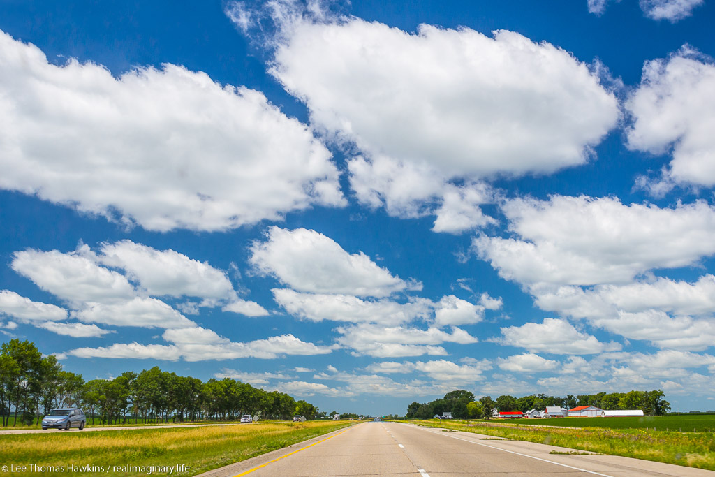
After setting out from Craig, we arrived at Rocky Mountain National Park at about noon. We drove scenic Trail Ridge Road to Estes Park, spending about 90 minutes at the Alpine Visitor Center along the way. Finally, we proceeded to the Denver suburb of Aurora to spend the evening with family. (Ignore the map for now…Google Maps is being dumb 😛 )

Once again, we got a later start than we hoped. Though we weren’t out incredibly late, we didn’t get to sleep until around 11 last night. We wanted to be up and on the road by 6am to possibly beat the traffic rush at Rocky Mountain National Park, but that didn’t happen. Yesterday took a lot out of us, and rather than using the bonus time from not having to pack up our tent to get an early start, we opted for more sleep. We managed to get on the road by about 8:30.

What Might Have Been

Travelers Inn, our motel in Craig, Colorado

Beyond our last day in Yellowstone, we couldn’t make reservations at Grand Teton National Park, and we didn’t have any at Rocky Mountain National Park. This gave us the option of spending either two nights at Grand Teton and one at Rocky Mountain, or vice versa. We ended up staying the two nights in Grand Teton. Our original plan was to spend one night—last night—camping in Rocky Mountain, which would give us the better part of the day to hike in the east side of the park near Bear Lake.

However, on our first full day at Grand Teton, we wound up at the emergency room in Jackson because I was dehydrated. We had planned on hiking up into Cascade Canyon. Since we didn’t want to leave without a hike, we decided to extend our time at Teton—and we dropped the plan to camp one night in Rocky Mountain National Park. All of this resulted in having time only for a basic drive through. Now with the late start, my original goal of hiking near Bear Lake looked like a major long shot. I often wonder how things would have gone if we hadn’t juggled things around so much, because I had drank enough water like a good boy! C’est la vie…

Reality In the Rockies

I can’t really complain too much…for being a couple of first-timers doing this on our own, well over a thousand miles from home in strange, rugged lands, without our moms or dads or any locals by our side to help us avoid dangers, we’d seen and done an awful lot without dire consequence in the last two weeks! Adventure awaited us yet again as we set out for our fifth and final national park for this trip. Up until 9 days ago, Becky and I had only ever seen 6 of the 47 national parks in the Lower 48—and in this one trip we’d almost doubled that number and seen places we’d only ever read about in books, seen on TV, or dreamed about. I always thought this would be a lot harder…and I’m really glad we decided to do this!

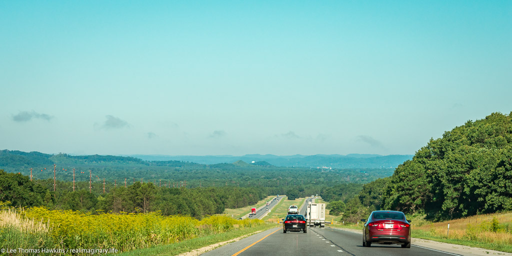
Anyway, we started out east on US-40 with me driving to the next town, Steamboat Springs, which was almost an hour away. We traversed high desert for most of yesterday, so I was hoping for some trees today. The maps depicted national forests just a few miles to the east of Craig, but yesterday we saw nothing of these woodlands on our drive in from Wyoming, not even in the distance. Most of the drive from Craig to Steamboat Springs followed the Yampa River and a railroad line. It was pretty country but not spectacular, with a lot more greenery than anything we saw last night. The scenery really started to improve just as we entered Steamboat Springs.

Steamboat Springs

While Craig seemed more like a blue collar town where the locals worked at growing, mining, or making things, Steamboat Springs instantly struck me as a larger version of Jackson, Wyoming…a fancy ski resort town with a lot of tourist money flowing through. On the mountain in the distance, you could see grassy green ski trails between the trees, although we were not yet close enough to make out the lifts. The architecture as well screamed “rustic ski resort!”. You could tell they worked hard to appeal to international tourists too, with all their speed limit signs in both imperial and metric units.

The plethora of retail along the main road had me hoping for a decent place to score a quick breakfast. Also, the amount of water I’d been drinking made the stop totally necessary. We still had nearly two hours of driving to get to Rocky Mountain National Park, and this was the most sizeable community for quite some distance. We drove through most of town when I finally just pulled into a Starbucks. One of their La Boulange breakfast sandwiches would do the trick for me, and Becky was happy to get coffee and dig into our trail mix.

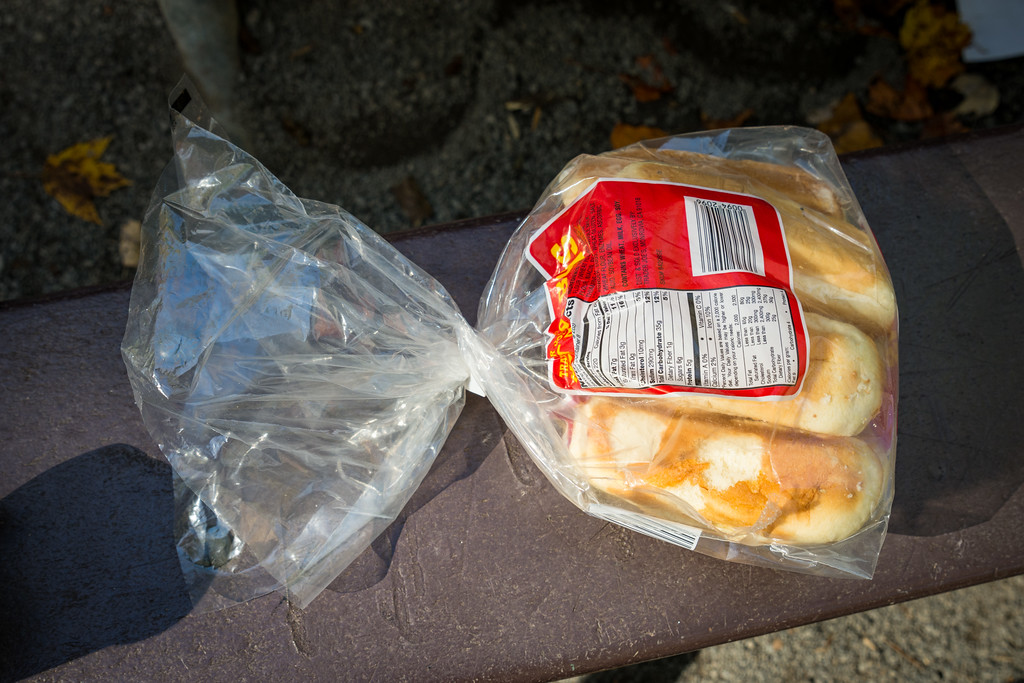
Our Big Fat Bag of Potato Chips

When air pressure outside the bag drops, air inside the bag expands to equalize pressure.

Among the many things we packed for our trip back home in Northern Ohio were two bags of Trader Joe’s Hawaiian-Style potato chips. Somewhere in South Dakota, Becky noticed that she couldn’t get them to fit into one of the plastic food bins in the trunk. By the time we’d reached Cody, Wyoming, the bags were puffed up like a balloon, and Becky wondered what had gone wrong with the chips! She knew that sometimes a bag would spoil and expand, but she couldn’t believe it had happened so fast. She opened one of them, and the chips seemed perfectly fine…but she was still mystified as to what was going on.

When Becky brought this to my attention, I asked her what happens to air pressure at higher elevations. I saw the light bulb go on instantly! Back in Ohio, we live below 1,000 feet, but by the time we were in Cody, we were around 5,000 feet, with much thinner air, causing the air in the air-tight bags to expand. Our last bag of chips had survived some pretty high elevations so far—most of our time in Yellowstone was over 7,000 feet, and we’d crossed Powder River Pass in the Bighorns at over 9,500 feet. Now came the ultimate test—Trail Ridge Road—which at one point surpasses 12,000 feet! When I rummaged for my camera in the back of the car, as Becky was taking over on driving, I remembered our our big fat bag of potato chips and put them in the back seat so we could hear when it pops. Either it was gonna blow today or not at all!

Rabbit Ears Pass & US-34

On the road again, we ascended from 6,700 feet in Steamboat Springs to over 9,000 feet over Rabbit Ears Pass. The highway hugs the side of a mountain most of the way up, giving way to spectacular views of lakes below, and snowy peaks far off into the distance. About halfway between Steamboat Springs and the entrance to Rocky Mountain National Park, US-40 and US-34 are marked as the Colorado River Headwaters Scenic Byway. The two roads fork just before the town of Granby, where US-40 heads southeast to I-70 and Denver, and US-34 proceeds northeast into the park.

US-40 follows the Colorado River through some semi-rugged terrain east of Hot Sulphur Springs.

For several miles, US-34 follows the resort areas along the shores of Lake Granby and Shadow Mountain Lake. The lakes were rather large with giant mountains rising up on the opposite sides. There were a number of marinas, motels, vacation houses, and mobile homes all along the highway. We crossed the fledgling Colorado River a couple of times here, as the road closely follows it.

Finally we passed beyond Shadow Mountain Lake, turning northward and more uphill, and saw a sign that we were entering Rocky Mountain National Park. The busy resort area gave way to forest and meadows on both sides of the road. All around, everything was green and peaceful.

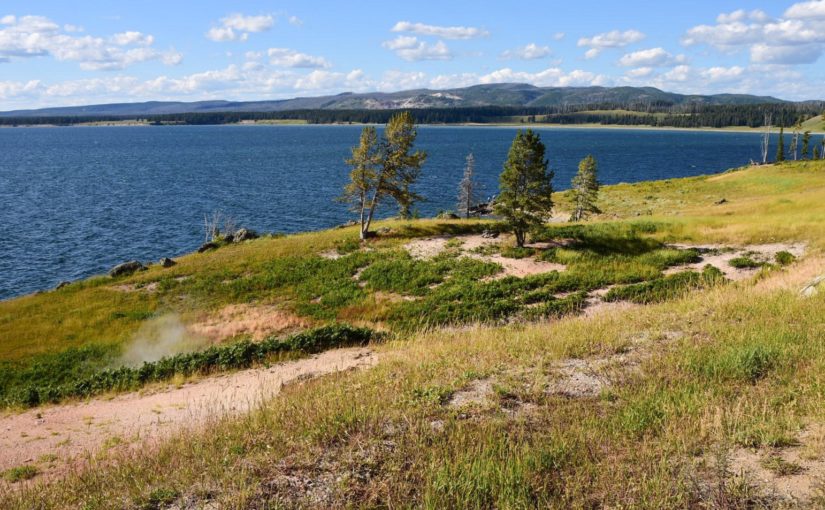
Looking to the mountains across Lake Granby

Rocky Mountain National Park

Not far down the road we came upon the Kawuneeche Visitor Center, which is just outside the Grand Lake Entrance Station. We stopped here so Becky could get our friend’s National Park Passport book stamped, and of course, so we could use the restroom. The visitor center was small, but extremely busy. It was close to noon, and every family was there with their kids. One room had a relief map of the park and its features. You could press a button and get one to light up—but it was of little use with the never-ending stream of kids repeatedly pushing all of the buttons out of shear boredom.

While Becky looked for the stamp, I looked for a park ranger. I suppose it was wishful thinking, but I asked if it was realistic to get a hike in at Bear Lake and still be back in Denver by 5:30pm. She told me that driving and parking there at this time of day is no picnic, and that we’d probably run out of time for a hike before we found our way to a trailhead. She suggested options along Trail Ridge Road…some were along the Colorado River, while others were in the alpine areas of the park. She warned us to be careful about lighting in the alpine areas, since there’s no cover.

The Grand Lake Entrance Station

For some reason I still thought we should head for Bear Lake, but I was more open now to checking out something in the high country, especially the Alpine Visitor Center. The west side of the park was green with lots more trees, but Bear Lake was on the more interesting rugged east side of the park. Besides its ruggedness, the east side was also within a two-hour drive of Denver, which made it exceptionally popular. The alpine regions through the center of the park sounded like a worthy compromise.

Ascending the Trail Ridge

So we got back on the road, which for about 10 miles passed through forest land, with the Colorado River on our left, and mountains towering to our right. The Colorado at this point is just at the small beginnings of the mighty river it turns into downstream. The valley narrows gradually until the road takes a hairpin turn to the right and begins ascending a long switchback that surpasses two miles above sea level!

Along the way were spectacular pulloffs, but we were unable to stop—not so much due to time, but due to urgency. Since we were going up a road that topped out over 12,000 feet in elevation, I had been drinking plenty of water to thwart a repeat of my dehydration episode at Grand Teton National Park. So even though I took care of things back at the Kawuneeche Visitor Center, I had to go pretty badly…again.

We passed right on by the Fairview Curve and on to our first restroom opportunity at the Lake Irene Picnic Area. After relief, I felt a bit woozy and just told Becky I wanted to sit for a minute and get used to the altitude or whatever was bothering me. I hadn’t eaten a lot so far today, and we’d just gone up a switchback with numbered U-curves with a full bladder, so who knows for sure if it was one of these factors or the altitude.

It didn’t seem like we were two miles high up where we were. I looked around but didn’t find Lake Irene…I just saw a bunch of cars and a few picnic tables with people kicking back for lunch. We were still subalpine with trees surrounding the little meadow here. The only indications you were very high were the millions of hungry mosquitoes trying to eat you before the cold came back and killed them, and your body feeling funny and telling you to slow down.

I decided to eat a few slices of bread to calm my stomach. Becky was chomping on trail mix or almonds we had with us. All of a sudden, POP!!!

We looked at each other and thought for a second, and then we began giggling. Our science experiment in air pressure had ruptured at just short of 11,000 feet above sea level! The bag had ripped open along its bottom seam. We laughed some more about how low the air pressure must be, and started snacking on the chips too.

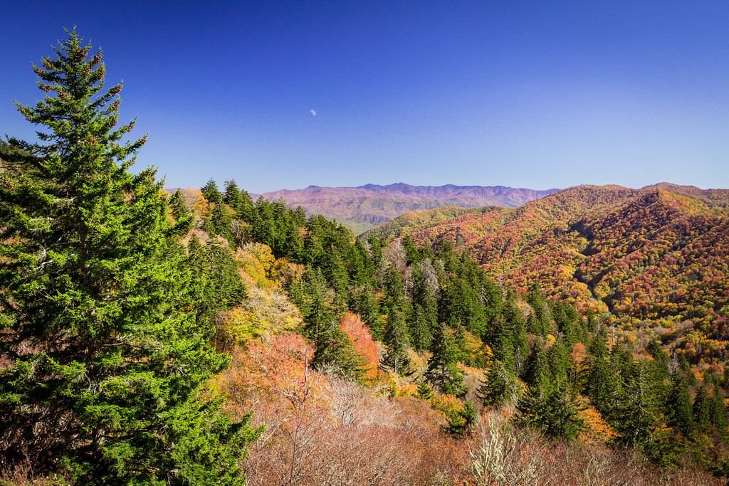
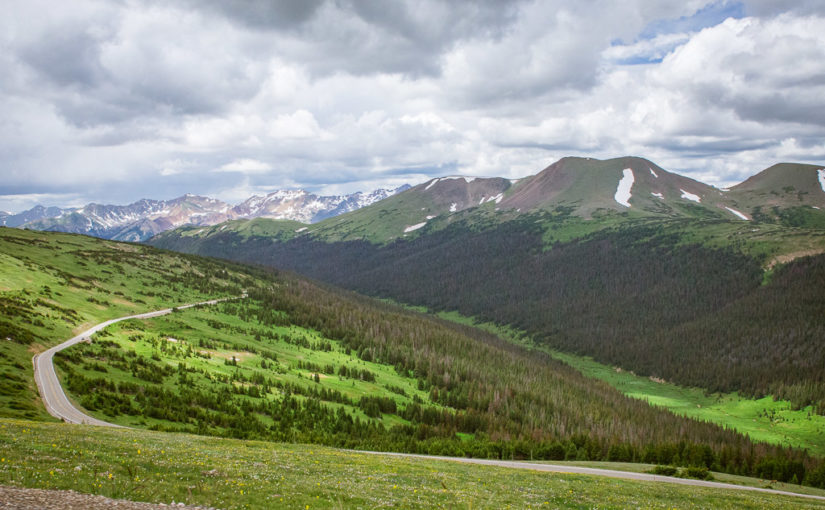
A few minutes later we felt jolly enough to continue up the road. About a mile down, we crossed the Continental Divide for the eighth and final time. After a few miles more, we ascended above the tree line to the alpine elevations—where only the smallest plants and grasses manage to survive. Another switchback later, we arrived at the Alpine Visitor Center, way up at 11,796 feet.

Looking southwest from above Medicine Bow Curve toward part of Trail Ridge Road that we drove on below Medicine Row Curve as we approach the Alpine Visitor Center.

Continue reading RealImaginaryWest Day 14 – Two Miles High in Rocky Mountain National Park