RealImaginaryWest 2019 Day 2—Nebraska’s Outlaw Trail

Seven Hours, No Stops!

We made it…this far! Once we got out of Greater Cleveland, traffic was a breeze, even around Chicago. Incredibly, Becky made the entire 7-hour drive without even a single stop! This got us to our hotel in the Quad Cities last night at 11:30pm local time. Checkin at the LaQuinta Inn Moline Airport was a breeze, and we settled into bed maybe a minute or two past midnight.

Iowa

‘Tis the Season

I haven’t had the best time sleeping lately…it seems 4 or 5 hours is about all I get most nights. I set an alarm for 6:15 with the hopes we could grab a quick breakfast in the hotel lobby and get on the road. My sinuses had other ideas—every year they let me know when August arrives. This morning they reminded me, which made it difficult to exist let alone get up. Becky was feeling it too.

“The World’s Largest Truckstop”

We finally got out the door and back on the road at 7:30am. The Iowa 80 Truck Stop just west of Davenport was our first refueling stop of the trip. It bills itself as “The World’s Largest Truckstop”, with about half a dozen fast food franchises, a ton of retail, a buffet restaurant, plenty of American automotive memorabilia, and of course gas and diesel.

Where We’re Going, We Don’t Need Interstates…

Normally we just follow I-80 all the way across Iowa. This time I wanted to try a different route farther north. US-20 runs from coast to coast—Massachusetts to Oregon—and it passes maybe 50 miles north of I-80 through Central Iowa before running across Nebraska within a few miles of the South Dakota border. Today we’ll head up I-380 to join US-20 until Sioux City, where we’ll diverge on the Outlaw Trail Scenic Byway to follow the Missouri River more closely.

The Great Plains: #NotFlat #NotBoring

I can’t say this enough, but I don’t understand why people repeat over and over again that the Great Plains are flat. I mean, I realize it’s not exactly mountainous (except it actually is in the High Plains!), but most of it has rolling hills. Eastern Iowa is especially pretty where farmers sow their crops to follow the terrain. We usually go through in July. August offers larger and more mature plants, including tasseled corn, but everything is still a wonderful green. When we passed through last September, things definitely appeared less verdant.

Splat 🙁

The weather was mostly cloudy at first. We even hit some rain between Cedar Falls and Fort Dodge. We also hit some gigantic bugs with yellow innards. Yuck. (Turns out these were actually monarch butterflies! Now I feel guilty too! Those poor things have it tough enough!)

Driving Across Iowa on US-20

We found the drive across Iowa on US-20 very pleasant compared to I-80. Traffic is nearly nonexistent past Fort Dodge, and the route is more scenic in the Western part of the state. The only drawback we discovered was the total lack of rest areas…but there were adequate numbers of gas stations all the way up to Sioux City.

Nebraska

At Sioux City we crossed the Missouri River and the state line into Nebraska. After stopping for fuel we diverged from US-20 to begin our journey along Highway 12—the Outlaw Highway—which follows the Missouri River and the state line with South Dakota.

Ponca State Park

Our first stop, Ponca State Park, preserves a section of the River that still looks much the way it did back in the time of Lewis & Clark. We stopped to enjoy the view at the Three State Overlook, where you can see South Dakota and Iowa while standing in Nebraska. This is one of the few places where the Missouri River hasn’t been dammed, straightened, or bypassed with a canal to better facilitate shipping (and flooding). The overcast sky and humidity weren’t the most comfortable, but it was exciting to ponder the beginning of Lewis & Clark’s adventure across the continent, as well as their return through this stretch of river two years later.

Continue reading RealImaginaryWest 2019 Day 2—Nebraska’s Outlaw Trail

RealImaginaryWest 2017 Lite Day 3 – Roasting in the Badlands & Relief in the Black Hills

After a very early start at Badlands National Park, we packed up camp and made a short hike at Saddle Pass, followed by hikes on the Notch, Window, and Door Trails. Before driving the Badlands Loop Road and heading to Wall Drug, we returned to Cedar Pass Campground to get showers. After lunch and a couple of hours perusing Wall Drug, we took I-90 to Rapid City and SD-79 & SD-36 into the Black Hills and Custer State Park. Finally we followed US-16A to Bismarck Lake Campground near Custer in Black Hills National Forest.

Well today had a pretty good start with a rather dry finish… I suppose another way of putting it would be, “The Great Plains strike again!” Let me start at the beginning…

Sunrise at Badlands National Park

It all started at about 4:30am for me. I didn’t quite sleep as long as I’d hoped, but I did feel OK. The eastern horizon was already alight with the impending sunrise and birds were up singing. And just like last night, except in reverse, the moon was close to setting in the west.

Since we got to bed fairly early the night before and the forecast high would likely surpass the century mark, I woke Becky. It wasn’t supposed to get truly hot until late morning or noon. If we got up now, we could do some hiking and beat the heat as well as the crowds. While Becky moseyed to the restroom and got herself ready for the day, I packed up the tent and everything inside. We might come back later to cook or take showers, but there was no need to leave the tent up since it was already bone dry. I’m proud to say I had our bedding and tent all packed up solo in 25 minutes.

Just as the sun began to peek through the clouds over the Badlands wall, I ran off and shot a panorama of the brilliant sunrise! There were some reds but mostly oranges and violets. I would have shot the moonset too, but clouds on the western horizon totally obscured it.

Saddle Pass Trail


Looking up the Saddle Pass Trail in Badlands National Park. Blue markers help to identify the trail amid the indistinct terrain.
Looking up the Saddle Pass Trail. Blue markers help to identify the trail amid the indistinct terrain.

We were on the road before 6am and drove the short distance to the Saddle Pass Trailhead. The temperature was comfortable for now, around 70 degrees and low humidity. The Saddle Pass Trail is short at only 1/3 mile, but it’s a steep 216-foot climb up to the top of the Badlands wall.

We were on the road before 6am and drove the short distance to the Saddle Pass Trailhead. The temperature was comfortable for now, around 70 degrees and low humidity. The Saddle Pass Trail is short at only 1/3 mile, but it’s a steep 216-foot climb up to the top of the Badlands wall.

We started up the trail around 6am. It starts out exceptionally steep and has loose gravel footing. We were nearly halfway up when Becky decided she couldn’t go any further. It was just too much for her first thing in the morning. All the literature promised 360-degree views, so I decided to continue up to the top. The view did not disappoint!

Looking south from Saddle Pass in Badlands National Park.
Looking south from Saddle Pass. The tiny black thing in the parking lot near the tree is our car!

After shooting a few photos, one of the car from all the way up on top, I headed back down. There’s a trail that runs along the top of the Badlands wall, but I didn’t check it out because I wanted to make sure Becky was OK. I was off the trail and back at the car just 45 minutes after we arrived. Becky was starting to feel better and suggested that she probably just needed something to eat to get her energy up. While I’d guess our bodies were still on our usual Eastern Time Zone schedule, it was probably just too quick of a start to the day for her.

Up to the Door/Window/Notch Trailhead

A bighorn sheep rests in morning shade north of Cedar Pass along the Badlands Loop Road in Badlands National Park.
A bighorn sheep rests in morning shade along the Badlands Loop Road on our way to the Door/Window/Notch Trailhead.

When we visited Badlands back in 2015, our only real hike here was the Door Trail. The same trailhead actually has two other trails, the super short Window Trail, and the more challenging Notch Trail. None of the three trails are particularly long, so we had plenty of time to do all three if we wanted to. The sky was crystal clear with bright sunshine now, but the temperature was still comfortable.

We made it to the parking lot around 7am, still well ahead of the crowds. We started with the Notch Trail, which is only 1.5 miles round trip. It winds through a small canyon for about 1/3 mile or so, and then there’s a ladder that takes you up to the rim so you can continue through a slightly larger canyon. We somehow missed the ladder, and realized it when the trail suddenly ended at an impasse. We could hear people just above us, so we retraced our steps. Turns out we followed a wash and went right past the ladder. It’s pretty easy to get disoriented and lose trails here! Almost all of them, including Notch, are actually marked with stakes at regular intervals so you can tell you’re going the right way.

Becky awaits my return as I hike the section of the Notch Trail above the ladder.

A Perilous Wrong Turn

Becky took a look at the ladder and gave it a nope. I’m afraid of heights and didn’t find it at all intimidating. The easy slope and the grip of my hiking boots made it easy to walk upright the entire way.

I then made my way around the rim and came across some signs that got me confused. One said “KEEP RIGHT”, and the other was an arrow pointing at what I thought was the way to go. I’d heard the Notch Trail could be challenging, but I was surprised it would go right up this steep wash. I forgot to even look for a marker stake. Before I knew it, the wash got too steep and too loose to safely go any further—obviously a dead end!

Continue reading RealImaginaryWest 2017 Lite Day 3 – Roasting in the Badlands & Relief in the Black Hills

RealImaginaryWest 2017 Lite Day 2 – The Jolly Green Giant & the Big Badlands

From our motel in Madison, Wisconsin, we followed I-90 West to Badlands National Park with brief stops at Green Giant Statue Park in Blue Earth, Minnesota and The Corn Palace in Mitchell, South Dakota.

Despite getting in late last night, I was awake at 5am. I suppose it’s always harder to sleep in a new bed. By 6:30am we were out of the motel and refueling across the street. With all of our meat still solidly frozen, there was no need to buy ice for the cooler. After Becky grabbed a coffee at Starbucks, we were back on I-90 again by 6:50.

Crossing Wisconsin & On to Minnesota

It was a beautiful morning! Last time we passed through Wisconsin, the sky was a very strange color due to forest fire smoke from way up in Alaska and Canada. This time we had magnificent sunny blue skies and good early morning light. Wisconsin is wonderfully green and pretty in summer. We’ll definitely spend more time here on some future road trip.

Since we got going early, there were no traffic problems through the often-congested Wisconsin Dells area. When we crossed the Mississippi River into Minnesota near LaCrosse, our chances of hitting any traffic at all dropped to almost nothing.

Overlooking the Driftless Region of Wisconsin from Jacksonville Pass on I-90 near Tomah, Wisconsin on a summer morning
Overlooking the Driftless Area of Wisconsin from Jacksonville Pass on I-90 near Tomah, Wisconsin

In the past we’d never been on I-90 across Minnesota beyond the first exit. We gradually worked our way west from Pepin along the Mississippi through heavily-wooded regions of the state. As we passed directly west this time, we noticed a significant transition in the nature of the land. After winding up the hill from the Great River and onto Minnesota’s rolling hills, it was as if all the trees were different and more sparse. The land also transitioned from mostly woodland to entirely agricultural. This dramatic change told me we were now on the Great Plains.

Cumulus clouds stretch across the sky over I-90 and prairie farmlands near Blue Earth, Minnesota.
Cumulus clouds stretch across the sky over I-90 and prairie farmlands in Minnesota.

Green Giant Statue Park & Blue Earth, Minnesota

A billboard along I-90 near Blue Earth, Minnesota encourages tourists to stop and visit their 60' Jolly Green Giant.
A billboard along I-90 encourages tourists to stop and visit the 60′ Jolly Green Giant in Blue Earth, Minnesota.

By 10:50am we’d crossed half the state. We stopped for an early lunch in a small town called Blue Earth. Besides the town’s eccentric name, it also has a 55-foot, 8,000-pound statue of the Jolly Green Giant we have all seen on numerous Green Giant labels and television commercials. He made his first appearance at the dedication of I-90, as the very last section was completed near Blue Earth in 1978.

The Story of the Jolly Green Giant Statue

People gather at Green Giant Statue Park in Blue Earth, Minnesota to photograph a 60-foot tall statue of the Jolly Green Giant.

At the time, the Green Giant company operated a canning plant in Blue Earth and was headquartered 60 miles north in Le Sueur. The idea for erecting the statue to attract travelers on the new transcontinental freeway originated with local radio station owner Paul Hedberg. On his weekend program he would interview families passing through Blue Earth on US-169, providing them with samples of Green Giant vegetables. Many children inevitably asked where they could see the Jolly Green Giant. So with the company’s blessing, Mr. Hedberg assembled funding from local businesses to bring the Giant to life in time for the freeway dedication.

One year later, the Green Giant company merged with Pillsbury, and the brand has changed hands a few times throughout the years. However. another company still continues to can corn and peas at the plant in Blue Earth. And the statue attracts 10,000 annual visitors. Each year the Giant Days festival is held at the adjacent Fairbault County Fairgrounds.

Continue reading RealImaginaryWest 2017 Lite Day 2 – The Jolly Green Giant & the Big Badlands

RealImaginaryWest Day 7 – Devils Tower, the Bighorns & Our First Rodeo

The most driving we’ve done since Day 1 started in Rapid City, South Dakota. We took the scenic route through the Northern Black Hills to Devils Tower. We then took I-90 to Buffalo, where we followed the Cloud Peak Skyway/US-16 over the Bighorn Mountains. We continued on US-16/20 West from Worland, through Greybull, and on into Cody…where we camped before heading into Yellowstone National Park the next day.

Devils Tower & The Northern Black Hills

We made it! This far…

Up and off we went around 7:30am from the M Star Rapid City on Mount Rushmore Road/US-16. The weather was still a bit hazy, but it was probably the clearest morning we’d had on the entire trip. We got started a little later than we’d hoped, but we figured we still had time to hit Devils Tower and make it to Cody in time to set up camp and see the famous rodeo there. After finally remembering to clean the bugs off the windshield, we followed I-90 up to US-85, and then followed SD-34 across the Wyoming state line. Here, the road turns into WYO-24 and heads to Devils Tower. We could have stayed on I-90 and taken a faster route via US-14, but these three roads were all marked scenic.

Becky and I had already decided yesterday that what we’d seen so far of the Black Hills was pure awesome! We’d love to come back and camp either in Black Hills National Forest or Custer State Park. Seeing it for a day made us want to come back for a week! However, Devils Tower and what we saw of the Northern Black Hills in Wyoming made it hard to imagine confining a return trip to only the better-known Southern Black Hills in South Dakota.

At the last second I almost decided to stick to faster highways in the interest of time. After we got a few miles into Wyoming, though, I was so glad that we took the scenic route instead of the freeway! The red rocks and canyons along the Belle Foursche River held a type of beauty we saw nowhere else in the Black Hills. It was definitely worth the extra few minutes! Then we passed over a crest and around a curve—and caught our first glimpse of something like a giant tree stump on the horizon—that was just unmistakably Devils Tower.

It wasn’t the clearest day…but this was where we first laid sight on Devils Tower from WYO-24, still over 13 miles away as the crow flies. The hills on the right are the Little Missouri Buttes, which are just 3-4 miles northwest of Devils Tower and of the same geological composition.

Red sandstone is exposed along much of the Belle Foursche River as it runs below Devils Tower.

Devils Tower as seen from the east on WYO-110. Each angle offers a unique view.

It’s no wonder the Sioux and Kiowa saw it and thought, “This means something! This is important.” (Sorry, couldn’t resist!). The Kiowa have the coolest story about what Devils Tower means. The story is told in Ken Burns’ documentary, The West, and they had a display about a similar legend.

I can’t help but feel a sadness about the cultures that were destroyed by the United States’ westward expansion. The Indians really loved the land, and all the creatures that lived in it (at least when they weren’t warring with rival tribes). While the new Americans certainly intended on leaving their imprint on the West, often for the love of power and riches—they at least saw that places like Devils Tower should be held sacred, just as the Indians thought they were. And thus in 1906 with the passage of the Antiquities Act, President Theodore Roosevelt created Devils Tower National Monument—the country’s very first national monument.

While photography is all about capturing light, creating dramatic images is all about the shadows—and even in the middle of a hazy summer day, Devils Tower delivers from this northwest view! I can’t wait to see this printed on glass or metal…!

One last shot from the west, taken from the visitor center

At the visitor center, there were lots of ranger-lead activities and several hiking trails around the mountain that I would love to have seen. There were plenty of gorgeous campgrounds in the area too, within the national monument land as well as all up and down the nearby Belle Foursche River. Unfortunately, we didn’t allocate much time here in favor of more time at Yellowstone—and we needed to get going in order to make Cody. So on we pushed to US-14 and I-90…

Continue reading RealImaginaryWest Day 7 – Devils Tower, the Bighorns & Our First Rodeo

RealImaginaryWest Day 6 – The Black Hills, Mount Rushmore & Wind Cave

The weather held up really well, with just a little rain falling on us south of Rapid City as we drove from Badlands National Park to lunch in Keystone. We visited Mount Rushmore and got down to Wind Cave National Park just in time to catch the Natural Entrance Tour. Then we drove north into magnificent Custer State Park—WOW!—and finally made our way to our motel in Rapid City via the spectacular Iron Mountain Road.

Dreaming of the Old West

After a positively uneventful and peaceful night in Cedar Pass Campground at Badlands National Park, Becky and I woke up refreshed, and packed up our tent bound for the Black Hills. Becky cooked eggs in a tiny little portable stove she bought that resembles more of what a caterer uses to keep food warm than an actual stove. This was what we had to use to cook at Badlands, since there were no campfires allowed due to the risk of prairie fires. It took a while to cook a single egg, but it was effective.

After seeing I-90 and the Badlands Loop Road, I thought it would be best to drive to Rapid City via SD-44 so we could see the other side of the Badlands. Few likely see this area, since it is a much less popular part of the park. This was a great drive, which starts by going through the tiny little town of Interior, then passing through the town of Scenic, and finally to South Dakota’s second-largest city, Rapid City.

SD-44 straggles the border between Badlands National Park and Buffalo Gap National Grassland as it stretches West toward Scenic and Rapid City.

Black-footed ferrets, once extinct in South Dakota, prey almost exclusively on prairie dogs for food. They were reintroduced to the wild here in the 1990s, and as a result prairie dogs are protected in Buffalo Gap National Grassland.

Most of the way was either within Badlands National Park or Buffalo Gap National Grassland. The road runs alongside an abandoned railroad line where small wooden trestles still cross creeks, just without the rails. There were also plenty of pulloffs where you could drive into the grassland on dirt roads. Signs said that this was a management area for the black-footed ferret, which was thought extinct in the late 1970s. A few years later they were spotted again in Wyoming, and eventually reintroduced in areas such as this one. For the majority of the route we could see badlands going on for miles and miles and miles.

The railroad line crossing all of the creeks just a few feet above was odd to me. The fact that the creeks had grass all the way down to the water along their entire banks was strange to me too. Back East, the railroads are built far above floodplains, and there are trees and underbrush all around creeks and rivers, and pretty much just mud on the dropoff into the creek. The rolling hills and twisting and turning railroad bed conjured up all sorts of westerns and cartoons I’d seen all my life with scenery like this. When we entered into Black Hills country, it especially felt like I was living in an old western movie, except that technology and the 20th Century had happened and it was a little different now. It was strikingly beautiful country, and a lot of the things I’d seen in stuff set in the Old West started to make sense. I could imagine riding a galloping horse through this valley and on up into Rapid City with the rolling prairie on either side of me, and with the first pines appearing in the Black Hills.

Writing the Itinerary As We Go…

Now today had me a bit nervous…up to this point, we had all of our accommodations planned and/or reserved well before we left, except for the motel in Wisconsin. I had also managed to score three nights worth of campsites in Yellowstone online the day we left, and after that nothing was reservable anyway. The one and only night I hadn’t planned out was tonight…I figured on getting a campground as close as possible to Mount Rushmore. I thought it would be good to be able to capture it at sunrise in case sunset didn’t work out, plus it would eliminate any extra driving at the end of the night and hopefully we’d be able to relax. Unfortunately, there were zillions of campgrounds in the area and I had no opportunity to research many of them. The ones I did check were all super-expensive, as in might-as-well-get-a-motel expensive.

When we got cell service back again and I could check the forecast, the potential rain and the possibility of having another repeat of DeSmet weather settled it! I Googled around and found a motel—the M Star Rapid City. It was the cheapest thing I could get, and it was close to I-90, so I jumped on it. That was settled!

Now it was time to decide which destination to hit first…there were two on our itinerary. I’d originally planned on going to Wind Cave National Park first thing, then heading to Mount Rushmore by way of the Iron Mountain Road and seeing Rushmore closer to sunset. This would give me the opportunity to photograph the sculpture both in the Golden Hour and after dark when it’s all lit up. It was still partly to mostly cloudy, but the forecast called for overcast and possibly rain in the evening. This significantly reduced the probability of getting any interesting shadows or blue sky—and it shouldn’t matter what the weather outside is to tour inside a cave—so we elected to hit Rushmore first after we grabbed lunch.

We got a bit of rain between Rapid City and Keystone. I’d never seen a freeway interchange with wood-framed overpasses like this one at the junction of US-16 and US-16A!

The drive out of Rapid City and deep into the Black Hills was peppered with many and varied tourist traps. Several were totally designed to grab an eight-year-old’s attention so that they would pressure their parents to visit. I still have to admit, a few were tempting to check out.

Right before Mount Rushmore, you go through the town of Keystone, which seemed to have more hotels than residents. Again, there were many and varied tourist attractions, several of which were themed around the presidents and their history. We stopped at the Grizzly Creek Restaurant to try their burgers. I went for the bourbon burger and Becky had the buffalo burger. They were tasty and hearty, but not remarkable for the price. They have ten beers on tap, two or three of which were the standard Miller and Budweiser choices, while the rest were all local microbrews. We still had a lot ahead of us for the day, so I decided not to have anything after I tasted a sample of the only beer that really sounded good to me—which was a wheat beer that tasted too hoppy for my liking.

Mount Rushmore National Memorial

The clouds were just beginning to subside as we caught our first sight of Mount Rushmore from SD-244.

Mount Rushmore was a busy place, probably the busiest we’d seen so far on this trip. It was nowhere near congested though, especially compared with just about any of the major tourist attractions in California. As you drive up on SD-244 to the monument, you actually catch your first site of it, which is pretty striking. At the entrance are ticket gates where you have to pay to park in the massive deck they built back in the 1990s. Unfortunately, the Annual Pass we just bought at Badlands doesn’t apply here, as a separate organization operates the parking deck. Finding parking was not too difficult, and neither was making our way up to the monument.

Mount Rushmore towers over the grand entrance to the memorial from the parking decks.

Continue reading RealImaginaryWest Day 6 – The Black Hills, Mount Rushmore & Wind Cave

RealImaginaryWest Day 5 – The Good & Badlands of South Dakota

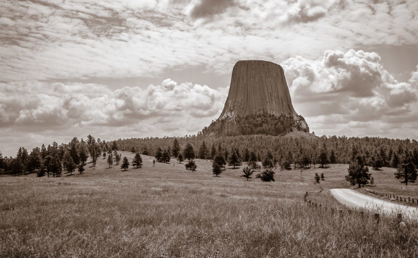
We drove through drizzly conditions from De Smet to Mitchell in Eastern South Dakota, and then traversed most of the state on I-90 to Badlands National Park and Wall.

Last Stop with Laura

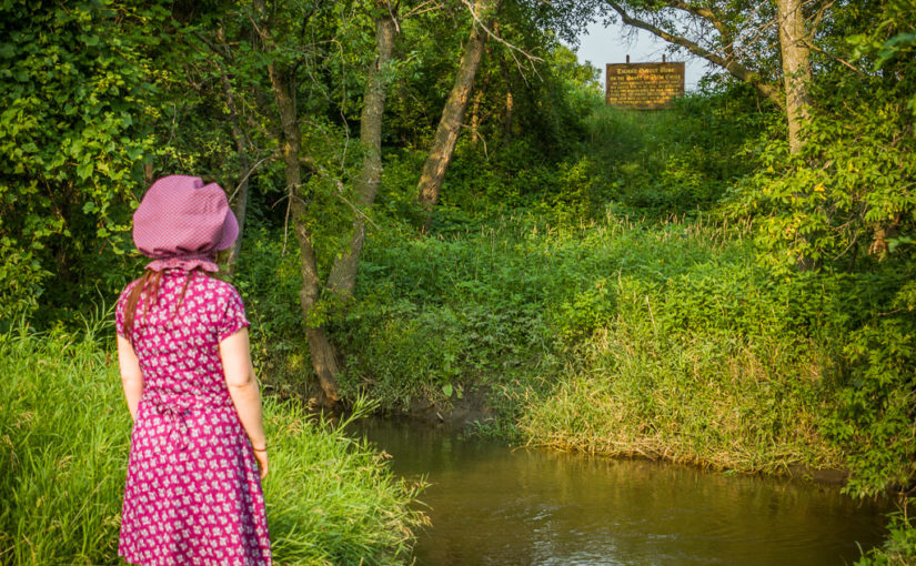
So, after another violent Great Plains storm (albeit in much more secure conditions) and our car already packed, we emerged from our covered wagon to much cooler but drizzly weather. The misty haze was not looking good for my photographic aspirations today! The forecast showed the rain holding on for just a little longer in De Smet, and that there would be a general clearing trend where the sun might come out and burn off the fog.  Becky and I each got showers this morning, since it would have more long-lasting effects than if we’d showered the night before with the 85-90 degree heat and humidity. The humidity in South Dakota was nowhere near as high as what we had experienced before we left Ohio, but it was enough to make you move a lot slower so you didn’t overexert yourself in the heat.  Now that the temperature had dropped to 65-70 degrees, everything except the haze was peachy.

We got a fairly early start, getting out of the Ingalls Homestead around 8am. We headed into De Smet and to the local coffee shop, Ward’s Store.  Interestingly enough, this was the site of Charles Ingalls’ store, and in the original building that rose in its place after he sold it and moved out to his homestead.  Becky was really glad to have gotten coffee here, since now she’s been to every place where Laura lived in De Smet.

We then continued south on SD-25, making our way down to Mitchell, which is only about an hour away. We planned to see the famous Corn Palace, and I hoped to score a quick breakfast.  Ever since we’d left De Smet, it had been horribly foggy, drizzly, and hazy.  The rain had let up completely by the time we’d reached Mitchell, but the fog lingered.

The World’s Only Corn Palace

A look south down Main Street in Downtown Mitchell

We got breakfast at a hip restaurant called Cafe Teresa. The place seemed to be loaded with college students, who I’m assuming were from Dakota Wesleyan University. It was easy to overhear bits of conversations about finals, classes, and professors. Becky and I both ordered eggs and toast, which hit the spot..and so off we went to see the Corn Palace.

The Corn Palace wasn’t quite itself on the day we visited… This made us sad. 🙁

It was still way cool to see the corn murals though! 😀

The Corn Palace is the main tourist draw in Mitchell, which has about 15,000 residents and a rather quaint and decidedly Western downtown. The building is decorated on its exterior by thousands or maybe millions of ears of corn, color coordinated to depict western scenes of cowboys, buffalo, stagecoaches, and Indians on the front and sides of the building. Unfortunately, it took us a bit to make sure we had actually found it because it looked much less flamboyant than the pictures we’d seen. Apparently they were in the process of replacing the domes on top and had run into a delay because the new domes weren’t strong enough to hold up to South Dakota’s wind (which Becky and I have noticed is quite substantial).  Also, it appeared that they were updating parts of the building’s exterior, which they do every year anyway because it’s probably a good idea to slap a fresh coat of corn on the building to keep it from peeling.

So it’s that kind of palace!

Becky and I proceeded inside “The World’s Only Corn Palace”, hoping for a more satiating indoor experience. There were lots of exhibits inside about corn, the history of the Corn Palace (reaching way back into the 1890s), and then there were doors…turns out through the doors you could see that the Corn Palace had a lot in common with San Francisco’s Cow Palace and the Detroit Area’s Palace of Auburn Hills—for it was a small basketball arena where a giant souvenir and gift shop had been set up.  I didn’t figure it for an opera house, but I have to admit that without having done any research that in the back of my mind when I saw the general shape and size of the building, I wondered if in fact this was a basketball arena.

It seemed like a very nice place to see a game. It was likely that it hosted games for either the Dakota Wesleyan University or the local high schools.  But either way, the clock was ticking and we had to move on to Badlands National Park, which was about 3 hours away on I-90.

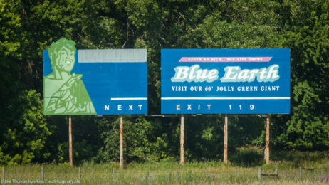
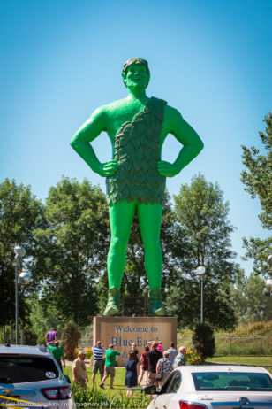
You GOTTA SEE South Dakota!


A VERY small sample of the gimmicky advertising…I regret that I did not capture more of these sorts of things!

I’d like to take this opportunity to recognize South Dakota for a couple of things. First, Mitchell was my first indication that South Dakota really was a great place to analyze advertising gimmicks, because between what we saw here and what we saw later that day in Wall, it was readily apparent that South Dakota took the art of a tourist trap to a refined art form!  There were signs and buildings and old trucks and cars and dinosaurs in front of billboards all along the interstate that really were sights in their own right and really made it tempting to stop a lot along the freeway and check this stuff out.

No, your eyes do not deceive—the speed limit really is 80mph!

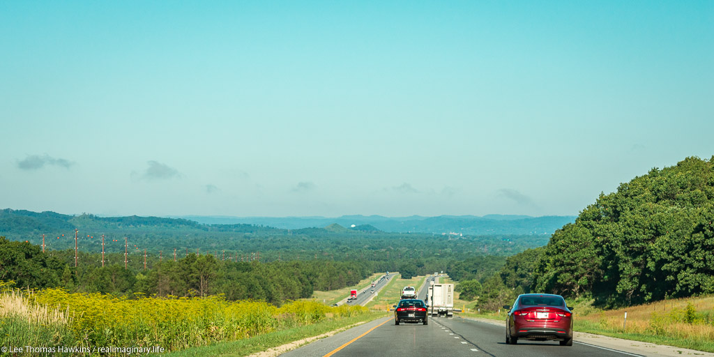
Second, the speed limits in South Dakota often seemed to actually make sense!  In Minnesota and most other states, you drove 55mph, maybe 60 if you were lucky in remote two-lane state highways—we hit the SD state line, and voila—65mph!  When we first got on I-90 in Mitchell, we had to check our eyes at first—”Speed Limit 80″—AWESOME! So thank you, South Dakota, for admitting that you might as well be able to drive fast on the roads here because there are so very few cars, the visibility is great, and it takes so very long to reach someplace.

Another reflection I have to make about South Dakota is that I didn’t expect it to have so many trees—in fact, I didn’t expect it to have any at all without at least a creek nearby, since it is in the Great Plains—and the Great Plains is a great big huge prairie that just doesn’t have the rainfall to really grow trees.  Apparently the main reason why there are so many trees is because of the Homestead Act, which allowed you to earn your 160 acres of land through growing enough trees on your claim…and probably because people who aren’t used to vast open grasslands prefer to have lots of trees to break up the scenery (and did we mention wind?). Personally, I’m all about diversity and history, so I was excited at the prospect of seeing a land that was just covered with prairie and all the things that come with it!  I also think a giant prairie sounds awesome for just grazing cattle, which we saw a lot of actually. Black Angus cows were everywhere, and lots of pieces of property up in the northern part of the state had lakes and sloughs where the cows often congregated to play in the water and drink as well as graze.  As we pushed farther west from Mitchell, we started to see a lot more of the open prairie I expected and we got to see fewer trees if any at all.

The Great Plains Are Not Flat

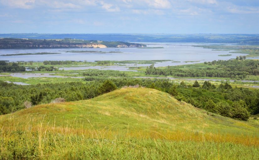
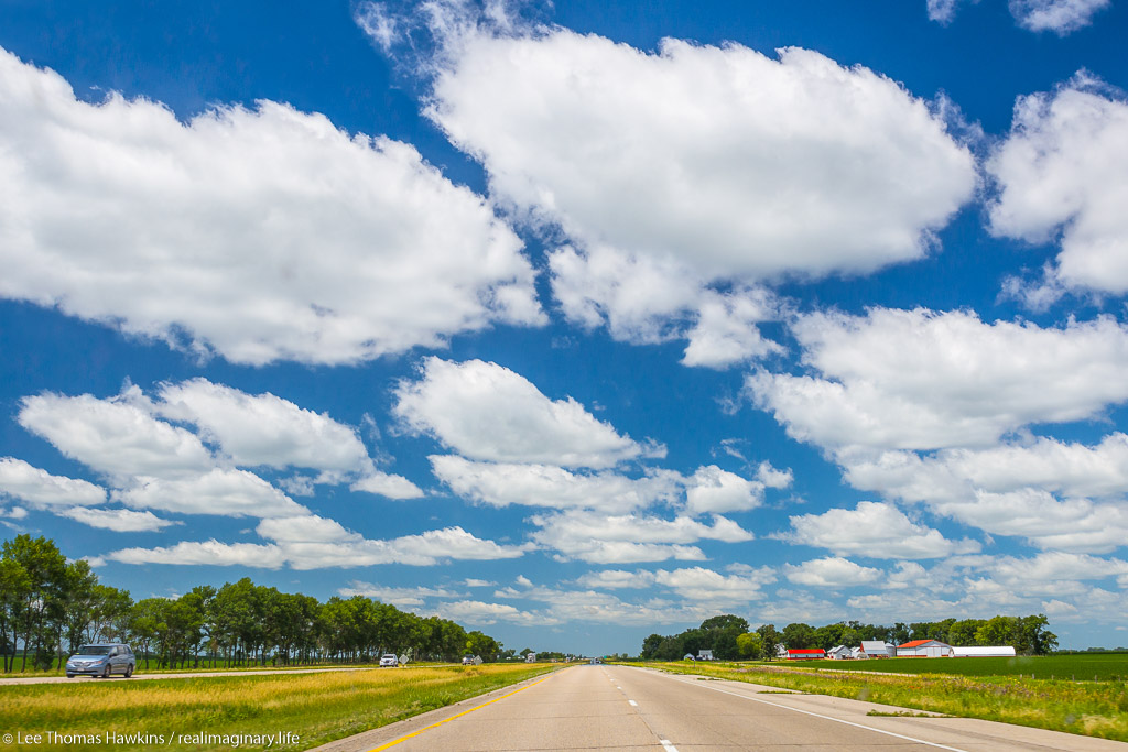
One big misnomer about the Great Plains is that it is all flat. That may be true in places like Illinois or Kansas, but it is most definitely not the case in Minnesota or South Dakota where rolling hills are pretty much the rule.

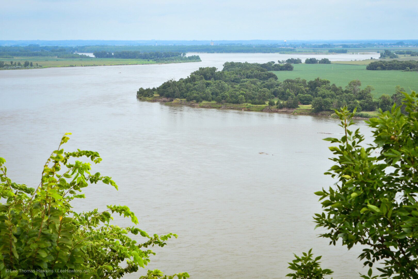
There are even deep valleys, especially along I-90, with the biggest valley being the Missouri River, which runs right through the state. It was unfortunately extremely foggy when we crossed it, but it was still a site to behold!  It seriously was more like crossing an expansive lake than crossing a river, and was actually much much bigger in person!  If they had called it part of the Mississippi instead of naming it a whole other river, the Missouri-Mississippi River would be among the longest in the world, and from what we saw, it had enough water to prove it!

Crossing the Missouri River on I-90. Sorry for how hard it is to see anything, but it was actually so foggy that we could see even less in person! I cranked the Dehaze on Adobe Lightroom up to +75 for this one (no joke)!

Crossing the Missouri was significant for another reason too—prairie dogs—of which we had seen none so far along the entire prairie we had crossed. I asked someone about that in De Smet, and was told that all the prairie dogs were located on the other side of the Missouri River.  The locals here hate them, because as this gentleman said, prairie dogs with their burrowing “just destroy the land”.  We were still looking forward to seeing some though, as they are an animal unique to the American West.

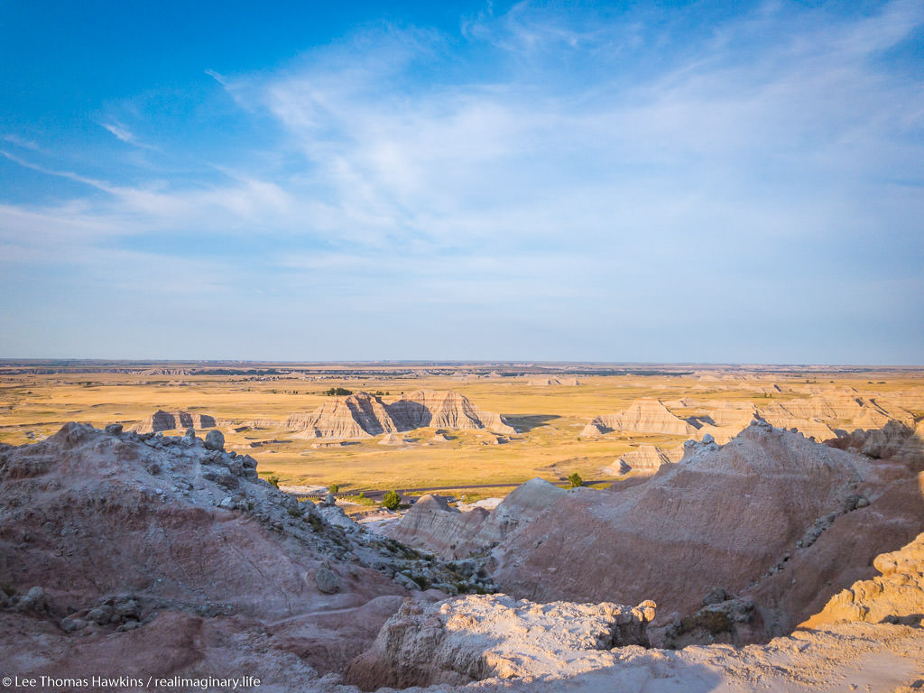
Another feature I noticed were steep escarpments to the south along the freeway, and sometimes there would be giant protruding chunks of land in the middle of the prairie. We were pushing closer to the Badlands, and so it seemed there were small little badlands appearing more frequently in the distance to our south along the freeway.

When we got on I-90, I told Becky to let me know if she wanted me to drive, since we’re about to get on a long stretch of mostly straight freeway where highway hypnosis can set in. About an hour or so away from Badlands, Becky said she was starting to have trouble, so I had her pull off a few exits down the road so I could finish my last blog entry.  It was my first taste of legally zipping along at 80mph, on a freeway in the middle of the open prairie.

Who knew crap like this would be in such demand?

We were just a few miles away from our exit for Badlands National Park on I-90 where we pulled off the freeway at a scenic overlook. As we headed up the hill to take in the view of the expansive prairie all around us and the Badlands in the distance to the Southwest, two people seemed engrossed in some sort of spectacle taking place on the ground.  When we got close enough, you could see two little pieces of poop rolling up the hill being pushed by little dung beetles who were happy to have scored dinner!

Overlooking I-90 from the scenic overlook at Buffalo Gap National Grassland, just a few miles east of the exit for Badlands National Park

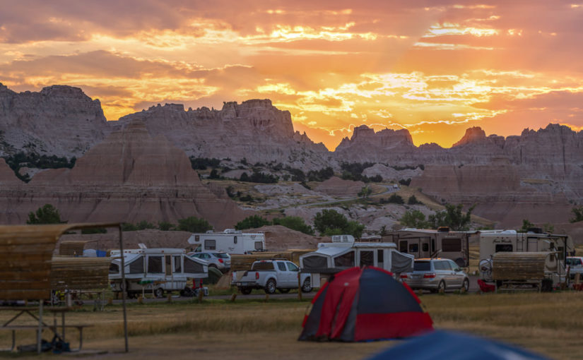
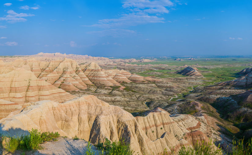
Entering Badlands National Park

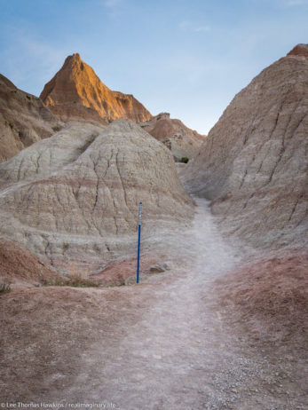
So many peaks…each unique…

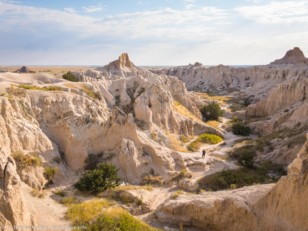
Unlike many national parks, you can go off-trail and climb on the rocks…so your photo-op creativity is really only limited by your command of gravity!

We pressed on into Badlands National Park, a place where neither of us had ever been, and our first national park of the trip.  On the map it looked as if you got off the freeway and BOOM there’s the Badlands. Reality however, was that it was still nearly ten miles until we reached the park entrance.  Since we planned on visiting four national parks with entrance fees on this trip alone, we ended up purchasing an annual pass for $80. The total for entering each of these with just an individual park pass would be $105, so I recommend the annual pass if you plan a trip like this, at it saves you a substantial amount of money!

Entering the Badlands was like entering another world!  You’re on the prairie and then there are sharp layered outcroppings of rock that look like teeth made of mud sticking straight out of the ground.  Some were as tall as a person, and some were hundreds of feet high, while plenty of others were in between. Cedar Pass was positively awesome, where the road descends at least a couple hundred feet down an escarpment that revealed how big these Badlands really were when you could see them from the south.  It was almost like going down a great big step over a monster’s bottom teeth and into its mouth.

Overlooking the lodge and visitor center from Cedar Pass

Continue reading RealImaginaryWest Day 5 – The Good & Badlands of South Dakota

RealImaginaryWest Day 4 – Connecting with Laura at the Ingalls Homestead

Our first day off the road! We visited Ingalls family historical sites and museums around De Smet, South Dakota and took time to relax and recover after the storm that drove us from our tent the night before.

A carriage traverses the Ingalls Homestead

Waking Up in De Smet

After getting practically no sleep the night before, we began our day at about sunrise by driving into De Smet and getting breakfast at the Oxbow Restaurant. There was no use hanging around the Ingalls Homestead anyway, since they didn’t open until 9am that day. They would hardly have even known we were there, save for a couple of bundles of firewood missing, since we had pitched our tent well after closing time and pulled it out only two or three hours later. The weather had calmed down, with partly cloudy skies and gorgeous shades of greens and yellows from the early sunlight on the terrain around us. The wind was still blowing hard and gusty, but it was all that was left besides a few puddles after the last night’s storm.

With what little of my brain was left, I checked the forecast—partly cloudy, 90 degrees for a high, and windy all day with severe storms likely in the evening with possible large hail. Uhm, yeah…we’re not doing the tent thing! NO WAY. Large hail was all we needed to know.

So at the Oxbow, it was great to sit in something that was not a car, and it was just awesome to get a nice hot breakfast with eggs, French toast, and bacon. Becky and I deliberated over whether we should get one of the covered wagons they have at the Ingalls Homestead that night, or whether we should get a motel.

At breakfast we met all sorts of locals, mostly farmers in the De Smet area. One older man said to another as he walked in, “How did you like the sound of MUSIC, last night!” I quickly concluded he was talking about the horrendous storm and had to laugh out loud! He loved the storm for watering his crops, while I hated the storm for wrecking my sleep and nearly wrecking my tent. It was also quite telling that he found pure enjoyment—apparently that isn’t even close to a bad storm for the Plains!

Laura Ingalls Wilder Historic Homes

After breakfast, we trekked back to the Ingalls Homestead and paid for our firewood and the night of not tent camping in the maelstrom. We also bought admission to the exhibits and activities there that demonstrate what Laura wrote about in her books. We planned to first go into town to tour the Laura Ingalls Wilder Historic Homes museum first, and then return to see the Homestead.

On the museum grounds there are four buildings: the main store, the old schoolhouse that Laura and her sisters attended, the small schoolhouse where Laura taught at the age of 15, and the railroad surveyors shanty that the family lived in when they first moved to De Smet. Becky was most excited to see the house Charles Ingalls built, which was across town from the museum itself. I’d love to share more photos, but photography inside the buildings is prohibited.

One remarkable difference with De Smet is that the Ingalls practically lived in the lap of luxury here! The surveyors shanty was originally located on Silver Lake, on the east edge of town, and even it had a huge kitchen with a sizable pantry, a bedroom, a living area, and a huge loft where the girls slept. It beat the pants off the dugout in Walnut Grove and would have been a lot easier place to spend the winters than the log cabin in Pepin. Charles Ingalls got a coup with this railroad job! The family was delivered from the grasshopper-ravaged farm at Walnut Grove and wound up in an even better position in a town that seemed much prettier.

Charles Ingalls built a 10′ x 14′ shanty in 1880, which he doubled in size the following year. This replica at the Ingalls Homestead also includes the 16′ x 20′ addition he added to hold the pump organ he and Laura bought for Mary.

Now while Charles Ingalls worked for the railroad, he opened a store at the center of town and also undertook another homestead claim. There he built a shanty for the family that started out as another “little house”, but was doubled and then nearly doubled again in size—to add a room big enough to entertain and to hold an organ. You see back in Walnut Grove, Laura’s older sister, Mary, at the age of 14 had contracted a fever that caused encephalitis, nearly killing her. This eventually resulted in her losing her eyesight and going away to attend a school for the blind where she would learn to play the organ. While she was away, Charles and Laura saved money to buy an organ for the house as a surprise for Mary’s homecoming. She became the organist at the Congregational Church the Ingalls attended in De Smet.

The Ingalls spent most of six years at the family homestead. Under the Homestead Act of 1862, Charles had to plant at least ten acres of crops for five years, live there for at least 9 months of each year, and build a house to live in, after which he would receive ownership of the 160-acre quarter-section of land he had developed at no charge from the federal government. Another way a homesteader could receive his land was to plant enough trees on the land successfully in that amount of time. Charles showed in his proving papers that he had succeeded at farming 30 acres and that he had also planted 6,000 trees, exceeding all the requirements to receive his homestead.

The Ingalls Home & Museum is the last house Charles Ingalls built and lived in.

As Charles and Caroline’s age advanced and his daughters except Mary got married and moved away, the family built a house in De Smet that would top even the modest shanty on their homestead. It started out small yet again, but Charles kept adding to it and improving it until Caroline had even said that they no longer lived in a little house—now they had a comfortable one. This is the only Ingalls house that still stands just as it was, kept up in its original interior decor. It was positively beautiful and looked like a palace compared to all the places they’d lived in before. All that hard work in unforgiving environments had really paid off for the Ingalls family! The house itself was often how Charles, Caroline, and Mary made their living as they got older, offering room and board to all sorts of people who needed a place to stay. The surviving daughters managed the house for several years after Charles and Caroline’s passing, eventually selling the house after it was in the family for 57 years.

Ingalls Homestead

After visiting the Ingalls homes and schoolhouses in De Smet, we stopped at the cemetery outside of town where the Ingalls family was buried, and then returned to the Ingalls Homestead to tour there.

360-degree panoramas of Ingalls Homestead. Click and drag to look around & click the arrows to see a different location. Click the top right button to go full-screen.

Continue reading RealImaginaryWest Day 4 – Connecting with Laura at the Ingalls Homestead

RealImaginaryWest Day 3 – On the Banks of Plum Creek & Little Tent on the Prairie

A woman wearing a bonnet looks across Plum Creek and up a hill to a sign that marks the location of the Ingalls dugout house.

We crossed the entire state of Minnesota, stopping in Walnut Grove, the settings for Laura Ingalls Wilder’s book, On the Banks of Plum Creek and the Little House on the Prairie television series. We then drove to the Ingalls Homestead in De Smet, South Dakota.

I thought this would be a short one today, seeing as our only true destination was our next Laura Ingalls stop, Walnut Grove, Minnesota. We hadn’t planned on staying in Walnut Grove, but rather we intended to carry on to DeSmet, South Dakota, our third and final Laura Ingalls stop. We had six hours of driving to be followed by one day and two nights of exploring DeSmet and relaxing! Unfortunately, our first night in South Dakota did not go quite as we planned…which I’ll get to after a few reflections on the last of our time in Pepin, the drive across Minnesota, and our visit to the Laura Ingalls museum there in Walnut Grove.

Packing Up in Picturesque Pepin

It was our first day packing up the tent and the campsite on this trip, plus we got back to the campsite late after sailing Lake Pepin, so I was nervous about getting a jump on the day. So nervous, actually, that I didn’t bother to shoot a pano of our campsite until after we’d packed the whole thing up. Before we left, I wanted to grab a pano of the waterfront at the center of town. Plus, we had been invited by our new friends from the cruise to brunch, so we thought we’d at least take a few minutes to have coffee with them.

360-degree panorama of our campsite at Lake Pepin Campground. Click and drag to look around. Click the top right button to go full-screen.

It was funny, though…when we went to shoot the pano, we saw Maria from our cruise perusing the streets just soaking everything in and enjoying it. And Pepin really was a very special-feeling place…great for Laura Ingalls lovers, art walks, and bumming along the riverfront. It felt like being at the beach, except it was a river instead of an ocean, and it was Wisconsin instead of the East Coast. Maria hung out with us after I shot the pano, as we were looking for Dave to see if we could find a tool I use to blow the dust off of my lens. She, as everyone else but the captain on the cruise, was from Minneapolis, and told of how she worked for many years with the family business in worldwide shipping. Her family was Greek, and she ran much of the company with her brother until recently when she retired and started her own business as a wellness coach. She shared how she was always more laid back than her brother, and that she really enjoys having a much more zen lifestyle than she had with the craziness of running the shipping business. She certainly seemed to be having a wonderful weekend so far, and it was great to see someone enjoying life like she was.

360-degree panorama at First & Main in Pepin, Wisconsin. Click and drag to look around. Click the top right button to go full-screen.

We then went out to our friends’ farm, about two miles out of town. The family was extremely hospitable, and their farmhouse and all their property was beautifully manicured and had a lot of old-fashioned charm. They were a wonderful family to have met, and we really enjoyed their company! They gave us a few suggestions of sights to see in South Dakota and suggested taking in as much of the Mississippi River as we could.

A highway curves around a tree-covered bluff with a rock outcropping on top

Maiden Rock Bluff along the WI-35 west of Pepin

We decided to take their advice and proceeded to take a slightly more northern route along the river west of Pepin. Then we meandered our way across Minnesota, working our way to US-14 at Nicollet. Minnesota was all rolling hills as far as we could see. Eastern Minnesota was forested with a few farms, giving way to fewer trees and almost exclusively farmland with a few small towns here and there as we proceeded west.

A highway curves past a sign that says 'Lamberton' and a very large barn that has 'Lamberton Stockyards' painted in large lettering across the top.

Approaching Lamberton, one of several small farming towns along US-14 in the Southwest Minnesota prairieland

Walnut Grove’s Laura Ingalls Wilder Museum

Masonry buildings line both sides of a very wide main street in Walnut Grove, Minnesota.

Downtown Walnut Grove, two blocks off of US-14 and three blocks around the corner from the museum
Cars are parked in front of a wooden building with letters that say 'Laura Ingalls Wilder Museum'.

Outside the main building & gift shop at the Laura Ingalls Wilder Museum in Walnut Grove, Minnesota

Eventually we arrived at Walnut Grove. We may have seen about four cars for the last half of that—I’m not sure if that’s because of lack of population density and tourism, or just because it was July 4th. Either way, roads and streets were extremely quiet, and there were very few people at the Laura Ingalls Wilder Museum in Walnut Grove, which I’m told was wall-to-wall people just the day before.

Continue reading RealImaginaryWest Day 3 – On the Banks of Plum Creek & Little Tent on the Prairie