RealImaginaryWest 2017 – Route 66 & Southwest Road Trip

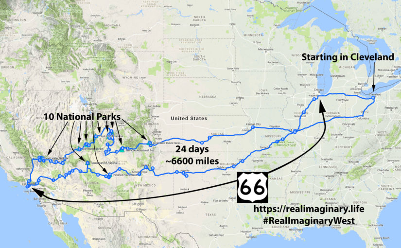
This September we’ll get our kicks on Route 66 as we head to the Southwest! The “Mother Road” starts in Chicago, so we’ll drive out to Illinois and follow it all the way to Los Angeles, camping for a couple of nights at the Grand Canyon along the way. After driving all the way to the Santa Monica Pier, we’ll visit Death Valley and the “Big Five” national parks in Utah. After our stops in Colorado, we’ll have visited TEN national parks in total!

This is our longest trip by far, clocking in at 24 days! We started planning back in January and have our itinerary ready to share below. Watch for our posts on Instagram, Facebook, and Twitter with the hashtag #RealImaginaryWest.

Highlights

Our route along Old Historic Route 66 to the Southwest & Canyon Country for RealImaginaryWest 2017
  • 24 days
  • 6,800 miles
  • 13 states
    OH, IN, IL, MO, KS, OK, TX, NM, AZ, CA, NV, UT, CO
  • Old Historic U.S. Route 66: “The Main Street of America”, “The Mother Road”
  • Part of the Santa Fe Trail in Eastern Colorado and across Kansas
  • 10 national parks:
    • Petrified Forest National Park
    • Grand Canyon National Park
    • Death Valley National Park
    • Zion National Park
    • Bryce Canyon National Park
    • Capitol Reef National Park
    • Canyonlands National Park
    • Arches National Park
    • Mesa Verde National Park
    • Great Sand Dunes National Park
  • Cities:
    • St. Louis
    • Tulsa
    • Oklahoma City
    • Amarillo
    • Las Vegas, New Mexico
    • Santa Fe
    • Albuquerque
    • Flagstaff
    • Los Angeles
    • Las Vegas, Nevada
    • Dodge City, Kansas
    • Kansas City
  • Also:
    • Palo Duro Canyon State Park (TX)
    • Meteor Crater (AZ)
    • Vasquez Rocks Natural Area Park (CA)
    • Red Rock Canyon National Conservation Area (NV)
    • Valley of Fire State Park (NV)
    • Kodachrome Basin State Park (UT)
    • Grand Staircase-Escalante National Monument (UT)
    • Dead Horse Point State Park (UT)
    • Natural Bridges National Monument (UT)
    • Bears Ears National Monument (UT)
    • Monument Valley (UT-AZ)
    • Fort Larned National Historic Site (KS)
    • Jefferson National Expansion Memorial (MO)

Continue reading RealImaginaryWest 2017 – Route 66 & Southwest Road Trip

RealImaginaryWest 2017 Lite Day 3 – Roasting in the Badlands & Relief in the Black Hills

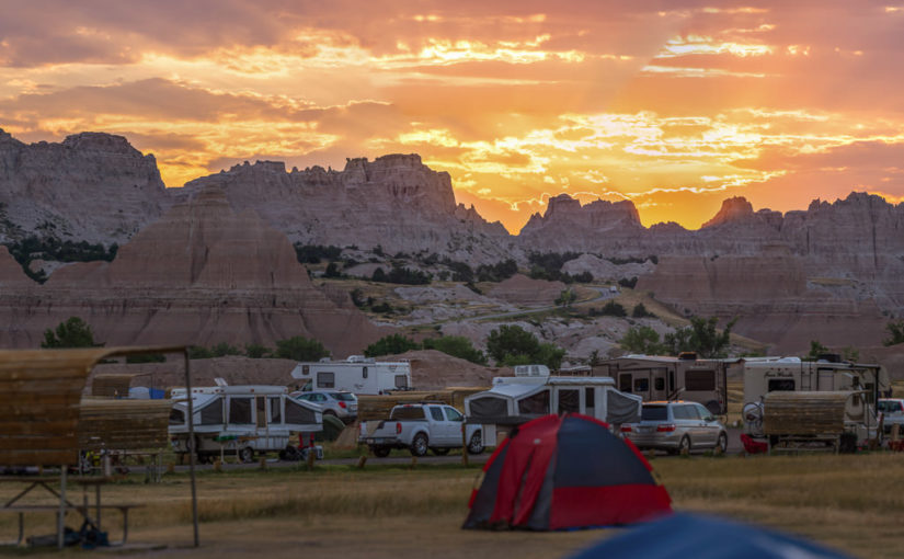
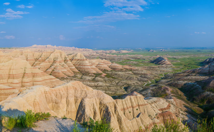
After a very early start at Badlands National Park, we packed up camp and made a short hike at Saddle Pass, followed by hikes on the Notch, Window, and Door Trails. Before driving the Badlands Loop Road and heading to Wall Drug, we returned to Cedar Pass Campground to get showers. After lunch and a couple of hours perusing Wall Drug, we took I-90 to Rapid City and SD-79 & SD-36 into the Black Hills and Custer State Park. Finally we followed US-16A to Bismarck Lake Campground near Custer in Black Hills National Forest.

Well today had a pretty good start with a rather dry finish… I suppose another way of putting it would be, “The Great Plains strike again!” Let me start at the beginning…

Sunrise at Badlands National Park

It all started at about 4:30am for me. I didn’t quite sleep as long as I’d hoped, but I did feel OK. The eastern horizon was already alight with the impending sunrise and birds were up singing. And just like last night, except in reverse, the moon was close to setting in the west.

Since we got to bed fairly early the night before and the forecast high would likely surpass the century mark, I woke Becky. It wasn’t supposed to get truly hot until late morning or noon. If we got up now, we could do some hiking and beat the heat as well as the crowds. While Becky moseyed to the restroom and got herself ready for the day, I packed up the tent and everything inside. We might come back later to cook or take showers, but there was no need to leave the tent up since it was already bone dry. I’m proud to say I had our bedding and tent all packed up solo in 25 minutes.

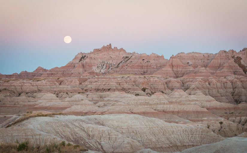
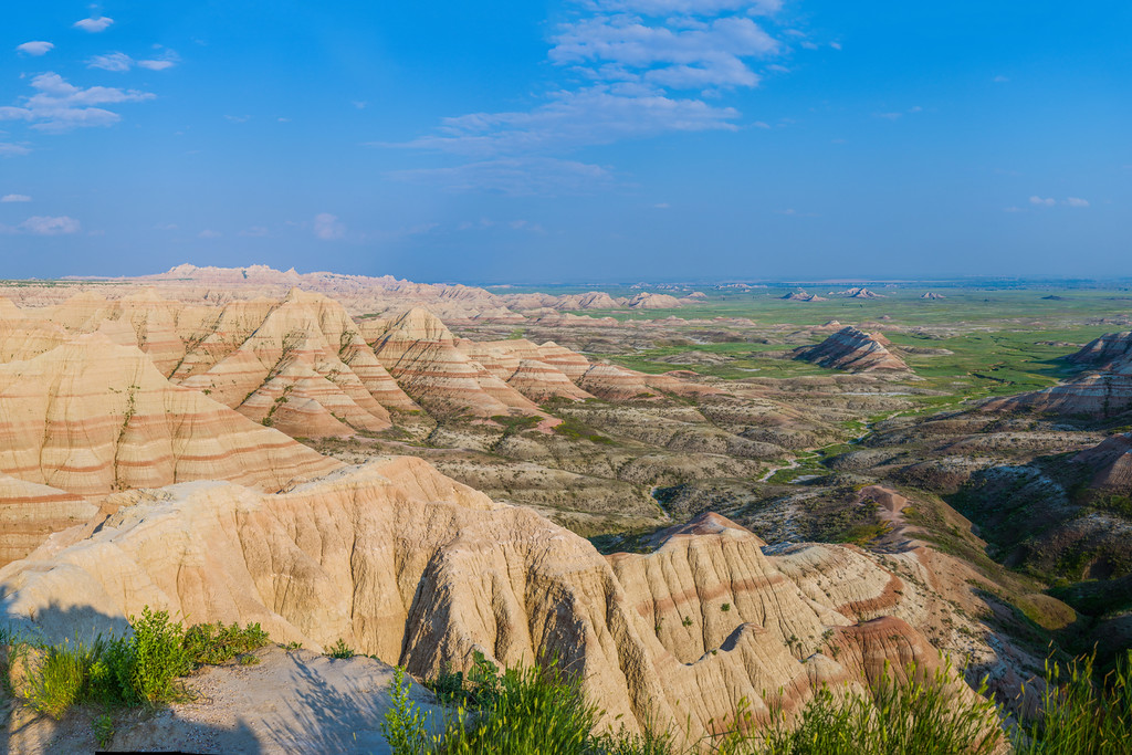
Just as the sun began to peek through the clouds over the Badlands wall, I ran off and shot a panorama of the brilliant sunrise! There were some reds but mostly oranges and violets. I would have shot the moonset too, but clouds on the western horizon totally obscured it.

Saddle Pass Trail


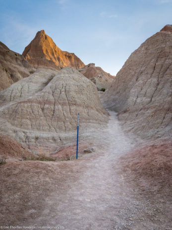
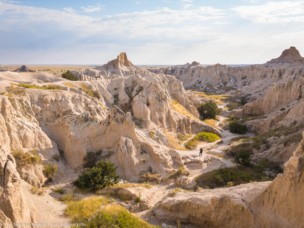
Looking up the Saddle Pass Trail in Badlands National Park. Blue markers help to identify the trail amid the indistinct terrain.
Looking up the Saddle Pass Trail. Blue markers help to identify the trail amid the indistinct terrain.

We were on the road before 6am and drove the short distance to the Saddle Pass Trailhead. The temperature was comfortable for now, around 70 degrees and low humidity. The Saddle Pass Trail is short at only 1/3 mile, but it’s a steep 216-foot climb up to the top of the Badlands wall.

We were on the road before 6am and drove the short distance to the Saddle Pass Trailhead. The temperature was comfortable for now, around 70 degrees and low humidity. The Saddle Pass Trail is short at only 1/3 mile, but it’s a steep 216-foot climb up to the top of the Badlands wall.

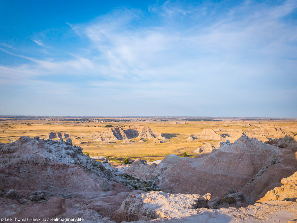
We started up the trail around 6am. It starts out exceptionally steep and has loose gravel footing. We were nearly halfway up when Becky decided she couldn’t go any further. It was just too much for her first thing in the morning. All the literature promised 360-degree views, so I decided to continue up to the top. The view did not disappoint!

Looking south from Saddle Pass in Badlands National Park.
Looking south from Saddle Pass. The tiny black thing in the parking lot near the tree is our car!

After shooting a few photos, one of the car from all the way up on top, I headed back down. There’s a trail that runs along the top of the Badlands wall, but I didn’t check it out because I wanted to make sure Becky was OK. I was off the trail and back at the car just 45 minutes after we arrived. Becky was starting to feel better and suggested that she probably just needed something to eat to get her energy up. While I’d guess our bodies were still on our usual Eastern Time Zone schedule, it was probably just too quick of a start to the day for her.

Up to the Door/Window/Notch Trailhead

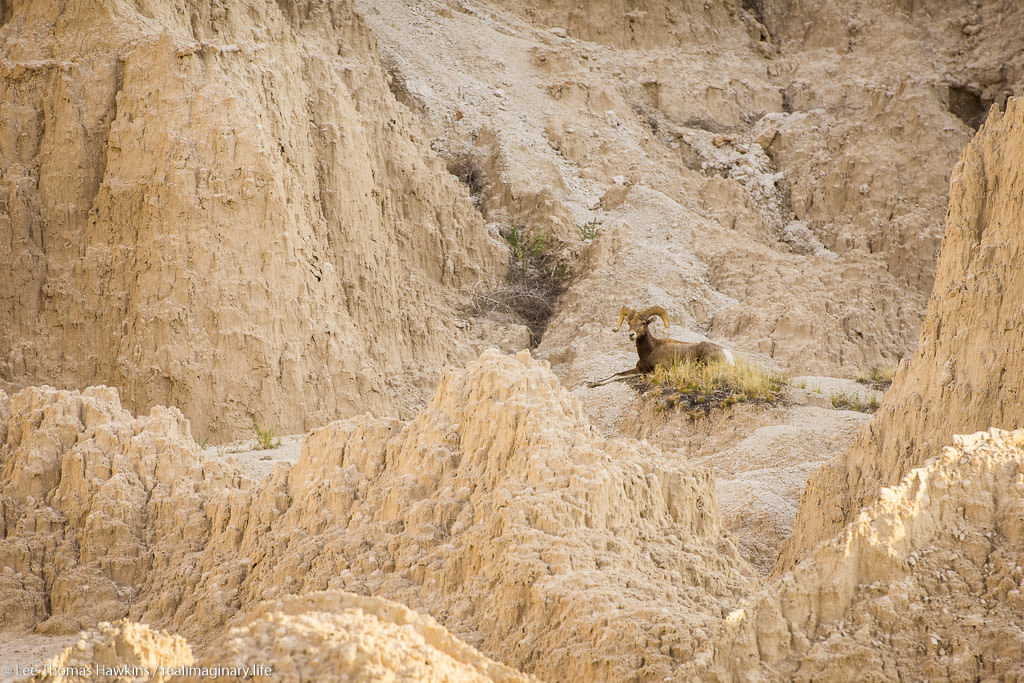
A bighorn sheep rests in morning shade north of Cedar Pass along the Badlands Loop Road in Badlands National Park.
A bighorn sheep rests in morning shade along the Badlands Loop Road on our way to the Door/Window/Notch Trailhead.

When we visited Badlands back in 2015, our only real hike here was the Door Trail. The same trailhead actually has two other trails, the super short Window Trail, and the more challenging Notch Trail. None of the three trails are particularly long, so we had plenty of time to do all three if we wanted to. The sky was crystal clear with bright sunshine now, but the temperature was still comfortable.

We made it to the parking lot around 7am, still well ahead of the crowds. We started with the Notch Trail, which is only 1.5 miles round trip. It winds through a small canyon for about 1/3 mile or so, and then there’s a ladder that takes you up to the rim so you can continue through a slightly larger canyon. We somehow missed the ladder, and realized it when the trail suddenly ended at an impasse. We could hear people just above us, so we retraced our steps. Turns out we followed a wash and went right past the ladder. It’s pretty easy to get disoriented and lose trails here! Almost all of them, including Notch, are actually marked with stakes at regular intervals so you can tell you’re going the right way.

Becky awaits my return as I hike the section of the Notch Trail above the ladder.

A Perilous Wrong Turn

Becky took a look at the ladder and gave it a nope. I’m afraid of heights and didn’t find it at all intimidating. The easy slope and the grip of my hiking boots made it easy to walk upright the entire way.

I then made my way around the rim and came across some signs that got me confused. One said “KEEP RIGHT”, and the other was an arrow pointing at what I thought was the way to go. I’d heard the Notch Trail could be challenging, but I was surprised it would go right up this steep wash. I forgot to even look for a marker stake. Before I knew it, the wash got too steep and too loose to safely go any further—obviously a dead end!

Continue reading RealImaginaryWest 2017 Lite Day 3 – Roasting in the Badlands & Relief in the Black Hills

RealImaginaryWest 2017 Lite Day 2 – The Jolly Green Giant & the Big Badlands

From our motel in Madison, Wisconsin, we followed I-90 West to Badlands National Park with brief stops at Green Giant Statue Park in Blue Earth, Minnesota and The Corn Palace in Mitchell, South Dakota.

Despite getting in late last night, I was awake at 5am. I suppose it’s always harder to sleep in a new bed. By 6:30am we were out of the motel and refueling across the street. With all of our meat still solidly frozen, there was no need to buy ice for the cooler. After Becky grabbed a coffee at Starbucks, we were back on I-90 again by 6:50.

Crossing Wisconsin & On to Minnesota

It was a beautiful morning! Last time we passed through Wisconsin, the sky was a very strange color due to forest fire smoke from way up in Alaska and Canada. This time we had magnificent sunny blue skies and good early morning light. Wisconsin is wonderfully green and pretty in summer. We’ll definitely spend more time here on some future road trip.

Since we got going early, there were no traffic problems through the often-congested Wisconsin Dells area. When we crossed the Mississippi River into Minnesota near LaCrosse, our chances of hitting any traffic at all dropped to almost nothing.

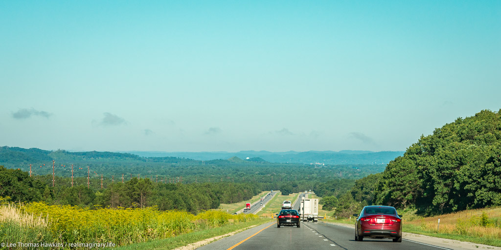
Overlooking the Driftless Region of Wisconsin from Jacksonville Pass on I-90 near Tomah, Wisconsin on a summer morning
Overlooking the Driftless Area of Wisconsin from Jacksonville Pass on I-90 near Tomah, Wisconsin

In the past we’d never been on I-90 across Minnesota beyond the first exit. We gradually worked our way west from Pepin along the Mississippi through heavily-wooded regions of the state. As we passed directly west this time, we noticed a significant transition in the nature of the land. After winding up the hill from the Great River and onto Minnesota’s rolling hills, it was as if all the trees were different and more sparse. The land also transitioned from mostly woodland to entirely agricultural. This dramatic change told me we were now on the Great Plains.

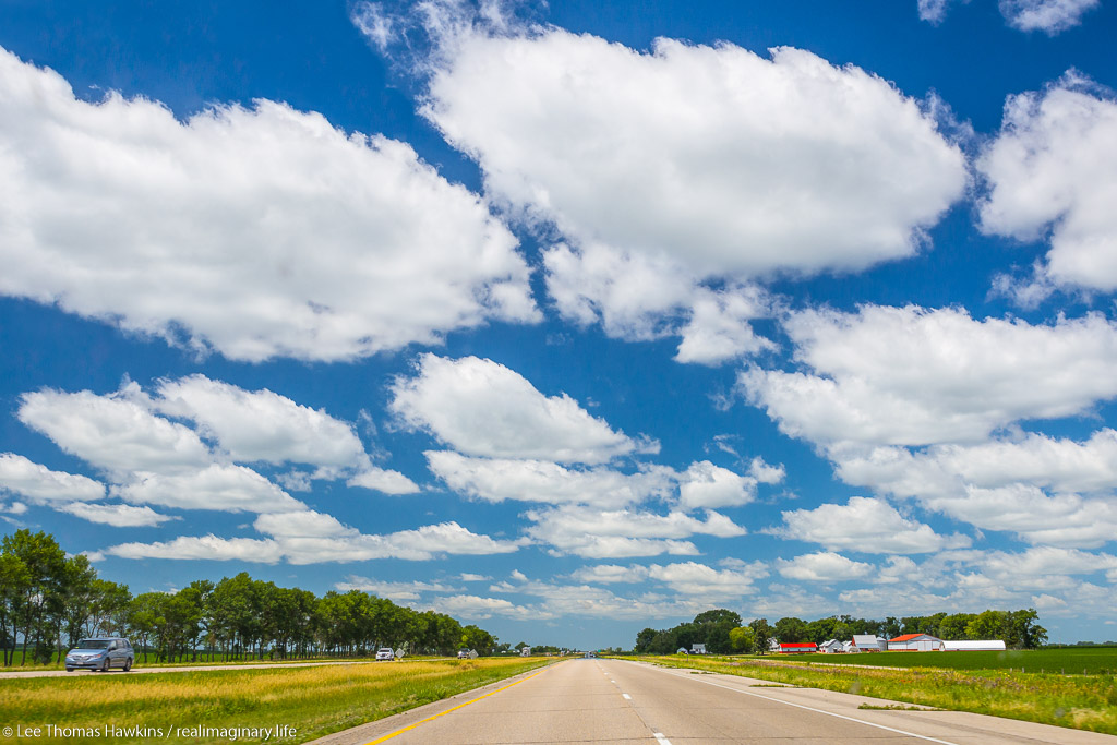
Cumulus clouds stretch across the sky over I-90 and prairie farmlands near Blue Earth, Minnesota.
Cumulus clouds stretch across the sky over I-90 and prairie farmlands in Minnesota.

Green Giant Statue Park & Blue Earth, Minnesota

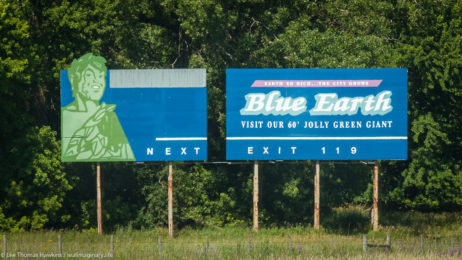
A billboard along I-90 near Blue Earth, Minnesota encourages tourists to stop and visit their 60' Jolly Green Giant.
A billboard along I-90 encourages tourists to stop and visit the 60′ Jolly Green Giant in Blue Earth, Minnesota.

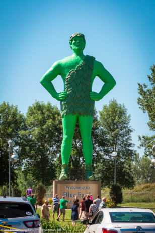
By 10:50am we’d crossed half the state. We stopped for an early lunch in a small town called Blue Earth. Besides the town’s eccentric name, it also has a 55-foot, 8,000-pound statue of the Jolly Green Giant we have all seen on numerous Green Giant labels and television commercials. He made his first appearance at the dedication of I-90, as the very last section was completed near Blue Earth in 1978.

The Story of the Jolly Green Giant Statue

People gather at Green Giant Statue Park in Blue Earth, Minnesota to photograph a 60-foot tall statue of the Jolly Green Giant.

At the time, the Green Giant company operated a canning plant in Blue Earth and was headquartered 60 miles north in Le Sueur. The idea for erecting the statue to attract travelers on the new transcontinental freeway originated with local radio station owner Paul Hedberg. On his weekend program he would interview families passing through Blue Earth on US-169, providing them with samples of Green Giant vegetables. Many children inevitably asked where they could see the Jolly Green Giant. So with the company’s blessing, Mr. Hedberg assembled funding from local businesses to bring the Giant to life in time for the freeway dedication.

One year later, the Green Giant company merged with Pillsbury, and the brand has changed hands a few times throughout the years. However. another company still continues to can corn and peas at the plant in Blue Earth. And the statue attracts 10,000 annual visitors. Each year the Giant Days festival is held at the adjacent Fairbault County Fairgrounds.

Continue reading RealImaginaryWest 2017 Lite Day 2 – The Jolly Green Giant & the Big Badlands

RealImaginaryWest 2017 Lite Day 1 – Making It to Madison

We followed I-90 west from Middleburg Heights, Ohio to a Motel 6 in Madison, Wisconsin.
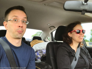
Lee & Becky are on the road again for their summer RealImaginaryWest 2017 Lite road trip to the Black Hills!

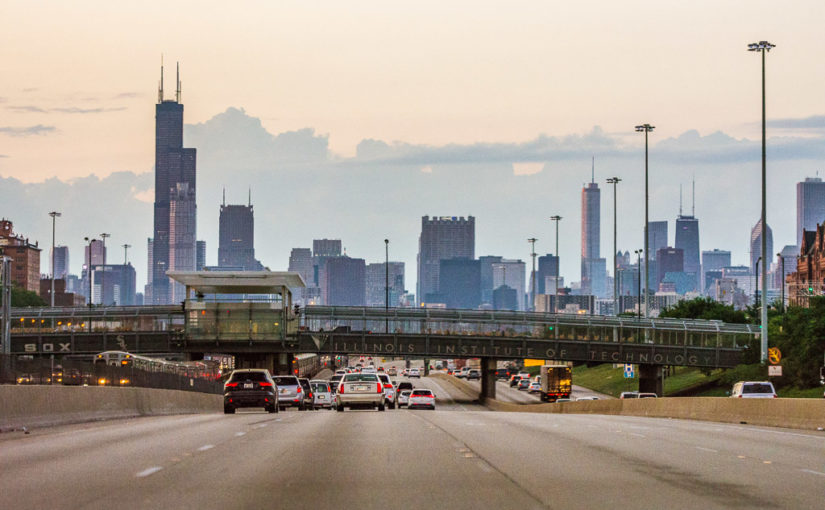
For the third year in a row, we are on the road and headed West in July! It’s been a flurry of activity these last few days. We pulled everything together and got on the road at 4:40pm this afternoon. We passed uneventfully through Chicagoland right around sunset, with just the typical slow spot Downtown. We arrived safely at a Motel 6 in Madison, Wisconsin at 10:40pm CDT.

Equipment Upgrades

Packing the car was a little more interesting this time. We’ve upgraded and added some equipment. Becky now has a respectable daypack. It has a little more room, but more importantly it redistributes most of its weight from the shoulders to the hips. She also has a pair of trekking poles to lighten the load on her knees.

I too finally have a daypack, so I can now carry more than just my camera gear. This will be critical for us in September when we hike in the arid Southwest, where we’ll both need to carry quite a bit of water to stay hydrated.

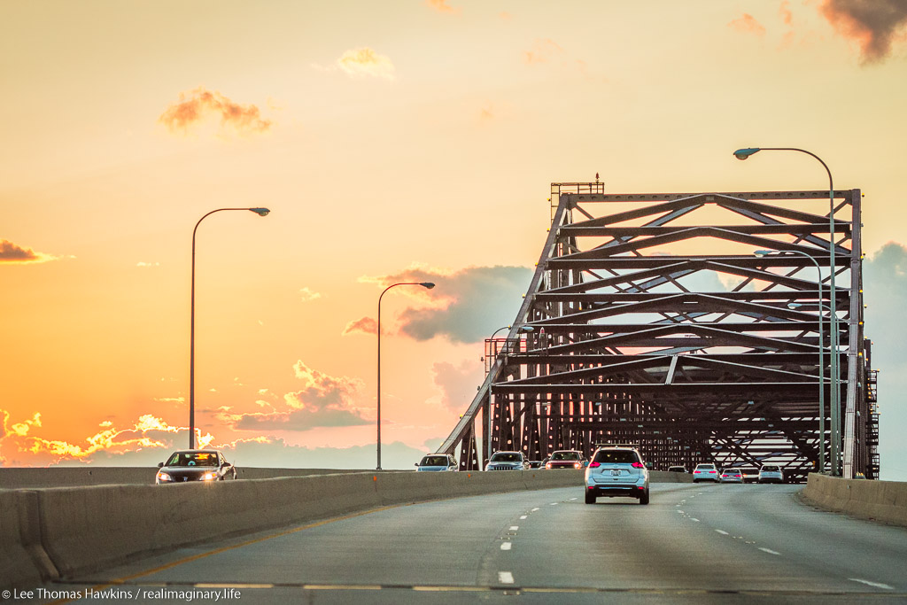
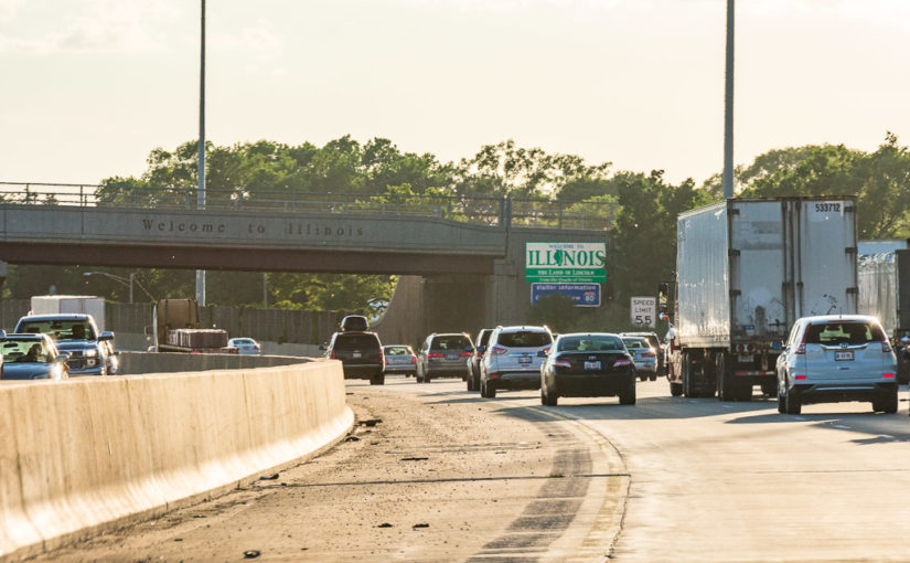
Cars make their way across the High Bridge on the Chicago Skyway at sunset.

Continue reading RealImaginaryWest 2017 Lite Day 1 – Making It to Madison

RealImaginaryWest 2017 Lite – Black Hills, Badlands, Rockies, and Wildcats

Ready for our adventure to the Southwest on Route 66? So are we…but not until September! I promise I’ll share our itinerary very soon, but right now we’ve squeezed in an 11-day trip to revisit a few areas from the past two years in more depth. We’ll spend most of our time in the Black Hills and Badlands region in South Dakota/Wyoming, followed by stops at Rocky Mountain National Park in Colorado and the Wildcat Hills in Nebraska.

Highlights

Our route to the Badlands, Black Hills, Rockies, and Wildcat Hills for RealImaginaryWest 2017 Lite
  • 11 days
  • 10 states
    OH, IN, IL, WI, MN, SD, WY, CO, NE, IA
  • 3 national parks:
  • Also:
    • Black Hills National Forest
    • Custer State Park
    • Devils Tower National Monument
    • Wildcat Hills (Western Nebraska)

Continue reading RealImaginaryWest 2017 Lite – Black Hills, Badlands, Rockies, and Wildcats

A Blog Is A Slog – Catching Up

Perfect Is the Enemy Of Good

Sorry if following my blog is like driving in bear traffic. I hope at least that you’ve enjoyed seeing the bison. 🙂

Today is March 9, 2017. Our first RealImaginaryWest road trip was in July 2015, and our second was in July 2016. I’m still editing them. :-/ There are other trips in the Eastern United States I’d like to share with you too. There are also plenty of articles I have planned, like tips on how to road trip and tent camp more successfully so you can avoid some of our mistakes, and tips on equipment and places to see. And this blog is far from the only project I’m behind on.

But alas…I have been working against depression for the better part of the last two years, and that’s slowed me down. I have been battling perfectionism, carefully editing every photo I’ve shot and every line of text I’ve written to make sure it’s vibrant, interesting, informative, fun, and…perfect. >:-/ I love looking back on what I’ve finished so far—but I am constantly fighting the urge to go back and rewrite and rearrange things until I get the larger project finished.

The good news is, I think I am going to win the war! My ambitious goal is to have all of my journal entries from RealImaginaryWest 2015 and 2016 edited and up before we leave on our next big road trip. This is really important to me because I keep thinking of all the cool places we’ve been and I still wonder how my photos turned out. I spent so much time creating so many images and writing so much background on our travels…I want to see these projects finished more than anyone!

So if anyone is actually reading this blog, I hope you’ll feel rewarded as I actually deliver! I have big plans and I believe that getting super sick four time in the last two months may have actually uncovered key underlying causes to my depression. This means that I will hopefully finally have the health I need to focus and see this through. I look forward to finally getting our stories out there to share. I also hope more than anything that I’ll have inspired other people to get out of their comfort zones and explore this wonderful world we live in! Hopefully I can share what you won’t find in the brochures that will help you to be well prepared when you embark on your own adventures!

Hey, How Was 2016?

Anyway, enough about my craziness—let’s talk about RealImaginaryWest 2016! Our first trip in 2015 was exciting, and I think Becky and I both enjoyed ourselves, but we flew very much by the seat of our pants. Becky did a marvelous job planning everything up through Day 4 in South Dakota, and I had made some plans on where we’d stay in the Badlands and Yellowstone, but there were a ton of gaps that I never thought through before we left. Planning your first road trip while you’re on it is probably not a great idea for a couple of anxiety-plagued 30-somethings! I got manic trying to see and do everything, which wore Becky out because she functions much better with more downtime and at least some semblance of routine. I eventually wore myself out too, because I ended up at the emergency room from dehydration! Everything turned out OK (we even went hiking the day after I was in the ER) but I knew at the end of the trip that it would have gone better if we set up more specific priorities.

Our first RealImaginaryWest road trip in 2015 just about fell off the rails on Day 9 of 18. I got some incredible images, like this one, but I almost ruined things for Becky…and myself, simply by trying to do too much in a day. I immediately slowed things down and saved the trip…but better and more considerate planning on my part in the first place would have prevented this!

Therefore RealImaginaryWest 2016 was much more thoroughly planned! I actually spent a great deal of time a month or two before researching and planning which specific activities and sights were important. I made several pages of notes and created a very detailed itinerary. When I shared this with people, many wrinkled their nose and said something to the effect of, “That doesn’t sound much like a vacation!” But hear me out, please!

Continue reading A Blog Is A Slog – Catching Up

RealImaginaryWest 2016 Day 1 – Our Adventure Begins in Iowa

We took I-80 west from Middleburg Heights, Ohio to the Super 8 in Davenport, Iowa.

Here We Go Again

After weeks and months of planning, we’re on the road again! We traveled 11 states, visited 5 national parks, and visited 3 Laura Ingalls Wilder towns in 2015. It was our very first big Western road trip. We loved it so much that we’re doing it again this year!

My biggest hope is also my biggest fear. (That’s when I figure the payoffs are biggest in life!) I hope that this year’s ambitious trip to travel the Oregon Trail route all the way to the coast and to four (maybe five) national parks will be doable on a realistic timetable. I really hope that it will be fun and…dare I say…epic like last year’s trip!

Continue reading RealImaginaryWest 2016 Day 1 – Our Adventure Begins in Iowa

RealImaginaryWest 2016 – The Oregon Trail & Pacific Northwest Road Trip

We’re headed out West again in July 2016! We’ll drive I-80 from Cleveland, Ohio to Western Nebraska and follow the Oregon Trail route all the way to Portland, Oregon. After a few days in the Pacific Northwest, we’ll spend a few days at Glacier National Park.

We’ve been planning this for a few months now and have our itinerary ready to share below. Watch for our posts on Instagram, Facebook, and Twitter with the hashtag #RealImaginaryWest.

Highlights

Our route along the Oregon Trail to the Pacific Northwest and Glacier National Park for RealImaginaryWest 2016
  • 17 days
  • 14 states
    OH, IN, IL, IA, NE, WY, UT, ID, OR, WA, MT, ND, MN, WI
  • The Oregon Trail
  • 4 national parks:
    • Olympic National Park
    • Mount Ranier National Park
    • Glacier National Park
    • Theodore Roosevelt National Park
  • 3 cities:
    • Portland, Oregon
    • Seattle
    • Minneapolis

Continue reading RealImaginaryWest 2016 – The Oregon Trail & Pacific Northwest Road Trip

Where We’re Exploring in 2016

Becky & I will always remember 2015 as a breakthrough year. We took the road trip of a lifetime and visited so many places we’d only ever heard of or read about. Maybe we saw a few of these places on TV, but it’s just not the same as experiencing it first-hand with someone you love!

But we didn’t just head West last year…we headed south during the peak fall foliage and toured historic and scenic places in Appalachia as well. We had a week off and saw parts of Southern Ohio we’d never seen, drove along the eastern edge of Kentucky and into the western tip of Virginia to visit Cumberland Gap, and then camped and hiked in Great Smoky Mountains National Park and Cherokee National Forest along the Tennessee-North Carolina border.

Our road trip camping throughout the West emboldened us to do things we’d never done before. I never thought I could camp in a tent if the temperature dropped below 50 at night. I would never have dreamed that we could pretty much fly by the seat of our pants and find motels and campsites pretty much wherever we wanted to go. While it was nerve-wracking at times, I learned a lot about planning a road trip like this and so of course we had to do it again to apply what we learned and go see more!!! The Appalachian road trip was an outgrowth of this emboldening, but to really truly test ourselves, we needed to Go West yet again…

Lightning in a Bottle?

When we packed up our tent last October, we were ready to be done camping for the season and sleep in our bed for the next few months. As the fall and then winter went on and spring approached, we already had the fever to get out with our tent again! I pulled out the maps and decided to mark all of the national parks we still hadn’t seen, and began looking for a route that would allow us to see several parks in one trip like we did in 2015.

Last year’s trip was pretty easy to plan. It all started because Becky wanted to see where Laura Ingalls Wilder lived, and I saw that those places would make an easy path west to see four national parks, and that we could then swing south to visit one more in Colorado before visiting my aunt and cousins in Denver for the first time in 29 years. It really felt like the trip of a lifetime, but then again, my trip around California in 2008 felt like the trip of a lifetime too…so even though I felt like we’d captured lightning in a bottle, my prior experience made me think that just maybe we could do it again…I mean, it can’t hurt to try, right???

Lembert Dome, near Tuolumne Meadows in Yosemite National Park when I toured California in 2008

Continue reading Where We’re Exploring in 2016

RealImaginarySmokies Day 7 – Bald River Falls & the Road Home

After packing up at Indian Boundary Campground, we visited Indian Boundary Lake and Bald River Falls in Cherokee National Forest before heading back to I-75. After a stop in Knoxville, we continued north on I-75 across Tennessee and Kentucky to Cincinnati where we picked up I-71. It rained torrentially across much of Kentucky and Ohio before we finally made it home up in Cleveland just after midnight.

Windy Thoughts

I awoke at 4am at Indian Boundary Campground in Cherokee National Forest to a much higher temperature and the wind kicking up…ugh. It had to be at least 60°F, which made me downright uncomfortable until I shed the extra layers I was wearing.

But that wind—it was as if the sky would take a deep breath and then exhale it all in one big long push. The trees swooshed around, and each time I’d tighten up—expecting rain to fall and get our tent all wet just before we’d have to pack it up! I’d hear pattering on the roof of our tent, thinking they were giant raindrops…but they were just leaves. I knew the wind couldn’t be too strong though, because our tent wasn’t flapping like we’ve seen before (De Smet!)—but the pattern unnerved me nonetheless!

With every gust I held my breath, because I just knew we were gonna get it…and then nothing would happen. I wished that I could see a weather forecast or even just the radar…I thought that knowing what’s out there would help me calm down and relax. I kept thinking and working out the physics in my head…I didn’t hear any thunder or see any lightning or smell that ozone smell you get when it’s about to rain…maybe it was just the way wind currents and air pressure worked coming through the mountains? My mind kept racing in circles, so I finally decided to myself that this wind was not going to bring rain right now—it’s probably just a warm front moving through and we’ll be fine.

That wasn’t much solace though. My heart wanted to go along so I could go back to sleep, but every time I’d doze off, the wind would blow hard and wake me up. I started thinking about about how great it would be to sleep in my own bed tonight. Yeah! And I could have cell service, a hard roof over my head, and I wouldn’t feel so disconnected from the rest of the world and all the information I needed to go about my business. Ahhh…yes! It felt wonderful to think such thoughts!

So I decided right then…I was ready to go home. The anxiety of rain, cold, wind, mice, cutting wood, getting stuck with green wood to burn, finding a dishwashing station, not having a clean neat place for a shower…all of that would be gone if we were at home. Home is where my heart is now, so home is where we’ll go! No stop-overs at some other place tonight, just heading straight on home after maybe checking out this area a bit…after all, we were by a lake and among mountains I had not yet seen, no need to waste that. So go see stuff, then drive home. Yeah! It’ll be great!

So when it was light and Becky woke up, we talked about packing up and heading home. She was cool with going back a day earlier than we had to. I know her face still bothered her and made it more difficult for her to enjoy herself. I told her we were only about eight or nine hours from home, but she seemed skeptical. I would have pulled up Google Maps and showed her, but well…you know.

Panos, Wind & Fire

So before we got started on packing up everything inside the tent, I set up my pano rig to get a shot of our campsite with our super-dirty car. We still hadn’t had a drop of rain, but the wind was still blowing and whipping all the trees around, wrecking my shot. I kept running over whenever the wind would die down, but the lulls would never last long enough to shoot all the way around. I eventually gave up and devoted all my energy to cooking some breakfast.

I chopped down some logs to make kindling and got a fire going…sort of. Every time I thought I had it burning, it would die down until it just pathetically smoldered. We got one round of eggs cooked, but for the second round I had to chop up a lot more kindling to get things hot enough again. I had thrown every log but one into that so-called fire and this wood simply refused to burn. I swear that the best way to extinguish any well-burning fire would have been to throw this wood into it! It was the worst firewood we’ve had all year long!!! The label said it was kiln-dried, but I had to wonder if they ever bothered to heat up the kiln…

In the midst of the firewood fighting my fire, the wind died down and just stayed that way. Weird! Thankfully I’d left my pano rig set up, so I ran back over and I think I finally got my shot. At last I can take down the tent!

360-degree panorama of Site 3 in Indian Boundary Campground in Cherokee National Forest. Click and drag to look around. Click the top right button to go full-screen.

A Final Farewell

So with breakfast eaten and our car all packed, there was only one thing left to do. This was the ceremonial burning of our fire-handling logs. They had been pretty good to me, and we’d used them all week. We didn’t do anything crazy…I just rearranged the smoldering wood so I could throw the logs down on top. In my mind, I thought it should be like they were Darth Vader burning on the pyre at the end of Return of the Jedi. Becky and I said nice things about the logs, told them they were good, and watched them burn.

And what a contrast! A minute or two later, the whole thing came to life because of these two little logs…we had a real campfire again! We knew this was too good to waste, so we considered roasting the last of our hot dogs. However, neither of us wanted to dig to the bottom of the car where we’d buried the hot dog skewer…so we said never mind.

Then Becky broke a stick off of a downed limb nearby and fashioned it into a hot dog skewer with her knife…and voila! Hot dog time!

With our completely dry tent in our completely packed car and with our fire now burning brightly…while we roasted our last hot dogs on our last campfire of the season on what was probably our last campsite of the year…a light rain finally started. We were both very happy that it held off just long enough for us not to feel one bit rushed! In spite of our mishaps, the whole week went pretty well overall, and the whole year had brought us a lot of camping in a lot of places and with a lot of friends. It was a fitting finale.

Indian Boundary Lake

While this moment brought a great deal of contentment, the day was not over yet! The rain only lasted a minute or two, so we ate our hot dogs, put out the coals, and moved along to visit the camp store and check out the lake.

The Indian Boundary Outpost was thoroughly stocked. While not large, it had everything a tenter or RVer would need if something was broken or forgotten—food, firewood, snacks, utensils, air beds, and of course souvenirs. Best of all, they had tons of maps and the lady running it was super helpful at identifying hikes, drives, and waterfalls in the area. She helped us decide to stop at Bald River Falls, a 90-foot waterfall that’s on our way to Tellico Plains and I-75.

We then drove out of the campground to the beach and picnic area on Indian Boundary Lake. It’s not a big lake, but the beach was nicely maintained. There’s a boat ramp and fishing pier across the lake, with beautiful mountains rising beyond.

Indian Boundary Lake this cloudy morning

Bald River Falls

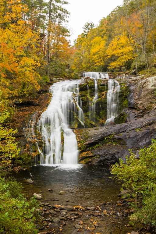
Bald River Falls

We drove back out to the Cherohala Skyway and cut over to River Road/Forest Road 210, which is a narrow old logging road that follows the Tellico River. Just a couple miles east, the road crosses the Bald River on a bridge offering a perfect view of Bald River Falls. There’s a sign next to the road so you don’t miss it, and a small parking area beyond. It was Saturday, so there were lots of motorcycles, several photographers, and a healthy number of people here.

Things were a bit congested, but still nothing like we experienced at Great Smoky Mountains National Park. I was able to shoot some stills and a 360° panorama just before the crowds built up and the rain started again. Rather than cutting straight back over to the Cherohala Skyway/TN-165, we followed behind a few motorcyclists on River Road/FR-210 as it wound alongside the scenic Tellico River.

Continue reading RealImaginarySmokies Day 7 – Bald River Falls & the Road Home